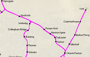
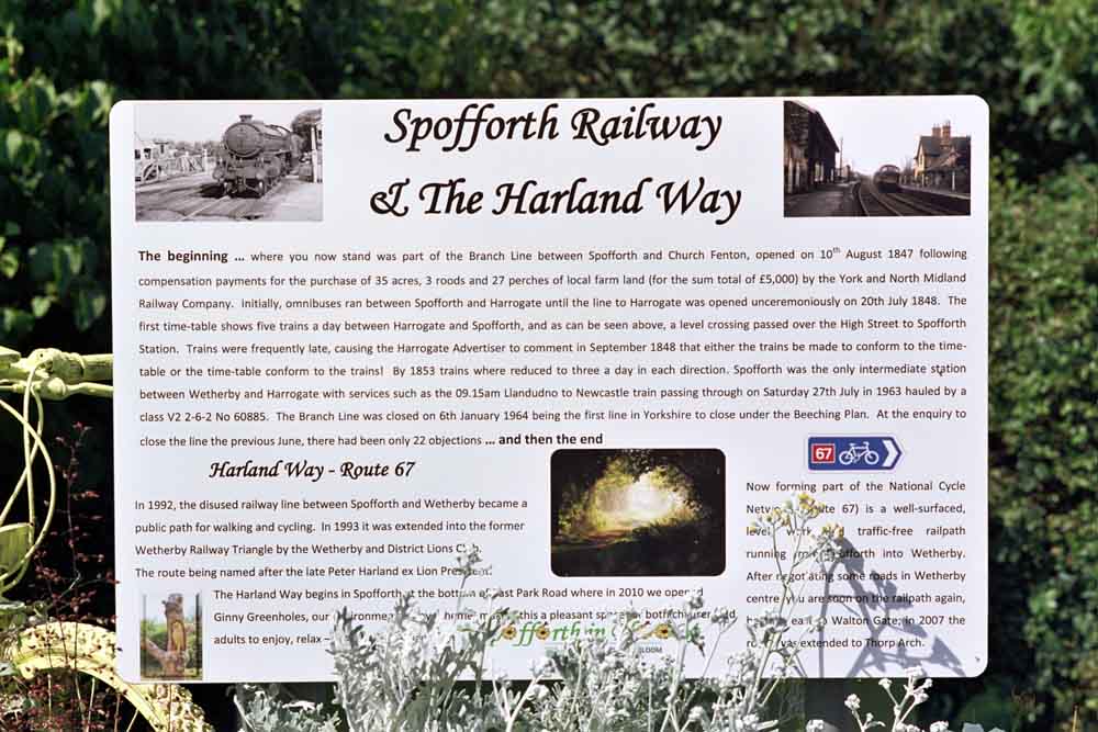
Church Fenton to Harrogate
Phill Davison
The railway arrived in Harrogate in 1848 built by George Stephenson and
the York and North Midland railway company. The branch line diverged from
the Leeds and Selby line at Church Fenton and had stations at Sutton,
Tadcaster, Newton Kyme, Thorpe Arch and Spofforth, the line then navigated
the Prospect tunnel and the magnificent 31 arch Crimple viaduct were it
meets the present day Leeds line. The Church Fenton to Harrogate line has
the dubious honour of been the first line to fall under the Beeching axe
with all stations closing in 1964. The original Harrogate station was
called Brunswick and was situated next to Trinity Methodist church on
Trinity Road opposite the stray.
See Phills blog at -
http://blog.myspace.com/index.cfm?fuseaction=blog.view&friendID=265602590&blogID=351327703 |
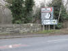
Church Fenton
   Wetherby
branch (18-05-19) : Paul Needham Wetherby
branch (18-05-19) : Paul Needham
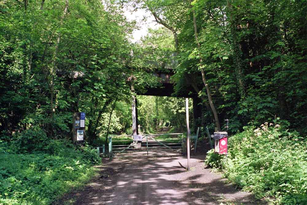
Here are the 2 bay platforms for the Wetherby
branch at church Fenton, now heavily overgrown and barely able
to make out.
When I first found them a few years back there was no
security gate the bay was used as staff
parking and both sides were weed free, sadly no so now. behind the fence
are the 4 current tracks. |
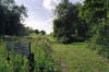
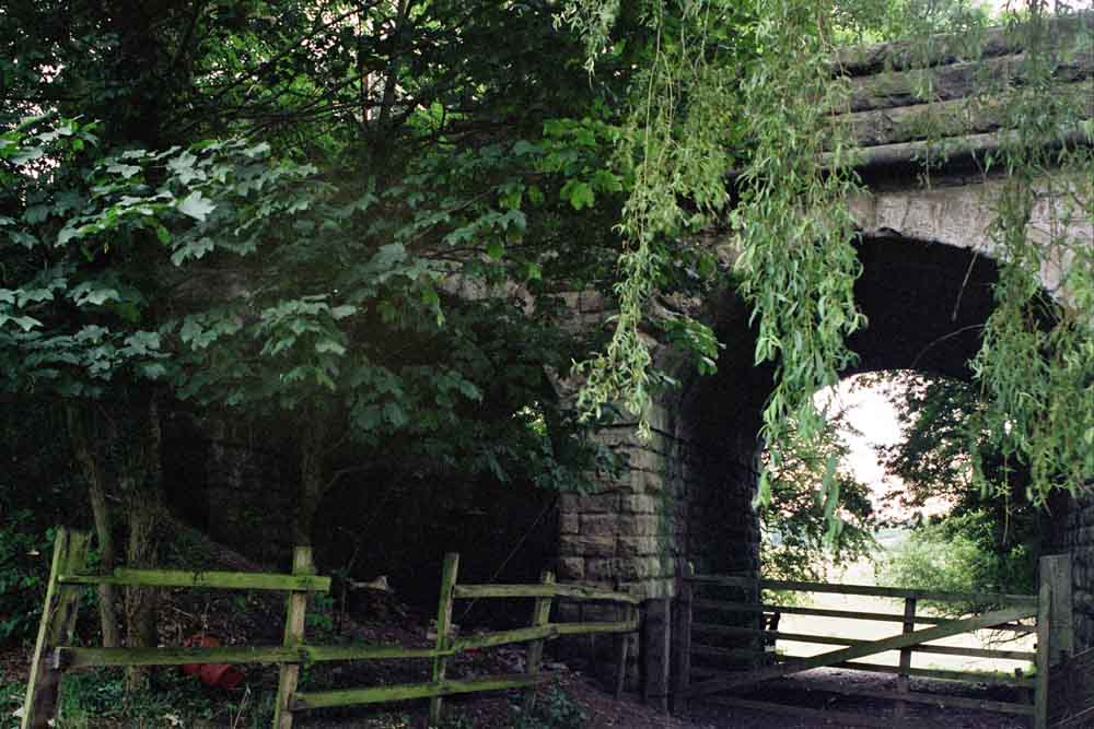
 Stutton Stutton
A162
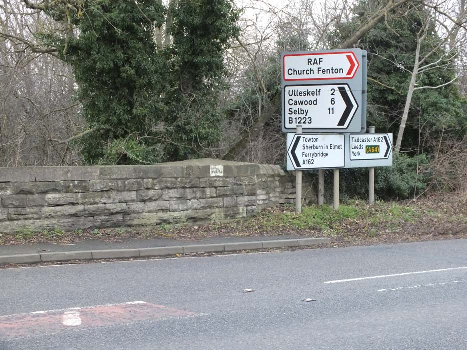
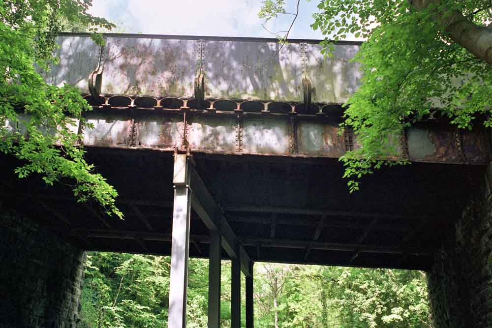
0verbridge (29-06-14) : Denis Thomson
A162 0verbridge near Stutton at junction with
B1223 Raw lane
towards Ulleskelf (note the BR/B stencil). |
 A162
0verbridge (29-06-14) : Denis Thomson A162
0verbridge (29-06-14) : Denis Thomson
Close up of the stencil on the A162 overbridge. |
 A162
0verbridge (29-06-14) : Denis Thomson A162
0verbridge (29-06-14) : Denis Thomson
Arches on A162 overbridge. |
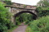
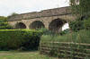
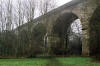
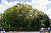
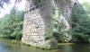
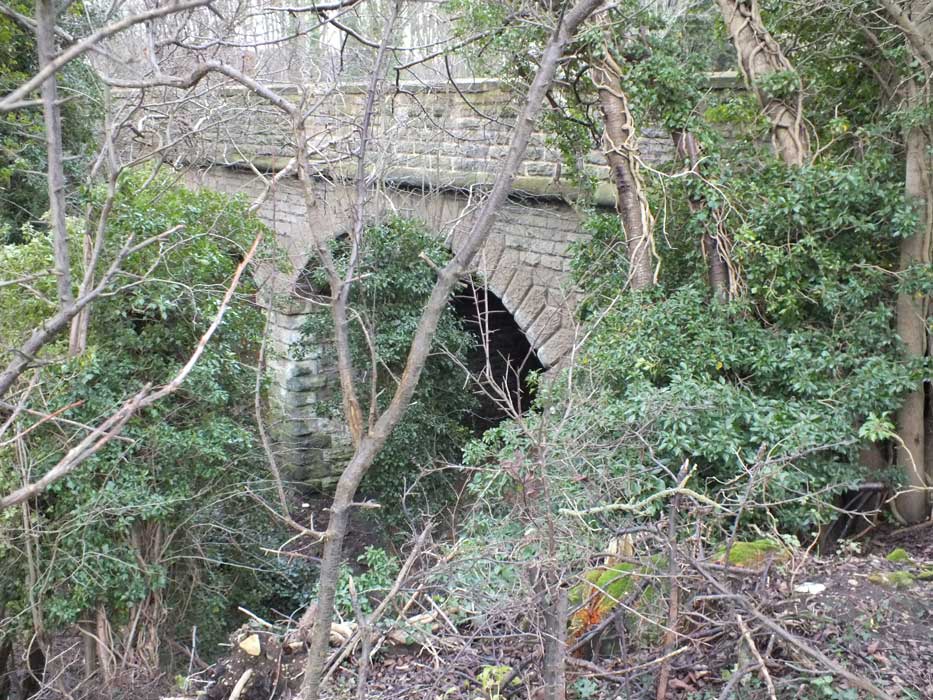
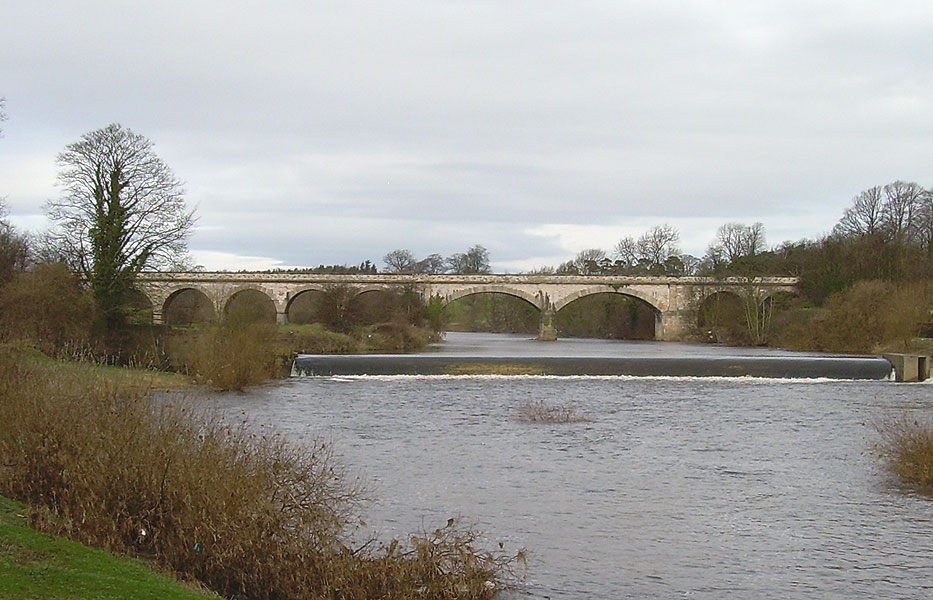
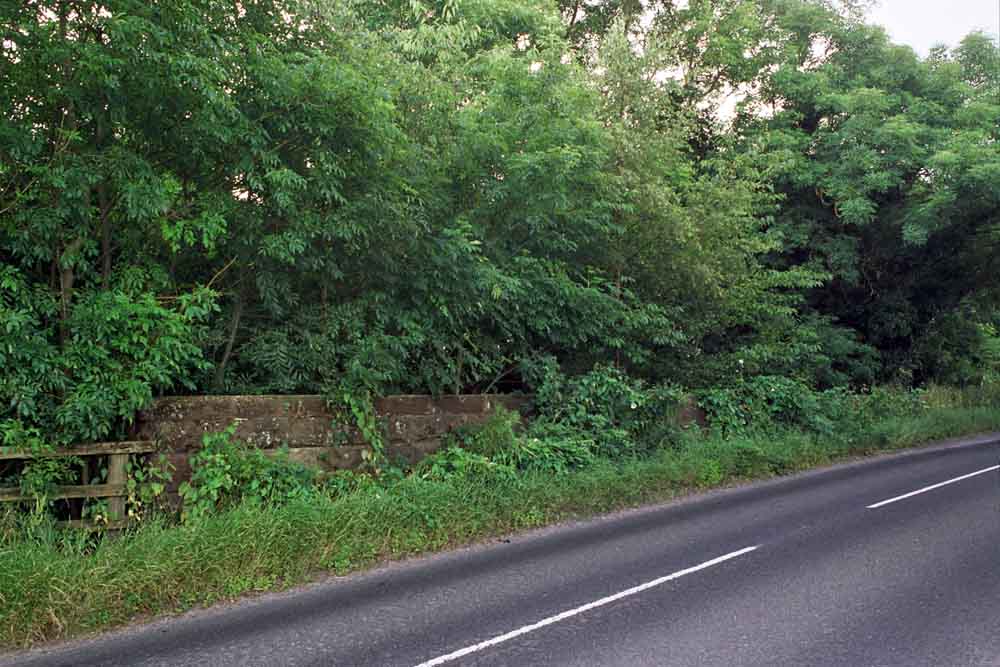
Tadcaster (Wharfe viaduct, part of a failed 1848 project)
 Tadcaster
viaduct facing north (24-02-08) : David Webdale Tadcaster
viaduct facing north (24-02-08) : David Webdale
In 1846 trains between York & Leeds travelled via
Methley. The York & North Midland Railway planned a more direct link.
The route was to be in 3 sections. First a new line would link
Copmanthorpe to Tadcaster. The existing Church Fenton line
would be used between Tadcaster & Sutton. Finally a new line would be
built between Sutton & Cross Gates. |
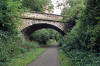
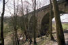
Tadcaster viaduct facing east (24-02-08) : David Webdale
 Work started on the project & by 1848 this tasty
eleven arch viaduct, now grade 2 listed, had been built across the river Wharfe.
Financial difficulties forced the company to abandon the project shortly
after & work never resumed.
Later on, in 1863, a less ambitious link was made between Church Fenton &
Micklefield. Eventually by 1882 the viaduct was used for goods traffic by
a nearby mill on the east side, now demolished. Freight continued up until
1955. Work started on the project & by 1848 this tasty
eleven arch viaduct, now grade 2 listed, had been built across the river Wharfe.
Financial difficulties forced the company to abandon the project shortly
after & work never resumed.
Later on, in 1863, a less ambitious link was made between Church Fenton &
Micklefield. Eventually by 1882 the viaduct was used for goods traffic by
a nearby mill on the east side, now demolished. Freight continued up until
1955. |
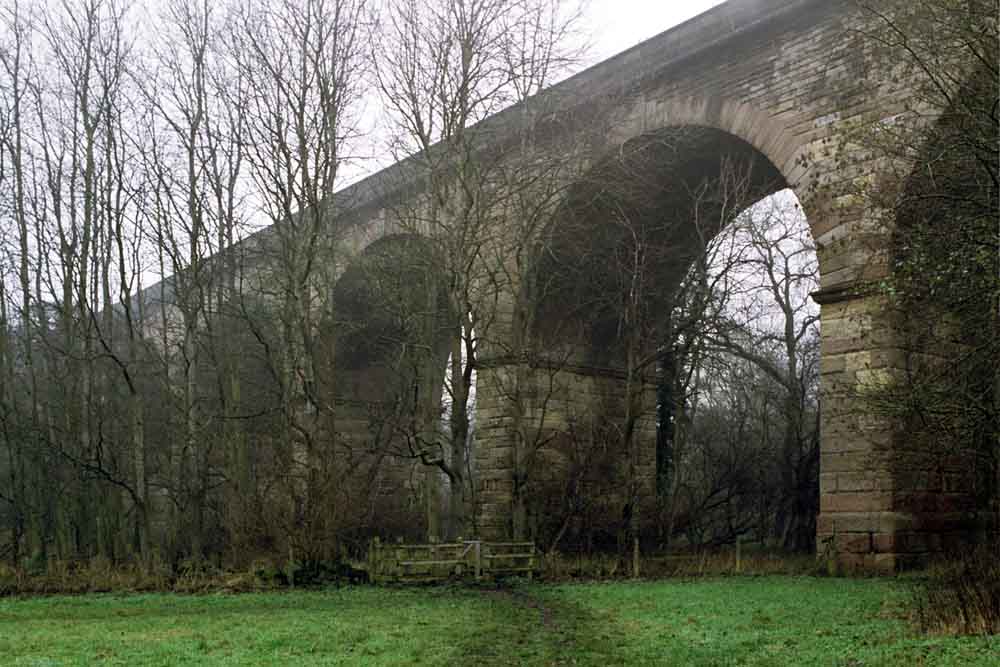
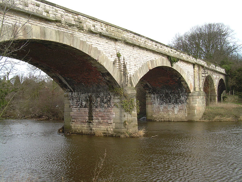
 Tadcaster
viaduct facing west (24-02-08) : David Webdale Tadcaster
viaduct facing west (24-02-08) : David Webdale
The structure consists of a viaduct of nine arches & a bridge of two spans
with a central pier & triangular cutwater.
The inside of each arch is brick & the walling is rusticated limestone.
The quoins & voussoirs are of finely cut magnesian limestone.
The designer was possibly the Leeds engineer J.T Leather & that's my dad blowing his nose. |
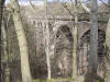
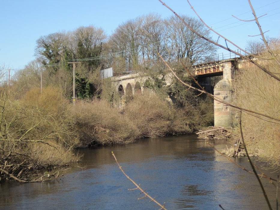
Newton Kyme - Thorp Arch viaduct
  Thorp
Arch viaduct (16-03-08) : Adrian Smith Thorp
Arch viaduct (16-03-08) : Adrian Smith
Church Fenton - Harrogate (NER) viaduct, from
the Newton Kyme bank of the Wharfe. Thorp Arch viaduct. |
  Thorp
Arch viaduct (16-03-08) : Adrian Smith Thorp
Arch viaduct (16-03-08) : Adrian Smith |
 Thorp
Arch viaduct (05-04-21) : Mark Pennington Thorp
Arch viaduct (05-04-21) : Mark Pennington
This viaduct has recently been decked and is
open to the public as a cycleway,
which more-or-less follows the trackbed from the A659 to the A168. There
is also access from the footpaths beneath. |
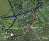
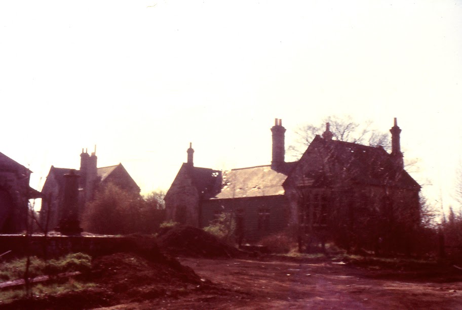
Wetherby station (First site)
See Leeds Wetherby
Note : Mike Bale
The line also had a station at Wetherby which
opened in August 1847 together with those from Church Fenton to Spofforth.
The Wetherby station shown on the above map is the passenger station
opened in 1902 at which time the original station became Wetherby Goods
station. You’ll know
that the lines around Wetherby were the first to close after the Beeching
Report. Apart from 3 overbridges the Goods Transfer Shed at the original
station is the only item of railway architecture remaining in the town.
See below. |
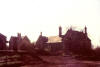 Wetherby
Station, 1st site, (c1970s) : Gary Fozzard Wetherby
Station, 1st site, (c1970s) : Gary Fozzard
This photo might be near the back of the old goods
station in Wetherby. |
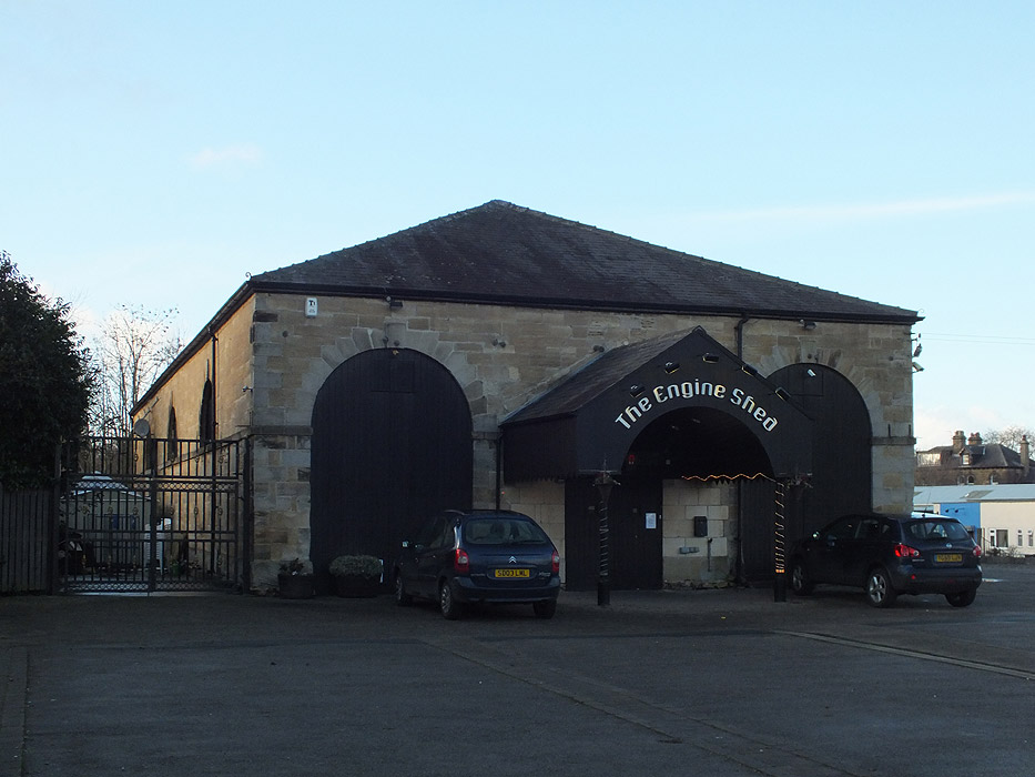
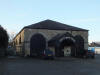 Wetherby
Station, 1st site, Goods Shed (29-06-14) : Denis Thomson Wetherby
Station, 1st site, Goods Shed (29-06-14) : Denis Thomson
At least it is still standing! |
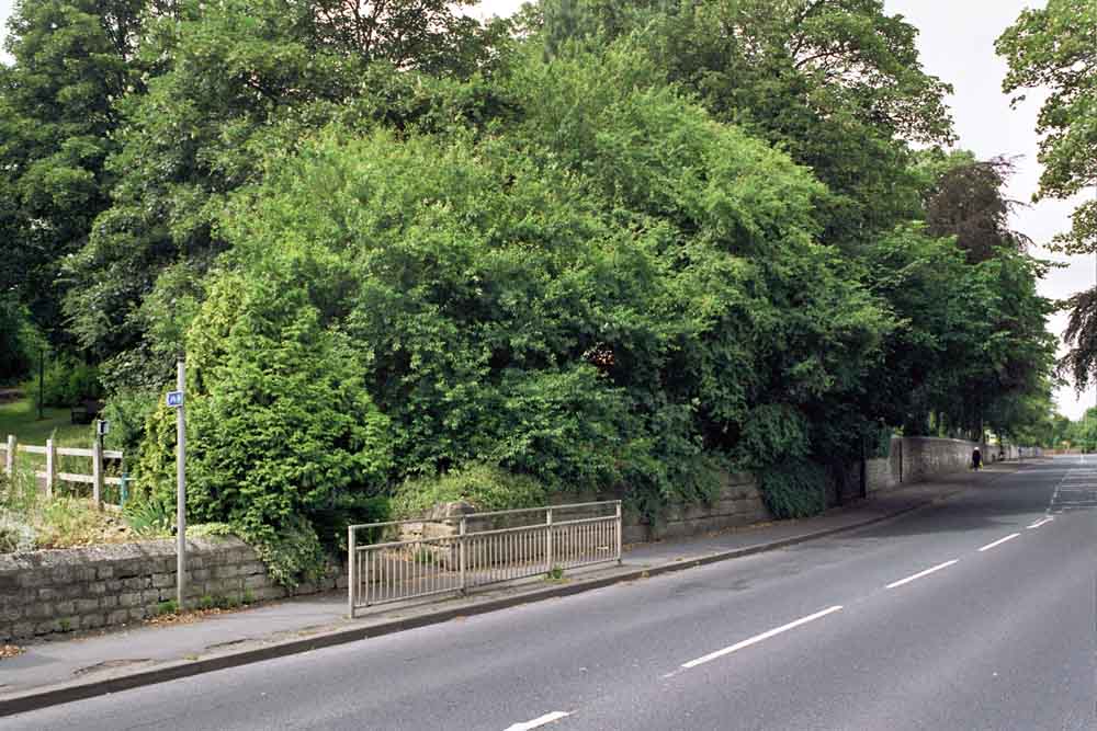
 Wetherby
North street
(21-07-14) : Malcolm Mallison Wetherby
North street
(21-07-14) : Malcolm Mallison
Start of cycle path, and remains of bridge in
B6164 North Street, Wetherby. |
Leeds - Wetherby & Church Fenton - Harrogate Triangle junction
See also Leeds - Wetherby
  Wetherby
(29-05-15) : Malcolm Mallison Wetherby
(29-05-15) : Malcolm Mallison
Bridge carrying A661 Spofforth Hill, with close up
of rust and bodge-it-and-run central support. |
 Wetherby
(29-05-15) : Malcolm Mallison Wetherby
(29-05-15) : Malcolm Mallison
Bridge carrying bridlepath across western branch of
triangle. |
 Wetherby
(29-05-15) : Malcolm Mallison Wetherby
(29-05-15) : Malcolm Mallison
Bridge carrying bridlepath across eastern branch of
triangle. |
 Junction
(21-07-14) : Malcolm Mallison Junction
(21-07-14) : Malcolm Mallison
Junction to Leeds (to left). |
 Junction
(21-07-14) : Malcolm Mallison Junction
(21-07-14) : Malcolm Mallison
Looking back at other end of junction. Leeds
to right. |
 Junction
(21-07-14) : Malcolm Mallison Junction
(21-07-14) : Malcolm Mallison
Bridge carrying Barleyfields Rd. http://www.britainfromabove.org.uk/image/epw023534. |
 Junction
(21-07-14) : Malcolm Mallison Junction
(21-07-14) : Malcolm Mallison
Bridge carrying bridleway, grid ref 399489. |
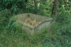 Junction
(21-07-14) : Malcolm Mallison Junction
(21-07-14) : Malcolm Mallison
Trackside bunker. |
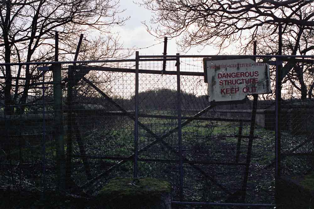
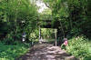
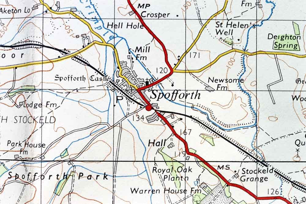
Spofforth Station
 Spofforth
Station
(21-07-14) : Malcolm Mallison Spofforth
Station
(21-07-14) : Malcolm Mallison
1958 1 inch map. The bridges carrying the
railway are now represented by mere dips in the path. There is no intact
masonry. Of the level crossings over the A661 and Park Lane there is no
sign. The current 25000 OS map still shows railway buildings on the site
of the old station, but my hopes were dashed when I got there- the site is
now detached executive houses. At least they called it Station Court. |
 Spofforth
(21-07-14) : Malcolm Mallison Spofforth
(21-07-14) : Malcolm Mallison
Sign at Spofforth end of cycle path. |
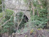
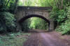
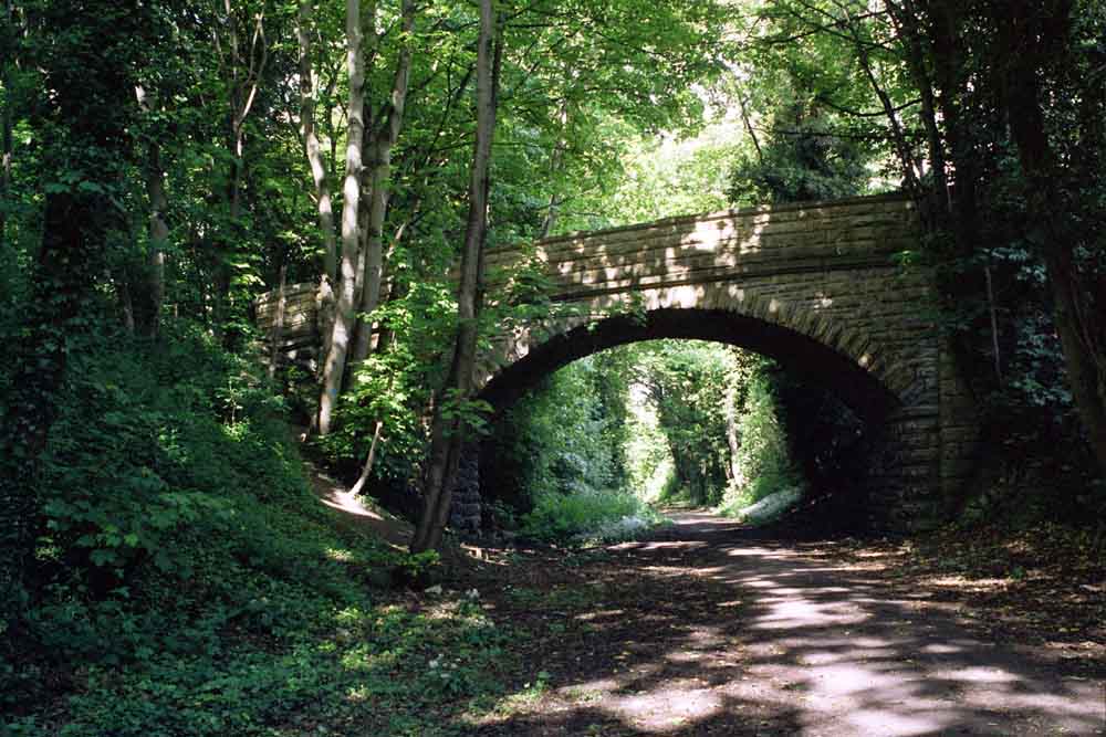
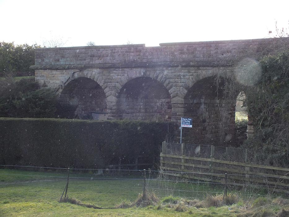
 Spofforth
viaduct Spofforth
viaduct
Spofforth viaduct (29-06-14) : Denis Thomson
Spofforth viaduct. |
  Spofforth
viaduct
(21-07-14) : Malcolm Mallison Spofforth
viaduct
(21-07-14) : Malcolm Mallison
Three arch viaduct reached via footpath behind
The Castle (pub). |
 Spofforth
viaduct
(21-07-14) : Malcolm Mallison Spofforth
viaduct
(21-07-14) : Malcolm Mallison
Behind Spofforth Castle. Someone seems to have
a viaduct in their back garden. How cool is that? |
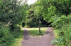
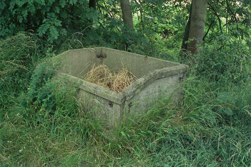
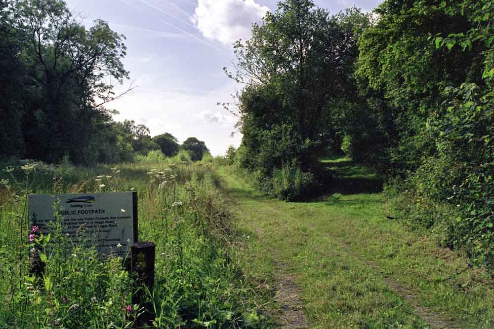
 Spofforth
(21-07-14) : Malcolm Mallison Spofforth
(21-07-14) : Malcolm Mallison
Footings of bridge on School Lane. Other side
of the road has a new house. |
  Spofforth
(21-07-14) : Malcolm Mallison Spofforth
(21-07-14) : Malcolm Mallison
Parapet at Haggs Bridge. I apologise for the
lousy exposure. Never trust auto exposure.
Cutting to south side is much
silted.
To north side has been filled in. |
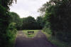
 Spofforth
(21-07-14) : Malcolm Mallison Spofforth
(21-07-14) : Malcolm Mallison
The trackbed from the footpath crossing
(340517) has been dedicated as a public footpath. It looks just like any
other farm track.
The bridge shown on the OS map (336518) has disappeared completely. |
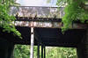
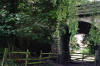
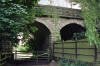
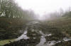
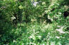
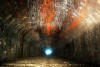
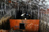
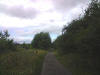
Prospect Tunnel
/Prospect%20tunnel%201_small.jpg) Prospect
Tunnel (03-02-08) : Phill Davison Prospect
Tunnel (03-02-08) : Phill Davison
Just past Crimple viaduct we catch sight of Prospect tunnel on the
Harrogate-Church Fenton line.
The line has the dubious honour of been the
first to close under the Beeching axe.
The line was gradually run down
over the years and the service was classed as 'nowt nor summat' amongst
the long suffering passengers. |
Prospect
Tunnel (03-02-08) : Phill Davison
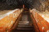
/Prospect%20tunnel%203_small.jpg) Nearly half a mile of tunnel ahead. Co-explorer added for scale. Nearly half a mile of tunnel ahead. Co-explorer added for scale.
Prospect tunnel is a straight 825 yds long and is in reasonable condition
apart from deep standing water throughout.
The tunnel is relatively
shallow at 81' below the surface and has a total of 3 air shafts. Note the
wooden type of fixing on the left of the portal.
It seems to be hanging
off a bit now. It appears to have been some sort of sign or notice board
there. (see next photo) |
Prospect
Tunnel : James Hinchcliffe
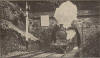 Express train leaving Prospect tunnel, 500 yards from crimple viaduct. Express train leaving Prospect tunnel, 500 yards from crimple viaduct.
On the back it says Leeds-West Hartlepool Express leaving Crimple Tunnel
4-4-0 Loco No. 1878 (Class Q).
Note the wooden type of fixing on the left of the portal, (see previous
photo)
Note : Andrew Ripley
It's not a sign, it's a sighting board for the signal in
front of it.
Similar white patches seen painted on the bridges of the S&C so the
semaphore signal has a white background to be seen against.
Note : Neil Mackay
Just for info, the white wooden board seen in the NER photo
and the current one is a "sighting board" for the signal at the entrance
to the tunnel (Crimple Junction's No. 22 "Up Advance - Branch").
These
were placed behind signals which would otherwise have been hard to see
because of a dark background - in this case the tunnel portal and cutting. |
/Prospect%20tunnel%205_small.jpg) Prospect
Tunnel (03-02-08) : Phill Davison Prospect
Tunnel (03-02-08) : Phill Davison
Looking back towards Harrogate, Another track refuge
coated in orange iron. |
/Prospect%20tunnel%206_small.jpg) Prospect
Tunnel (03-02-08) : Phill Davison Prospect
Tunnel (03-02-08) : Phill Davison
Close up detail. |
/Prospect%20tunnel%207_small.jpg) Prospect
Tunnel (03-02-08) : Phill Davison Prospect
Tunnel (03-02-08) : Phill Davison
In the middle of the tunnel we come to air shaft no 2. From the bottom of
the tunnel to the top of the cappped shaft measures 81'. |
/Prospect%20tunnel%208_small.jpg) Prospect
Tunnel (03-02-08) : Phill Davison Prospect
Tunnel (03-02-08) : Phill Davison
Marker for Prospect no2 shaft. The walls are coated in soot from the steam
trains. |
/Prospect%20tunnel%209_small.jpg) Prospect
Tunnel (03-02-08) : Phill Davison Prospect
Tunnel (03-02-08) : Phill Davison
Looking back towards the Harrogate direction at the end of the tunnel.
The
blue tint on the brickwork is caused by the daylight shining in on a long
shutter capture, I like this effect achieved with this method. |
/Prospect%20tunnel%2010_small.jpg) Prospect
Tunnel (03-02-08) : Phill Davison Prospect
Tunnel (03-02-08) : Phill Davison
View of the South portal and the embankement for the A658 now built over
the old trackbed. |
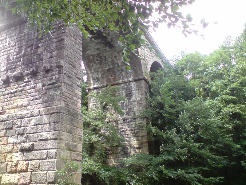
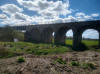
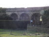
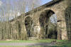
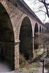
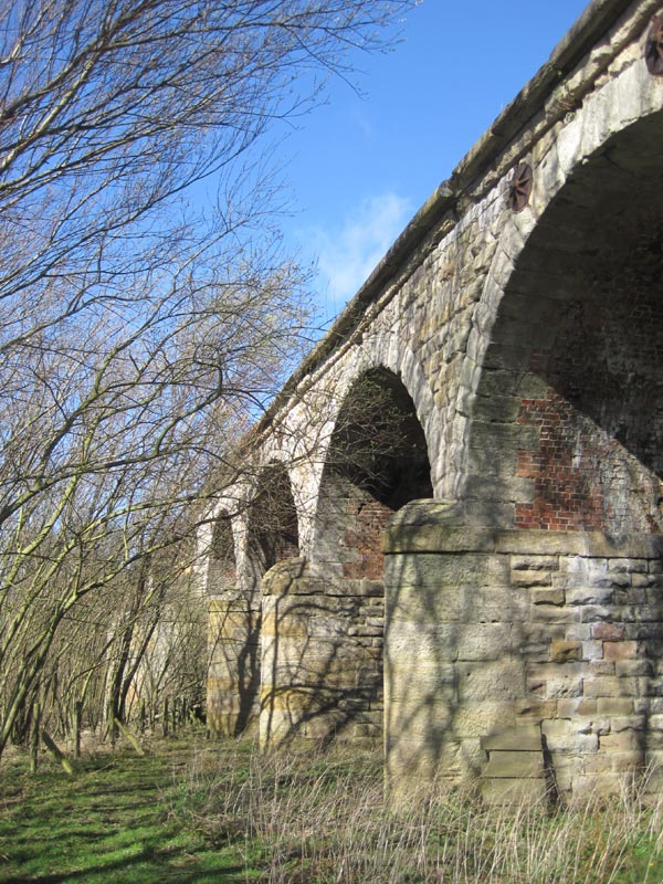
Crimple Viaduct
See also Leeds - Harrogate
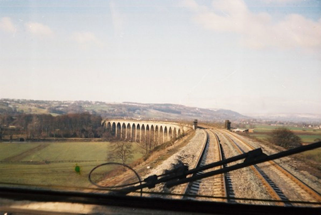
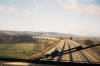  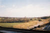 Crimple
Viaduct (c1980) : Philip Hardaker Crimple
Viaduct (c1980) : Philip Hardaker
These shots are taken from the HST cab going empty early
morning to Harrogate approaching Crimple Viaduct.
First photo showing the viaduct which you can see from the cab as you
pass spacey houses on the approach to Harrogate. |
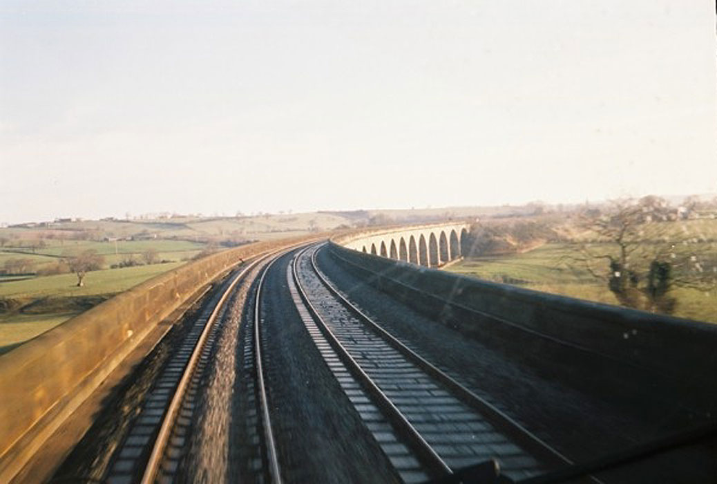
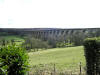 Crimple
Viaduct (17-10-09) : David Taylor Crimple
Viaduct (17-10-09) : David Taylor
The line closed as far as Crimple Junction, immediately north of Prospect
Tunnel, in 1964 but remains open from there in to Harrogate crossing the
Crimple Valley on the magnificent 31 arch Crimple Viaduct still used for
Leeds - Harrogate trains. |
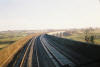
 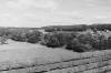 The
line to Crimple Low Viaduct
(21-07-14) : Malcolm Mallison The
line to Crimple Low Viaduct
(21-07-14) : Malcolm Mallison
In glorious monochrome (it was a Tri-X in OM-1 sort
of day).
The line to Crimple Low Viaduct, looking eastward from the High Viaduct.
Photos taken from a moving train.
http://www.britainfromabove.org.uk/image/eaw027389 |
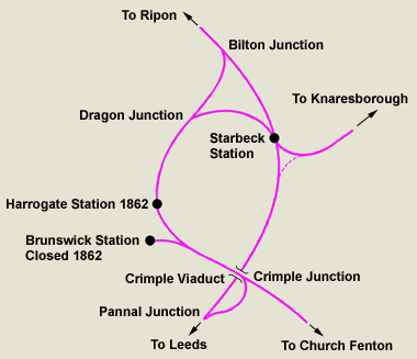 Harrogate
& Starbeck Harrogate
& Starbeck
The route from Starbeck to Rippon & Northallerton,
including the Dragon junction section,
were closed in 1967.
The original 1848 Leeds & thirsk line between Pannal Junction & Starbeck
was closed on
7 October 1951.
The later 1862 section between Pannal Junction & Starbeck taking in
Harrogate & including
the tight curve over Crimple viaduct is the one still in use today.
Pannal Junction to Starbeck (Disused)
Pannal Junction to Starbeck : David Taylor
In 1859 a spur was built from the L&TR at Pannal Junction up to the Y&NMR
at Crimple Junction, between Prospect Tunnel and Crimple Viaduct, giving
Leeds trains a direct line in to Harrogate centre.
A spur was built
northwards from Harrogate Station to re-join the L&TR at Bilton
Junction.
The original L&TR line from Pannal Junction to Starbeck was
closed in 1951.
(As kids in the days before Health & Safety madness we
used to play on the viaduct, although it was surrounded by farmland not
then a golf course.)
|
Pannal Junction to Starbeck (Disused)
 Pannal
(24-11-12) Malcolm Mallison Pannal
(24-11-12) Malcolm Mallison
The lost bit- the line which left the extant line near
Pannal, looped south and east of Harrogate under the Crimple Valley High
Viaduct to Starbeck. A pre-Beeching closure (shown as disused on 1961 OS
map). Footpath crossing grid ref 319525. On the day I was there
(24/11/12) someone had just (to the extent that the bonfire was still
smouldering) cleared away fifty years of undergrowth. |
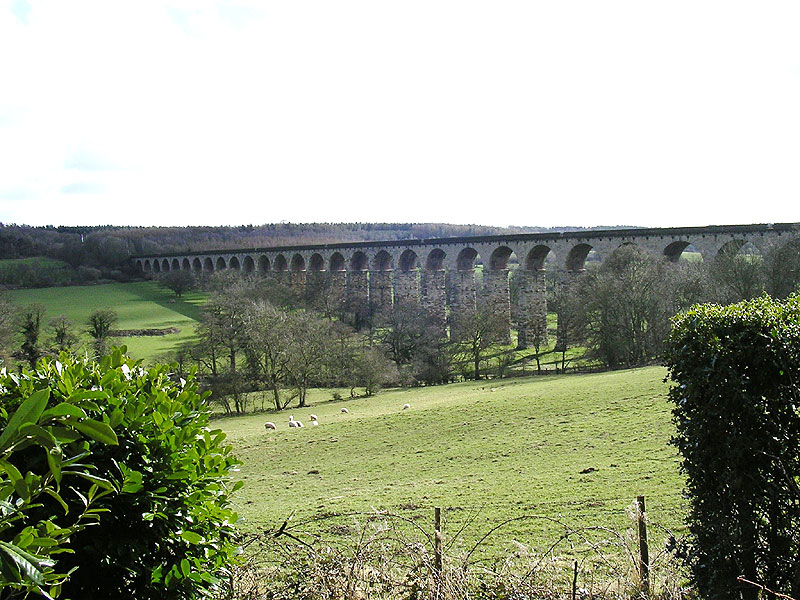
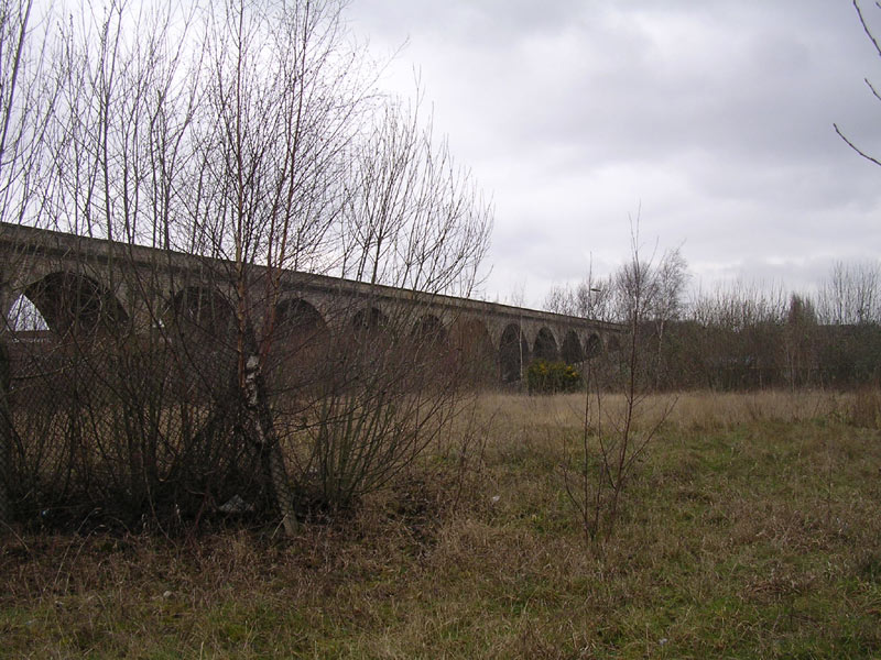
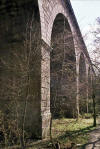
Crimple Low Viaduct
 Crimple
Lower Viaduct (17-10-09) : David Taylor Crimple
Lower Viaduct (17-10-09) : David Taylor
When opened in 1849 by the Leeds & Thirsk Railway (later the Leeds
Northern) the line by-passed Harrogate whose nearest station on that
line was at Starbeck. The line crossed under the Y&NMR's Church Fenton -
Harrogate line and over Crimple Beck on the 10 arch Crimple Lower
Viaduct. |
 Crimple Low Viaduct (24-11-12) Malcolm Mallison Crimple Low Viaduct (24-11-12) Malcolm Mallison
Crimple Valley Low Viaduct. Only relatively low- still an
impressive structure. Deserves a revisit in better weather. |
   Crimple
Low Viaduct (09-05-13) Malcolm Mallison Crimple
Low Viaduct (09-05-13) Malcolm Mallison
As promised, Crimple Valley Low Viaduct in better
weather.
|
   Crimple
Low Viaduct (09-05-13) Malcolm Mallison Crimple
Low Viaduct (09-05-13) Malcolm Mallison |
Crimple Low Viaduct to Starbeck section
 Crimple
Valley Low Viaduct to Starbeck (03-07-13) Malcolm Mallison Crimple
Valley Low Viaduct to Starbeck (03-07-13) Malcolm Mallison
Most of the line between Crimple Low Viaduct and Starbeck
has been built over, but the embankment remains over part of the route.
The least overgrown part- just shows the results of 60odd years of
abandonment. |
 Crimple
Valley Low Viaduct to Starbeck (03-07-13) Malcolm Mallison Crimple
Valley Low Viaduct to Starbeck (03-07-13) Malcolm Mallison
Cri002 Could be anything, anywhere. Actually the top of
the embankment. |
 Crimple
Valley Low Viaduct to Starbeck (03-07-13) Malcolm Mallison Crimple
Valley Low Viaduct to Starbeck (03-07-13) Malcolm Mallison
A bridge once crossed Hookstone Chase here. North side of
the road is a retail estate. |
Harrogate Brunswick Tunnel
Brunswick Tunnel & Air Raid Shelter Exploration by the Leeds Historical
Expedition Society L.H.E.S (26-01-08)
See more at -
http://blog.myspace.com/index.cfm?fuseaction=blog.view&friendID=265602590&blogID=351327703
This is the L.H.E.S pictorial record of our January the 26th 2008
trip to Harrogate to document Brunswick tunnel abandoned since 1862.
This little known about tunnel has also been rumoured to have been
utilized as an air raid shelter during WWII. There is very little
documentation or records of this tunnel to be found anywhere. The
intrepid investigators of the Leeds Historical Expedition Society are
about to put the record straight and document one of Harrogates lost
pieces of railway heritage for future generations. We hope you enjoy
reading about our story.
A great scoop for the L.H.E.S indeed. See photos below. |
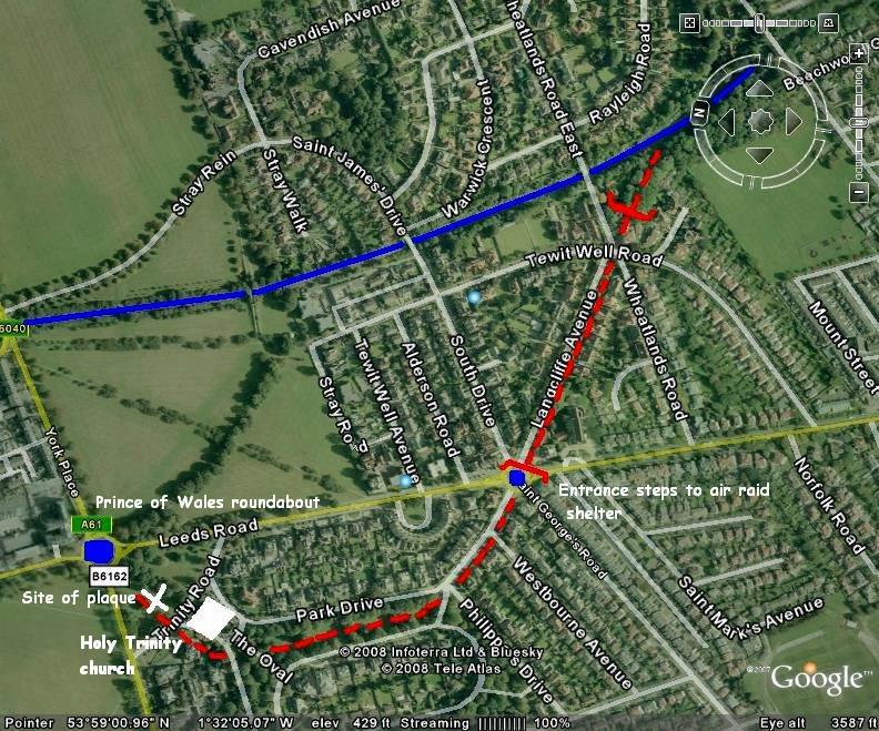
 The
2008 layout (26-01-08) L.H.E.S The
2008 layout (26-01-08) L.H.E.S
The abandoned Brunswick tunnel and station line in red. The
present day 1862 N.E.R route in blue. |
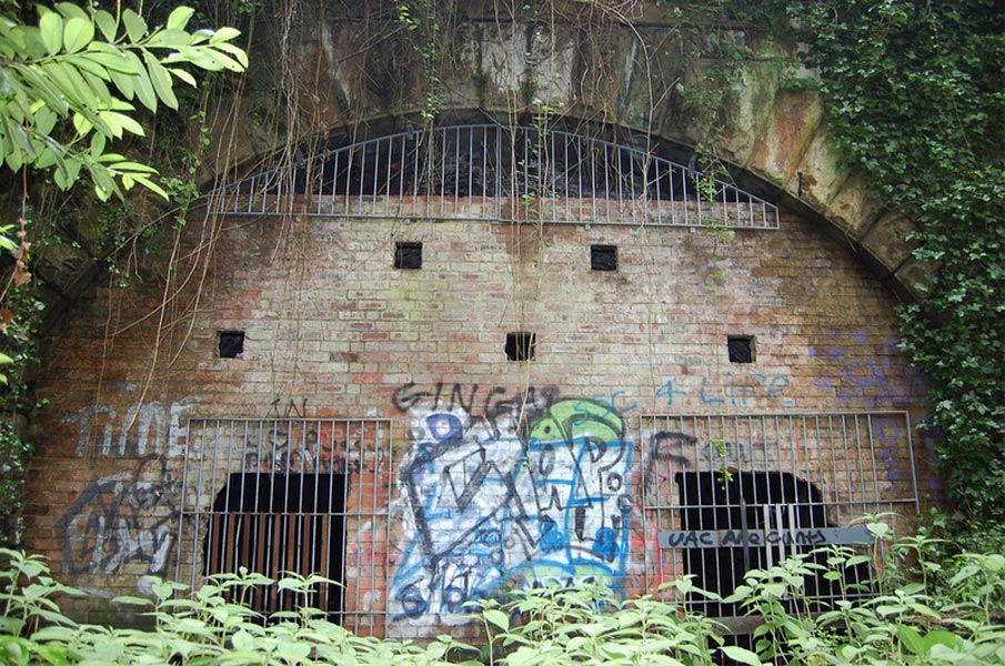
 South
portal (26-01-08) L.H.E.S South
portal (26-01-08) L.H.E.S
The last trains to negotiate this stretch of line was an incredible 126
years ago. After negotiating some treacherous terrain we catch a glimpse
of the South portal. Mother nature is hard at work keeping this tunnel a
hidden.
Due to the deep swamp conditions in the cutting this is as far back as
you can get to photograph the portal. |
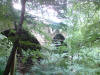
 Brunswick
Tunnel (26-01-08) L.H.E.S Brunswick
Tunnel (26-01-08) L.H.E.S
Brunswick tunnel is 400yds long with stone built
walls and brick lined roof arch, There are no refuges or air shafts
within the tunnel but it is in remarkably good condition. You can see
the indents in the tunnel floor were the sleepers used to be and there
is very little debris or vandalism once inside. |
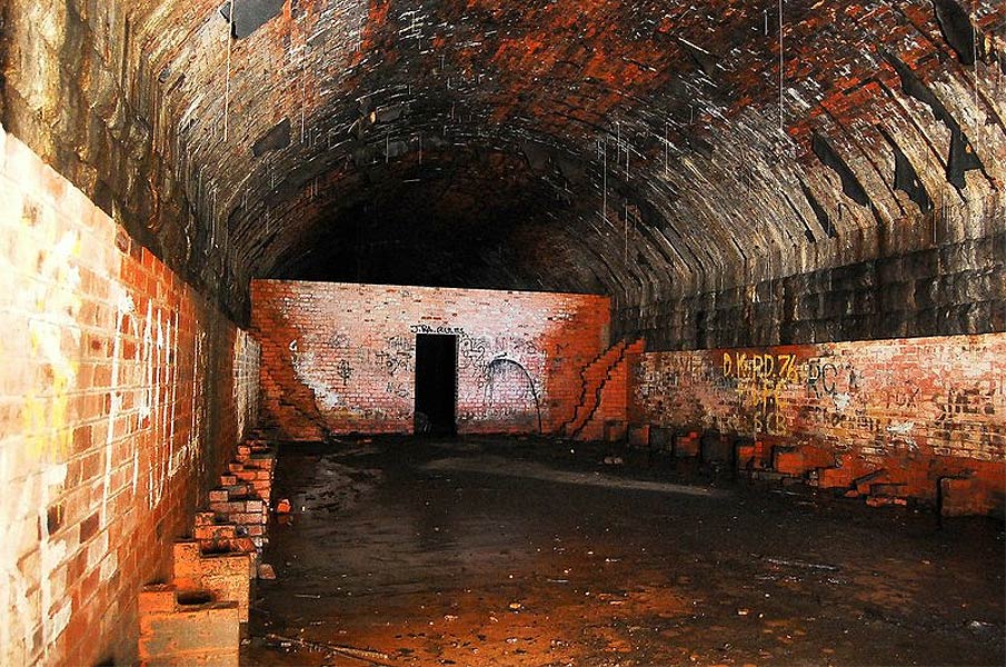
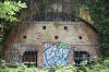
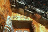
Air Raid Shelter (26-01-08) L.H.E.S
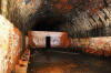 Once
through the door at the end of the tunnel we could survey the air raid
shelter. A concrete floor had been laid with a 6' high brick lined wall
lining the tunnel. Brick piers had been built to support a long wooden
bench both sides of the tunnel. You can see the remains of 'cubicles in
all four corners of the shelter, These appeared to have been make shift
toilets. We had heard the walls had been white washed during the war
years but we could see no evidence of this. This is the view looking
back towards the tunnel entrance. Once
through the door at the end of the tunnel we could survey the air raid
shelter. A concrete floor had been laid with a 6' high brick lined wall
lining the tunnel. Brick piers had been built to support a long wooden
bench both sides of the tunnel. You can see the remains of 'cubicles in
all four corners of the shelter, These appeared to have been make shift
toilets. We had heard the walls had been white washed during the war
years but we could see no evidence of this. This is the view looking
back towards the tunnel entrance. |
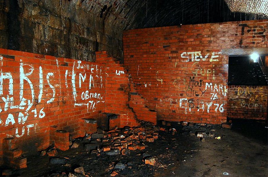
 Air
Raid Shelter (26-01-08) L.H.E.S Air
Raid Shelter (26-01-08) L.H.E.S
Close up detail of the brick bench piers and the
corner W.C closets.
Beyond the door way you can just make out the stairs that lead up to
street level on Leeds road. |
 Air
Raid Shelter (26-01-08) L.H.E.S Air
Raid Shelter (26-01-08) L.H.E.S
Looking up the air raid shelter stairs,
A narrow passage is at the top of the stairs on the right leading to the
final flight of stairs to street level. |
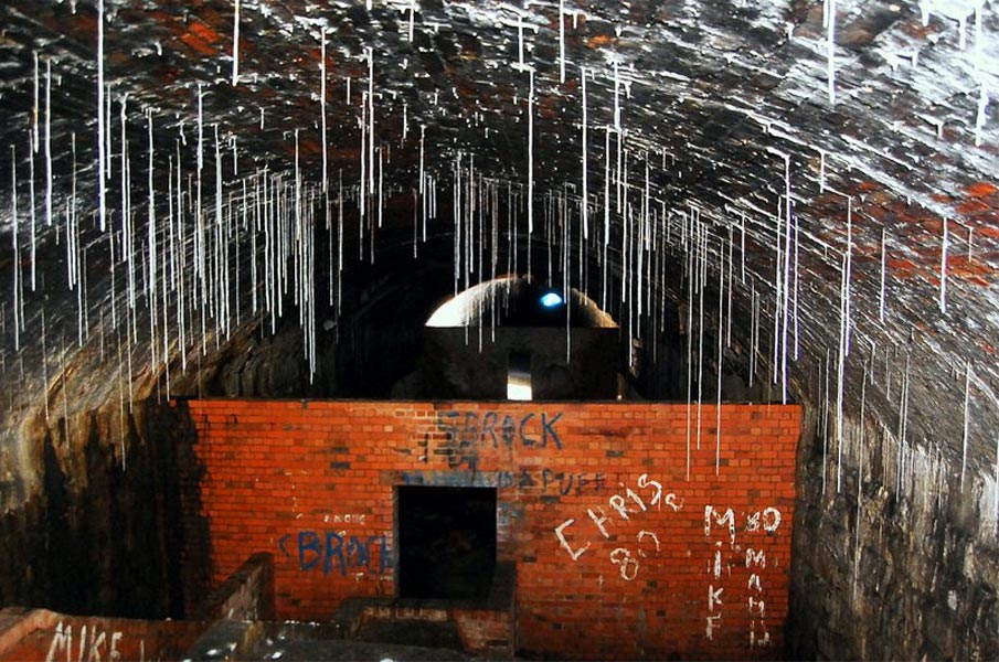
 Air
Raid Shelter (26-01-08) L.H.E.S Air
Raid Shelter (26-01-08) L.H.E.S
There is some magnificent stalagmites hanging from
the roof 4-5' long in places.
The blue 'glare' is daylight at the tunnel entrance 400yds away. |
 Air
Raid Shelter (26-01-08) L.H.E.S Air
Raid Shelter (26-01-08) L.H.E.S
Here we can see the 1848 stonework of the tunnel
portal next to the WWII concrete and brick modifications. It's amazing
to thing were stood looking at a railway tunnel abandoned for 126yrs and
at the same time an air raid shelter abandoned for 68 years. There was
evidence of electric cabling suggesting there had been a light and power
supply down here during the war years. |
 Langwith
Avenue (26-01-08) L.H.E.S Langwith
Avenue (26-01-08) L.H.E.S
The tunnel runs directly under the whole length of Langwith Avenue. |
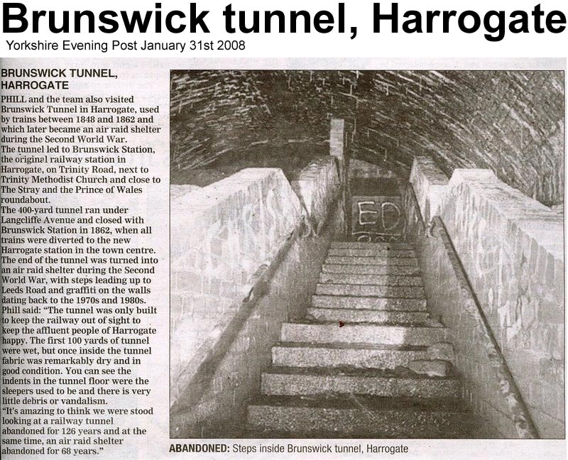
 Brunswick
Tunnel, Yorkshire Evening Post article (31-01-08) Brunswick
Tunnel, Yorkshire Evening Post article (31-01-08) |
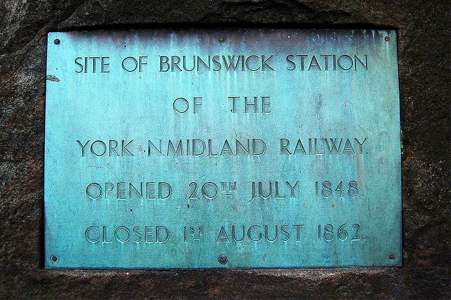
Brunswick Station plaque stone (26-01-08)
L.H.E.S
  Apart
from the plaque stone there is very little to suggest this was the site
of Harrogate's first railway station. Due to it closing so long ago
there are no photographs of the station, but it is thought to have been
built of a wooden construction as opposed to the later day stone and
brick method.
The Brunswick hotel can be seen in the distance.See more at -
http://blog.myspace.com/index.cfm?fuseaction=blog.view&friendID=265602590&blogID=351327703 Apart
from the plaque stone there is very little to suggest this was the site
of Harrogate's first railway station. Due to it closing so long ago
there are no photographs of the station, but it is thought to have been
built of a wooden construction as opposed to the later day stone and
brick method.
The Brunswick hotel can be seen in the distance.See more at -
http://blog.myspace.com/index.cfm?fuseaction=blog.view&friendID=265602590&blogID=351327703 |
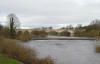
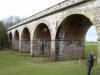
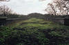
Nidd Gorge viaduct
Nidd Gorge viaduct (17-10-09) :
David Taylor
 North
of Harrogate the line crossed the Nidd Gorge on a 7 arch stone viaduct.
The line north of Harrogate closed to passenger in 1967 and to goods in
1969. It was a very busy line carrying Liverpool - Newcastle expresses
as well as other traffic to many North East towns. A1, A2, A3 and A4s
were all a familiar sights with of course the D49 Hunt Class on local
trains. Much of the track between Starbeck and the Nidd Viaduct is a
public footpath. North
of Harrogate the line crossed the Nidd Gorge on a 7 arch stone viaduct.
The line north of Harrogate closed to passenger in 1967 and to goods in
1969. It was a very busy line carrying Liverpool - Newcastle expresses
as well as other traffic to many North East towns. A1, A2, A3 and A4s
were all a familiar sights with of course the D49 Hunt Class on local
trains. Much of the track between Starbeck and the Nidd Viaduct is a
public footpath. |
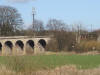
 Bilton
Railway Embankment (07-10) : James Lovell Bilton
Railway Embankment (07-10) : James Lovell
P110710_13.34: Bilton Railway Embankment. Looking towards the viaduct
along the railway embankment. This photo was taken near Bilton. (July
2010) |
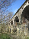
 Nidd
Viaduct (07-10) : James Lovell Nidd
Viaduct (07-10) : James Lovell
Nidd Viaduct -1. The Nidd Gorge Viaduct surrounded by trees, I was
amazed by the sheer size of it, the height difference
between the first and second pillar is about 50 or so feet. |
 Nidd
Viaduct (07-10) : James Lovell Nidd
Viaduct (07-10) : James Lovell
Nidd Viaduct-2. The Nidd Gorge Viaduct almost
belongs in this landscape. |
 Nidd
Viaduct (07-10) : James Lovell Nidd
Viaduct (07-10) : James Lovell
Nidd Viaduct-3. The Nidd Gorge Viaduct, showing
the height of it,
this photo was taken from the base of the valley on the bank of the
River Nidd. |
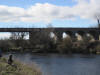
 Nidd
Viaduct (07-10) : James Lovell Nidd
Viaduct (07-10) : James Lovell
Nidd Viaduct-4. A panoramic view of the viaduct,
taken from the banks of the River Nidd.
The viaduct used to be open to the public but it was shut, mainly due to
people stealing the capping stones for their gardens. |
Kirkstall Viaduct
 Kirkstall
Viaduct (17-10-09) : David Taylor Kirkstall
Viaduct (17-10-09) : David Taylor
And if Arthington then how about the 23 arch Kirkstall Viaduct,
then that's all the viaducts on this line bar a metal trough one at
Ripon which was demolished some years ago to make way for the City
centre by-pass thus dashing hopes of re-connecting the line from
Harrogate to Northallerton but - - - -
http://archive.thenorthernecho.co.uk/2004/5/14/52376.html |


/Prospect%20tunnel%201.jpg)
/Prospect%20tunnel%203.jpg)

/Prospect%20tunnel%205.jpg)
/Prospect%20tunnel%206.jpg)
/Prospect%20tunnel%207.jpg)
/Prospect%20tunnel%208.jpg)
/Prospect%20tunnel%209.jpg)
/Prospect%20tunnel%2010.jpg)