 Halifax,
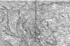
Queensbury, Low Moor & Wyke map (1843) : John Sutcliffe Halifax,
Queensbury, Low Moor & Wyke map (1843) : John Sutcliffe
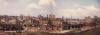
One inch to the mile map showing Sowerby Bridge in the west and Dewsbury
in the east. Published by Col. Colby dated 1843.
(This file size is about 1.4 meg, so it may take a while to download) |
 Halifax
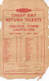
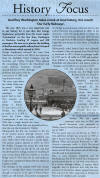
Lightcliffe handbill (1958) : Charles Boylan Halifax
Lightcliffe handbill (1958) : Charles Boylan
A very tatty handbill I found when emptying my parents house which
I scanned before it completely disintegrates. |
Midland Railway tunnel
 Midland
Railway tunnel at Skircoat, Halifax (09-08-13) : Carbootnut
see more on Flikr photostream Midland
Railway tunnel at Skircoat, Halifax (09-08-13) : Carbootnut
see more on Flikr photostream
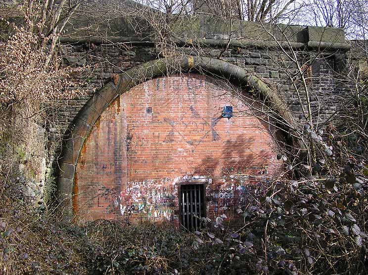
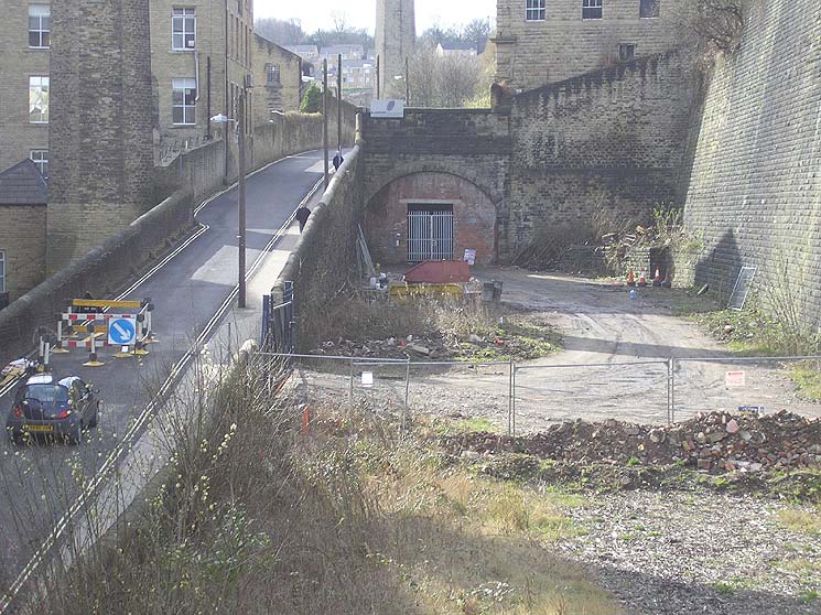
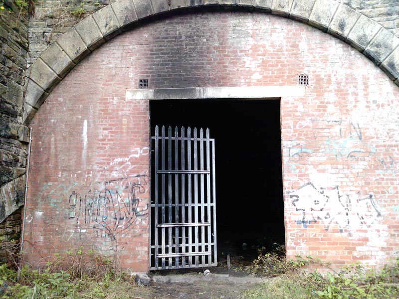
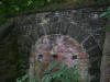
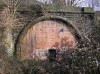
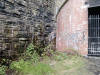
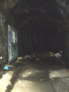
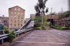
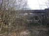
There's a tunnel at Halifax that was built by the Midland Railway. I
have posted a couple of them on my "Flickr" photostream.
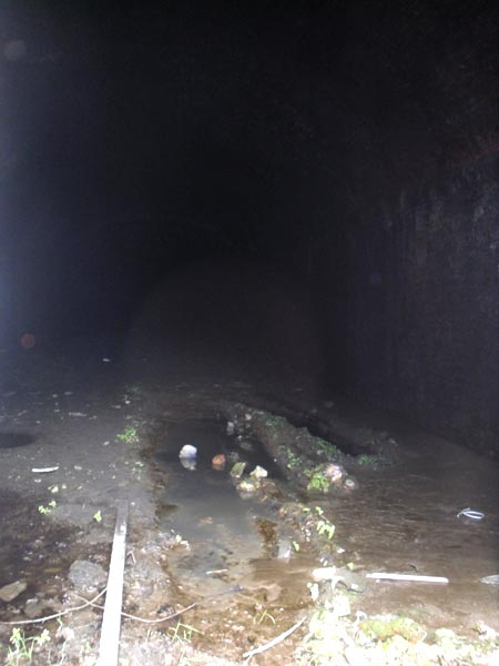
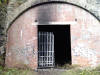
The tunnel is single track and was never completed, with only one portal
being constructed.
I don't know how long it is, but it was used as an air raid shelter. |
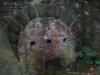 Midland
Railway tunnel at Skircoat, Halifax (09-08-13) : Carbootnut Midland
Railway tunnel at Skircoat, Halifax (09-08-13) : Carbootnut
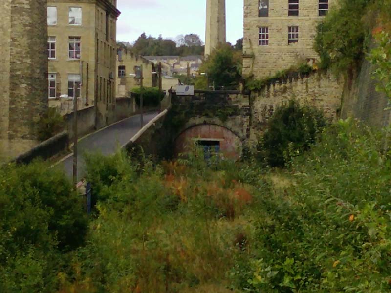
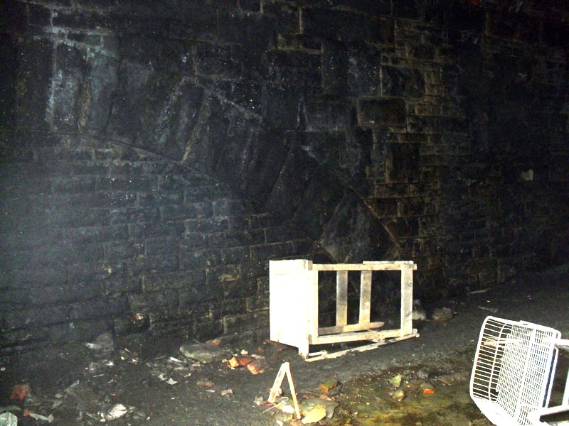
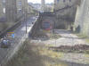
In 1898 a proposal had been put forward to build a
goods depot on the Shay Estate. In 1902 the Midland Rail Company agreed
to buy the estate having sought powers to construct a loop line at Low
Moor railway & to run a part of the L& Y line to Halifax. Shortly after
this the money ran out & all plans were abandoned. Work was started on
this tunnel to run under Skircoat Road, on the Well Head side of the
road. |
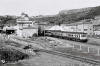
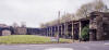
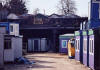
Halifax Old Station
Opened 1855.
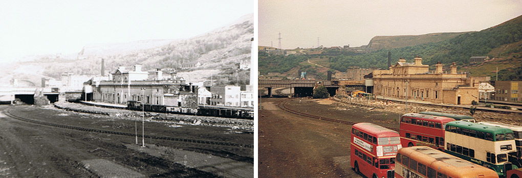
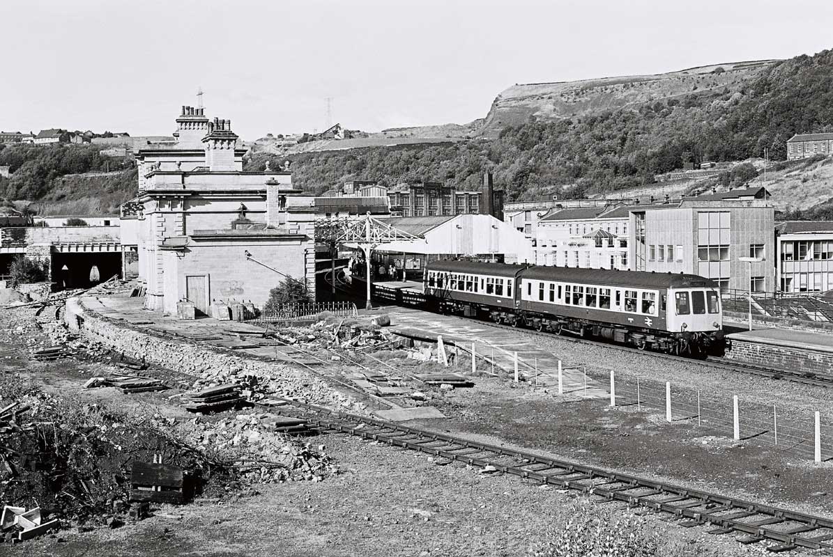
 Halifax
Station (11-81, 08-82) : Dave Heatley Halifax
Station (11-81, 08-82) : Dave Heatley
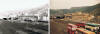
B&W photo taken in Nov ’81 – GN platform being demolished and track
recently lifted into freight sidings.
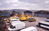
Second photo taken in Aug 1982 showing the bus museum parked out in the
open before moving to Low Moor. |
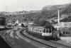
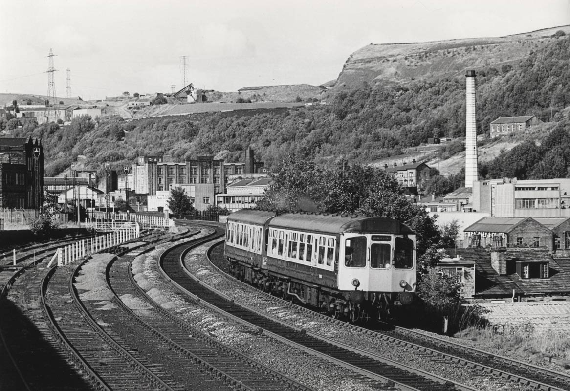
 Halifax
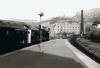
Station (19-08-86) : © Andrew Gallon Halifax
Station (19-08-86) : © Andrew Gallon
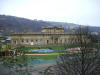
Halifax station on August 19th 1986, before redevelopment as part of the
Eureka! children's museum.
A two-car Class 108 Metro-Cammell DMU
forms the 15.55 Manchester Victoria-York. |
 Halifax
Town Crier Newspaper article Halifax
Town Crier Newspaper article
www.halifaxuk.co.uk |
 Halifax
Station (1981) : Dave Heatley Halifax
Station (1981) : Dave Heatley
Class25 25125 dragging a failed DMU to Bradford – Hammond St Depot
perhaps. |
 Halifax
Station (16-12-07) : Andrew Stopford Halifax
Station (16-12-07) : Andrew Stopford
Shot of Halifax Station & disused platforms.
|
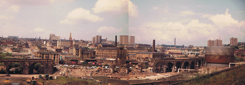
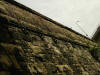
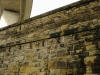
Coal
drops facing south (30-04-06) : David Webdale
 Next
to the existing Halifax Old station these massive coal drops.
The stub of the viaduct to North bridge to the left of coal drops. Next
to the existing Halifax Old station these massive coal drops.
The stub of the viaduct to North bridge to the left of coal drops.
The still in use viaduct leading off to Beacon Hill on the far left.
Note : Brandon Hatzer
The coal drops in Halifax are listed Grade II
http://www.calderdale.gov.uk/environment/conservation/listedbuildings/
The description reads - Coal drops. 1874. Built for the Ovenden and
Halifax Junction Railway Co. Rock-faced ashlar with wooden bunkers. 15
wooden bunkers each supported between stone piers and to the north an
open shed, with beyond a battered wall topped with a parapet. These coal
drops are built into the slopping hillside. Each wooden bunker has 2
metal doors which were raised on an iron ratchet geared pulley system.
This is a rare and large scale example of railway coaldrops.
I understand if you've already seen this or already know this but
hearing it from my Council pretty much asserts they are listed, and so
they should be! Better than being knocked down or being converted into
flats like every other memory! |
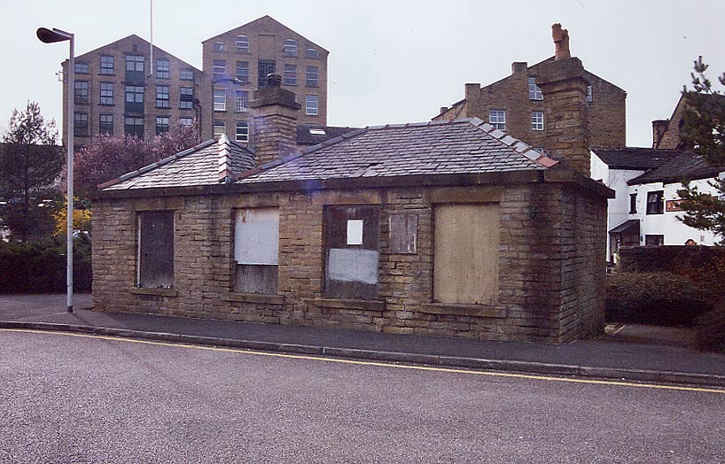
 Coal
drops building facing west 22-04-06 : David Webdale Coal
drops building facing west 22-04-06 : David Webdale
Little building survives in the corner of the car
park above the coal drops.
|
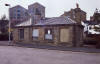
Shaw Syke station
 Opened 1844. Closed ? Opened 1844. Closed ?
Shaw Syke (19-08-86) : © Andrew Gallon
Shaw Syke, immediately south of Halifax station, on
August 19th 1986.
A two-car Class 110 Gloucester RCW 'Calder
Valley' DMU forms the 15.47 Leeds-Manchester Victoria. |
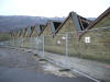
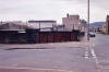
 Shaw Syke goods (16-12-07) : Andrew Stopford Shaw Syke goods (16-12-07) : Andrew Stopford
Built on the south side of Halifax station on the
L&Y Sowerby Bridge, Halifax & Bradford line.
Opened by the Lancashire & Yorkshire Railway in 1844. |
 Shaw Syke goods (16-12-07) : Andrew Stopford Shaw Syke goods (16-12-07) : Andrew Stopford
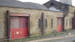
The old Shaw Syke goods/parcels station which
looks like its about to fall down or be pushed! |
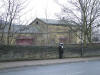
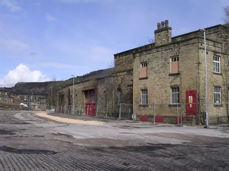
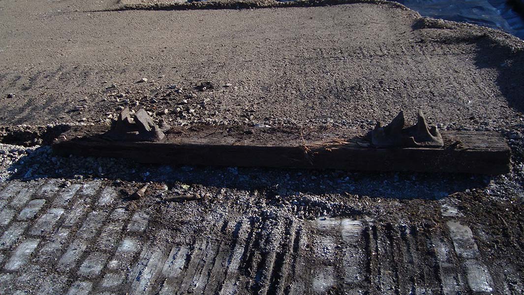
 Shaw Syke
goods (04-03-10) : David Taylor Shaw Syke
goods (04-03-10) : David Taylor
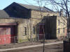
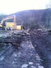
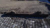
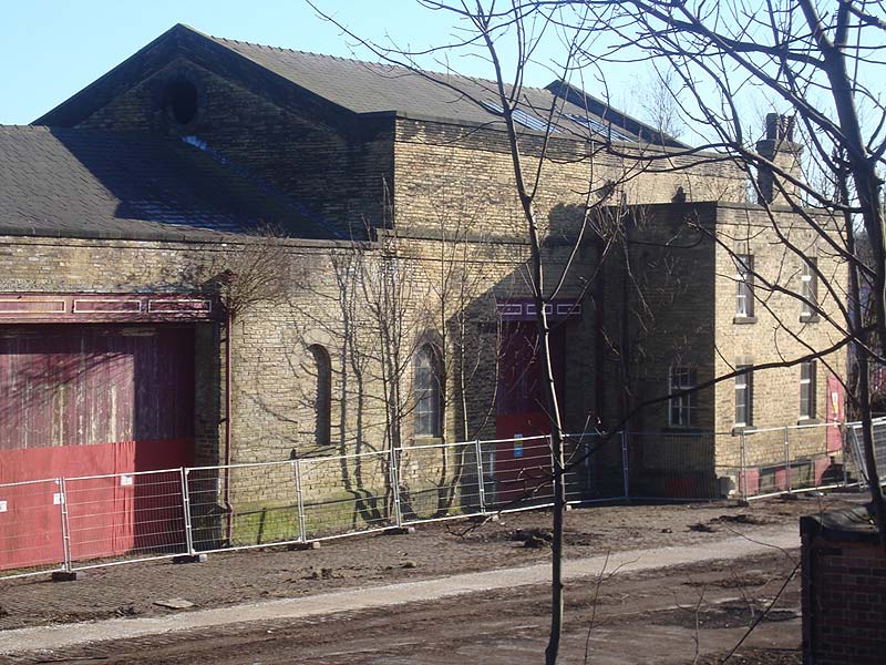
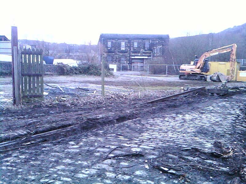
Following site clearance the GNR warehouse is
visible in the distance. See next photo.
|
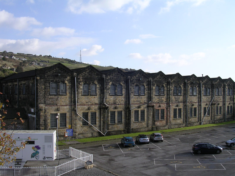
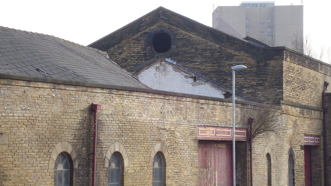
 GNR
warehouse (04-03-10) : David Taylor GNR
warehouse (04-03-10) : David Taylor
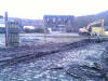
GNR warehouse west elevation.
|
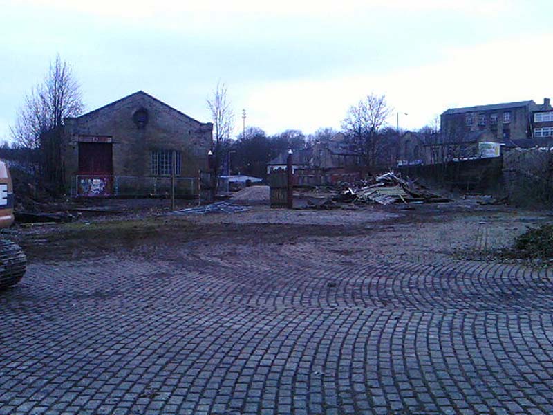
_small.jpg) _small.jpg) Shaw Syke
goods (04-03-10) : David Taylor Shaw Syke
goods (04-03-10) : David Taylor
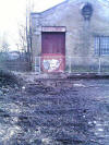
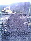
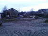
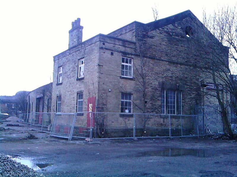
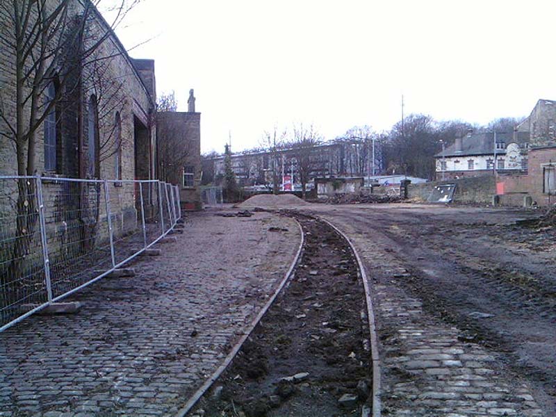
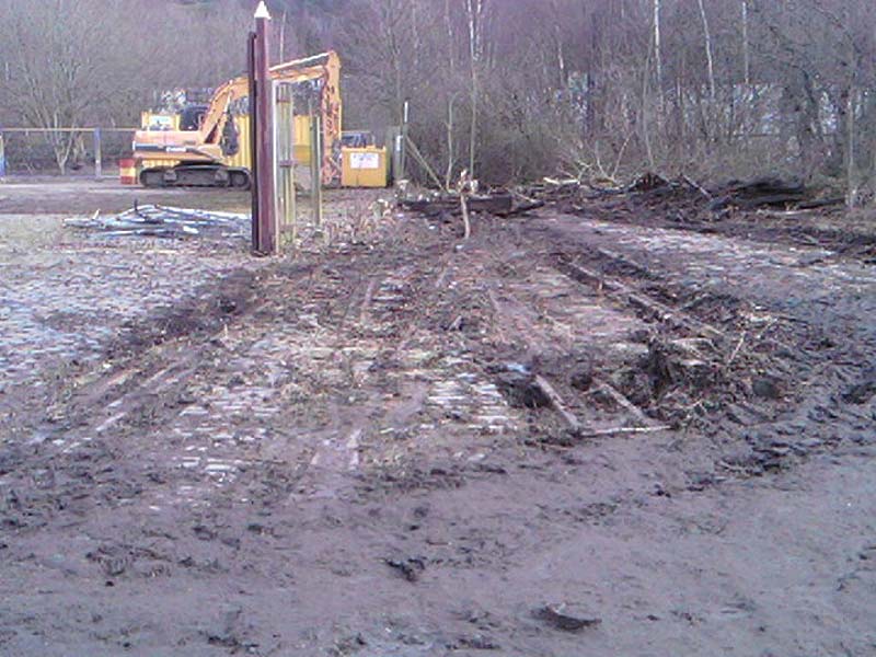
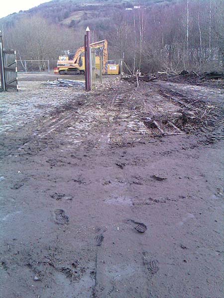
Yesterday I noticed that work seemed to have
started on clearing the site of the Shaw Syke Goods Yard for the
proposed car park which was announced last year. |
_small.jpg) _small.jpg) Shaw Syke
goods (04-03-10) : David Taylor Shaw Syke
goods (04-03-10) : David Taylor
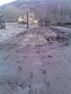
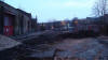
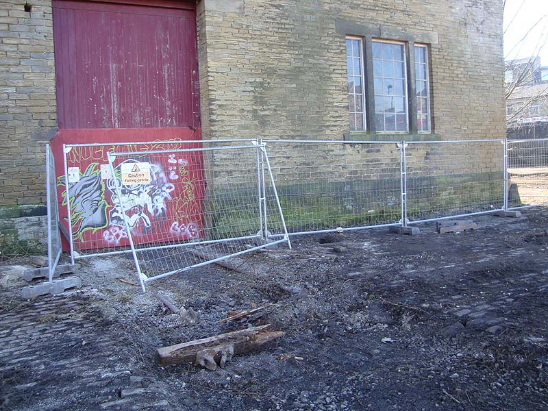
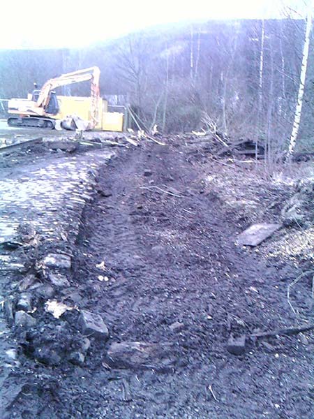
I went down today with my camera and they are well
on with clearing the site of the sidings and yard, sets piled up, but
the good news is the contractor told me the building has very recently
been Listed and so they cannot now demolish as originally intended. |
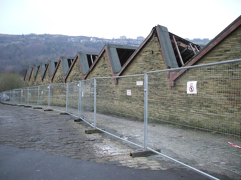
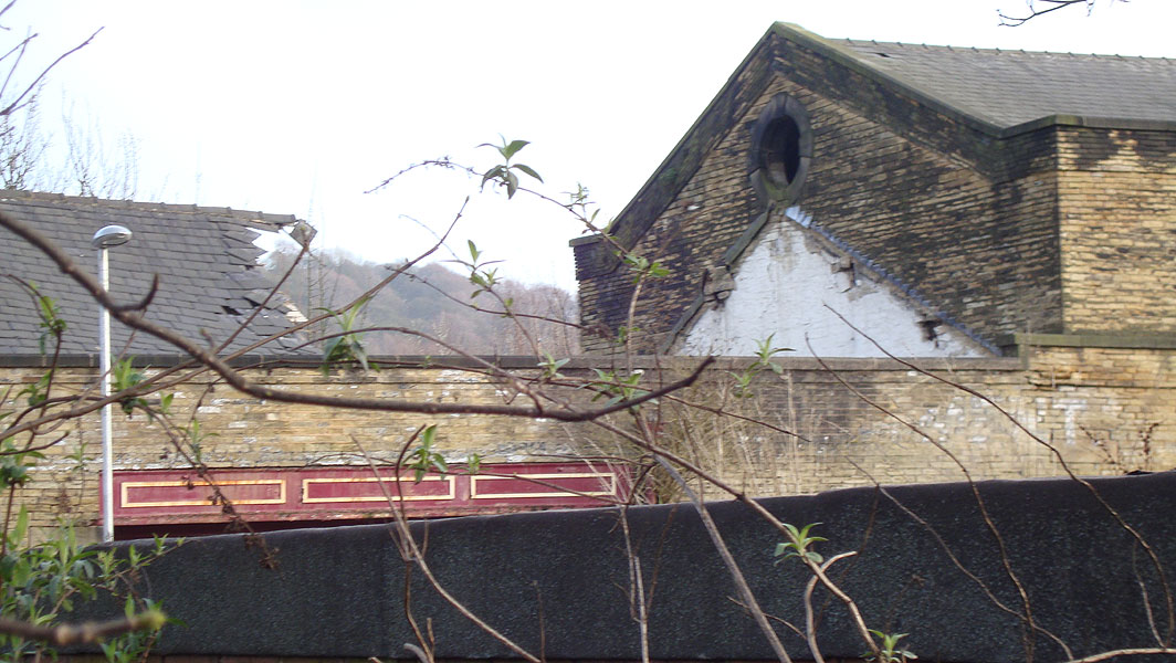
_small.jpg) _small.jpg) Shaw Syke
goods (27-03-11) : David Taylor Shaw Syke
goods (27-03-11) : David Taylor
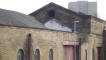
Sorry to say that part of the roof has now
collapsed. It was listed last year shortly before proposed demolition
but nonetheless I doubt there will be the money to repair it. It's now
owned by the Eureka, the National Children's Museum. |
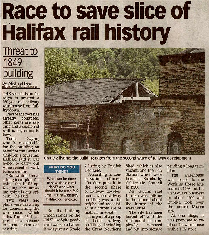
 Shaw Syke
goods (18-05-11) : Michael Bradley Shaw Syke
goods (18-05-11) : Michael Bradley
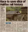
Article from the Halifax Courier Wednesday 18th
May 2011 regarding the current state of the former working horse museum. |
Shaw Syke goods (09-03-10) : Michael
Bradley
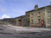
South Parade Goods yard Halifax, formerly the
“Working at Horses Museum”. The site was quite extensive survival of
railway infrastructure up to the past couple of years when the two road
open good shed was pulled down for safety reasons. The good shed itself
was of Lancashire and Yorkshire origin and was connected up to the sole
remaining siding which runs alongside in the yard to the Husnlet 0-4-0
and MK 2 coach which rests as a picnic and lunch are for visitors to
Eureka.
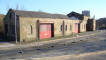
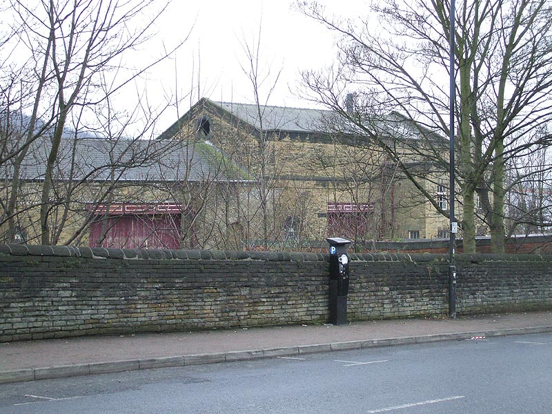
 Shaw Syke
goods (09-03-10) : Michael Bradley Shaw Syke
goods (09-03-10) : Michael Bradley
The Lancashire and Yorkshire good shed formerly
the "Horses at Work Museum" in Halifax. |
 Shaw Syke
goods (09-03-10) : Michael Bradley Shaw Syke
goods (09-03-10) : Michael Bradley
View of the building from the water lane side
pointing north towards the railway station. |
 Shaw Syke
goods (09-03-10) : Michael Bradley Shaw Syke
goods (09-03-10) : Michael Bradley
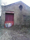
A view of the entrance to the good shed with the
intact railway infrastructure before the contractors arrived on site. |
 Shaw Syke
goods (09-03-10) : Michael Bradley Shaw Syke
goods (09-03-10) : Michael Bradley
View of the entrance with the track work removed. |
 Shaw Syke
goods (09-03-10) : Michael Bradley Shaw Syke
goods (09-03-10) : Michael Bradley
View of the entrance with the track work removed
up to approximately 1.5m from the building. |
 Shaw Syke
goods (09-03-10) : Michael Bradley Shaw Syke
goods (09-03-10) : Michael Bradley
A close up shot. |
 Shaw Syke
goods (09-03-10) : Michael Bradley Shaw Syke
goods (09-03-10) : Michael Bradley
The sole remaining siding (now filled in) i
believe |
 Shaw Syke
goods (09-03-10) : Michael Bradley Shaw Syke
goods (09-03-10) : Michael Bradley
The three way point that connected once all three
sidings together, one of the last few photographs of this in place. |
 Shaw Syke
goods (09-03-10) : Michael Bradley Shaw Syke
goods (09-03-10) : Michael Bradley
The tracked where the point which joined the shed
road to the sidings has now been cut short. |
 Shaw Syke
goods (09-03-10) : Michael Bradley Shaw Syke
goods (09-03-10) : Michael Bradley
Track removal in progress with the gate posts
which formed a gate which ran alongside the open good shed can still be
seen. |
 Shaw Syke
goods (09-03-10) : Michael Bradley Shaw Syke
goods (09-03-10) : Michael Bradley
The view from the 4 foot standing where the good
shed road once was. |
 Shaw Syke
goods (09-03-10) : Michael Bradley Shaw Syke
goods (09-03-10) : Michael Bradley
Another photo of the point underneath mud and
dirt. |
 Shaw Syke
goods (09-03-10) : Michael Bradley Shaw Syke
goods (09-03-10) : Michael Bradley |
 Shaw Syke
goods (09-03-10) : Michael Bradley Shaw Syke
goods (09-03-10) : Michael Bradley
View of the yard |
 Shaw Syke
goods (09-03-10) : Michael Bradley Shaw Syke
goods (09-03-10) : Michael Bradley
Another view of the yard looking in the direction
of water lane and the site of Shaw Syke station. |
 Shaw Syke
goods (09-03-10) : Michael Bradley Shaw Syke
goods (09-03-10) : Michael Bradley
The rest of the point is hidden in the undergrowth
which links to the siding which the Hunslet 0-4-0 and Mark 2 coach stand
one. |
  Shaw Syke
goods (06-04-11) : Michael Bradley Shaw Syke
goods (06-04-11) : Michael Bradley
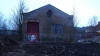
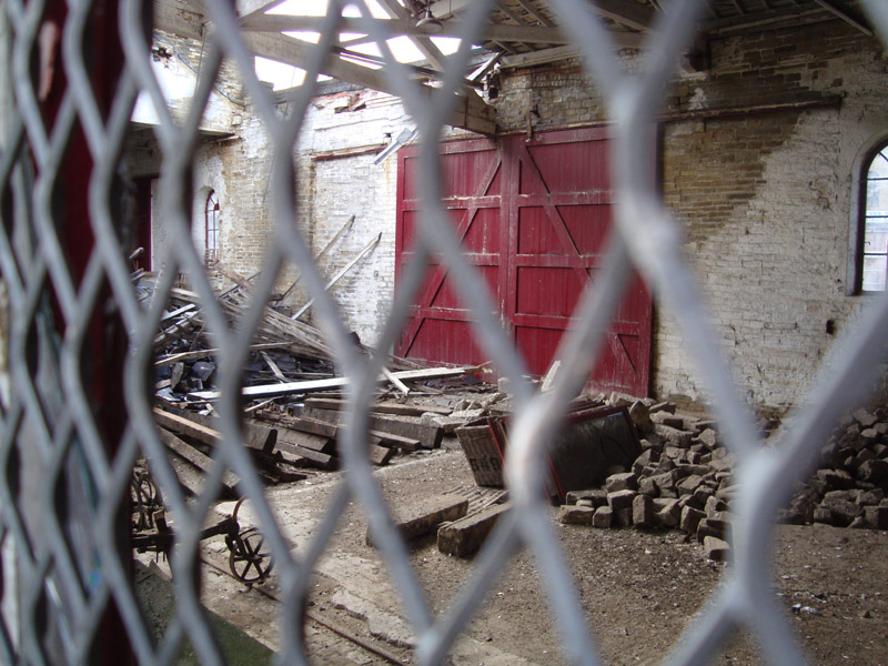
General views of the goods shed. |
  Shaw Syke
goods (06-04-11) : Michael Bradley Shaw Syke
goods (06-04-11) : Michael Bradley
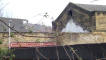
Close ups of the collapsed roof. |
 Shaw Syke
goods (06-04-11) : Michael Bradley Shaw Syke
goods (06-04-11) : Michael Bradley
A rare view of the interior. |
  Shaw Syke
goods (06-04-11) : Michael Bradley Shaw Syke
goods (06-04-11) : Michael Bradley
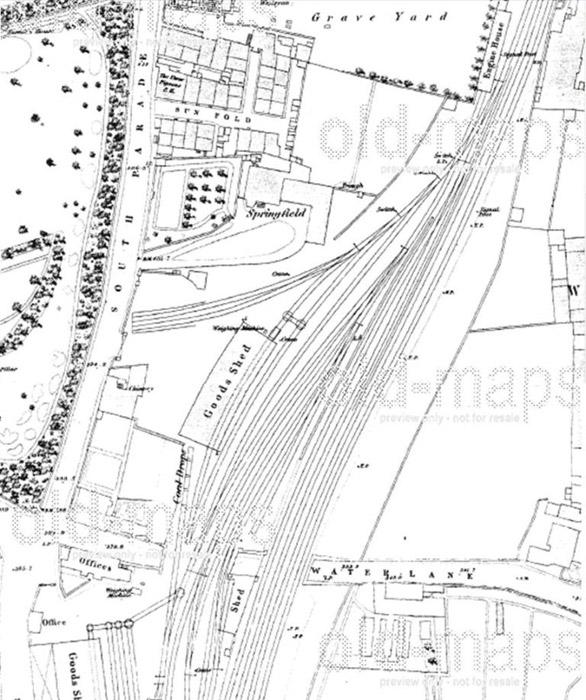
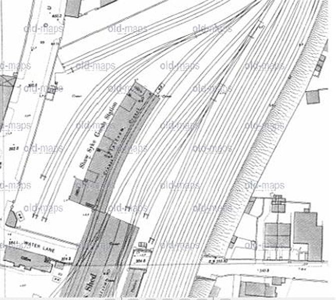
Maps from the late 19th century. See old maps here
- www.old-maps.co.uk/maps.html |
 Halifax to Queensbury 1880 - 1955
Great Northern Railway Halifax to Queensbury 1880 - 1955
Great Northern Railway
Hybrid Map - Roads 2010 Rails 1910
See Queensbury to Halifax section
|
 Lee
Bank Tunnel GNR Lee Bank
Tunnel to North Bridge is part of the Halifax to Queensbury Line Lee
Bank Tunnel GNR Lee Bank
Tunnel to North Bridge is part of the Halifax to Queensbury Line
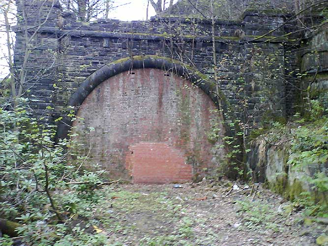
Lee
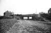
Bank Tunnel north portal April 06 : Matt C
North portal of the 267 yards Lee Bank tunnel |
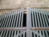
 Lee
Bank Tunnel north portal (21/04/07)
: Andrew Booth Lee
Bank Tunnel north portal (21/04/07)
: Andrew Booth
It appears some work has been carried out recently and the portal doors
have been bricked up there are also remnants of a old ground frame hut
or platelayers hut although the photos I took (Mobile phone) lack
detail. |
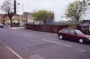
 Lee
Bank Tunnel south portal April 06 : Matt C Lee
Bank Tunnel south portal April 06 : Matt C
The portal was in- filled when the A629 Ovenden
road was widened into a dual carriageway. |
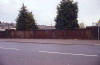
/Halifax%20Queensbury/20210527_125846_small.jpg) Lee
Bank Tunnel south portal (27-05-21) : NigglePics Lee
Bank Tunnel south portal (27-05-21) : NigglePics
This is a pic of the northern portal of Lee Bank
Tunnel Halifax on the North Bridge to Queensbury line, the picture was
taken on 27/05/2021. Taken whilst doing my YouTube video at
https://www.youtube.com/watch?v=TKaienGCWh8&t=318s |
Woodside Viaduct Dean Clough GNR
%20Viaduct_small.jpg) Woodside
Viaduct (17-01-10) : David Webdale Woodside
Viaduct (17-01-10) : David Webdale
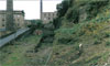
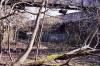
Remnant of the south end of the six arch viaduct
at Dean Clough originally Crossley's Mill.
Just beyond is the north portal of Old Lane tunnel, to the left of the
chimney, see next photo.
The viaduct was demolished when the A629 Ovenden road was widened into a
dual carriageway. |
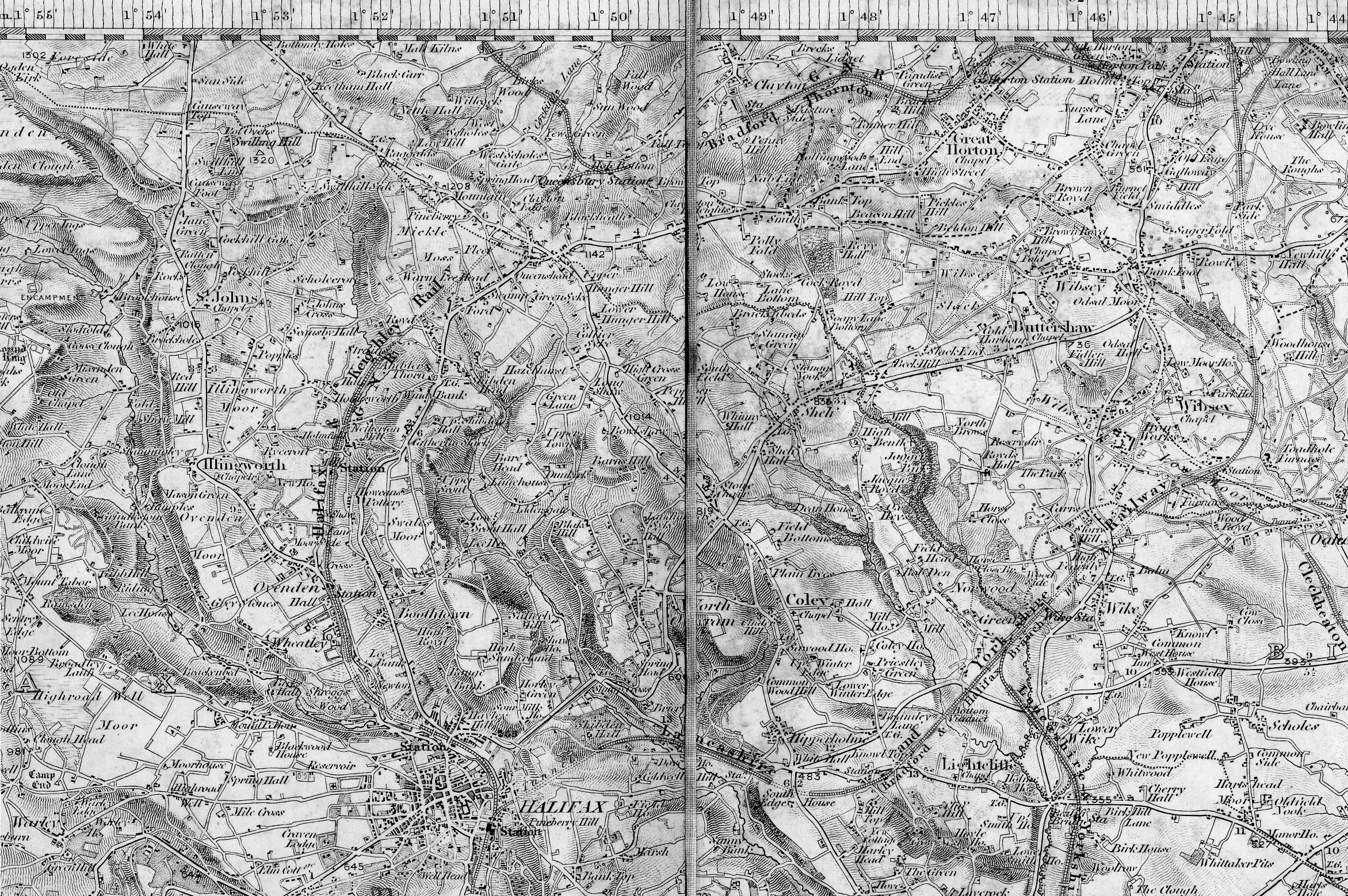
 Old
Lane Tunnel GNR Old
Lane Tunnel GNR
Old
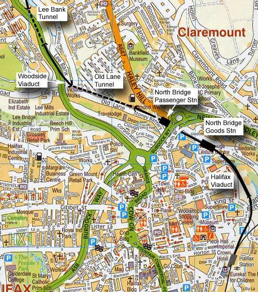
Lane tunnel north portal 18-04-06 : Matt C
North portal of the 403 yards Old Lane tunnel. |
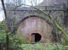
 Old
Lane tunnel south portal 18-04-06 : Matt C Old
Lane tunnel south portal 18-04-06 : Matt C
Old lane tunnel is located near to the old North Bridge
Station and at the southern portal, there has been some recent work
carried out inside the tunnel, maybe structural defects, but this has
not affected the northern portal which is still intact. |
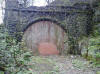
 Old
Lane tunnel south portal (12-10-09) : Brandon Hatzer Old
Lane tunnel south portal (12-10-09) : Brandon Hatzer
Of course something you will recognise, I just
thought I'd get a recent picture of it with it all overgrown,
which made
it too difficult to walk on from the North Bridge car park which I
originally planned to do a few weeks ago. |
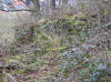
  Old
Lane tunnel south portal (03-05-10) : Brandon Hatzer Old
Lane tunnel south portal (03-05-10) : Brandon Hatzer |
Dean Clough Tunnel
 Old
Lane tunnel south portal / Dean Clough tunnel (03-05-10) : Brandon Hatzer Old
Lane tunnel south portal / Dean Clough tunnel (03-05-10) : Brandon Hatzer
A branch line leading down to Crossley's Carpets
at Dean Clough Mills
dived under the GNR Queensbury line just inside Old Lane tunnel.
The bricked up top of this tunnel is visible on the left. |
 Dean
Clough cutting Dean
Clough cutting
View showing Old Lane Tunnel to left and tunnel
into Crossleys Carpets in cutting to right.
See Alf Mullins set on Flickr -
http://www.flickr.com/photos/49903268@N02/4581650841/in/pool-leedsrailways/
See also Phill Davisons set on Flickr -
http://www.flickr.com/photos/phill_dvsn/4652433473/ |
 Dean
Clough tunnel (03-05-10) : Brandon Hatzer Dean
Clough tunnel (03-05-10) : Brandon Hatzer
View of the archway from inside Old Lane tunnel. |
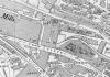 North
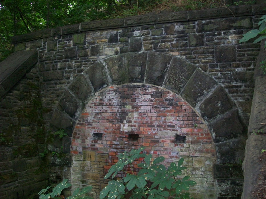
Bridge OS map (1905) North
Bridge OS map (1905)
The branch line leading down to Dean Clough mills
was steeply graded dropping downwards from just under the footbridge &
then diving under the main line & Old lane. Crossley's Carpets had an
internal rail system used for moving machinery & delivering coal to its
boiler houses. The wagons were originally horse drawn but in later years
a tractor was used. |
 Dean
Clough tunnel (03-05-10) : Brandon Hatzer Dean
Clough tunnel (03-05-10) : Brandon Hatzer
View of the other end of the tunnel down in Dean
Clough. |
 Dean
Clough tunnel (03-05-10) : Brandon Hatzer Dean
Clough tunnel (03-05-10) : Brandon Hatzer
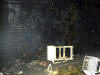
The view inside & bricking up at the other end
visible in the darkness. |
North
Bridge GNR
 Opened
25-03-1880. Closed 23-04-1955. Freight 1974. Opened
25-03-1880. Closed 23-04-1955. Freight 1974.
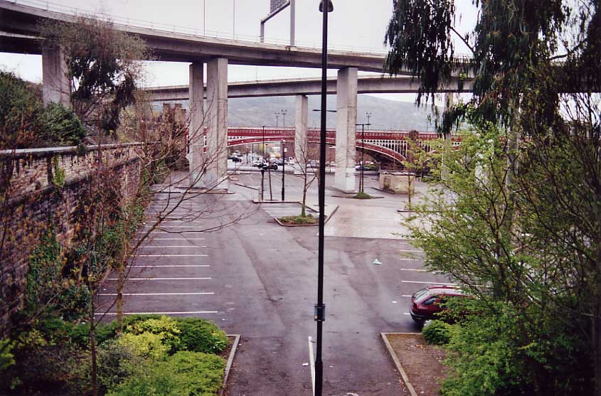
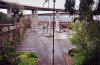
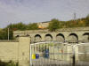
North
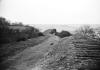
Bridge station facing east 30-04-06 : David Webdale
Taken from the cast iron footbridge, view of station site
& the north bridge.
See Queensbury to Halifax section |
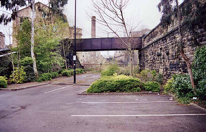
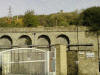
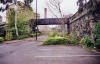 North
Bridge station facing west 30-04-06 : David Webdale North
Bridge station facing west 30-04-06 : David Webdale
Facing back towards the footbridge I was standing
on in the previous photo.
This little cast iron bridge is the only survivor of the whole station.
Old lane tunnel visible in the background. |
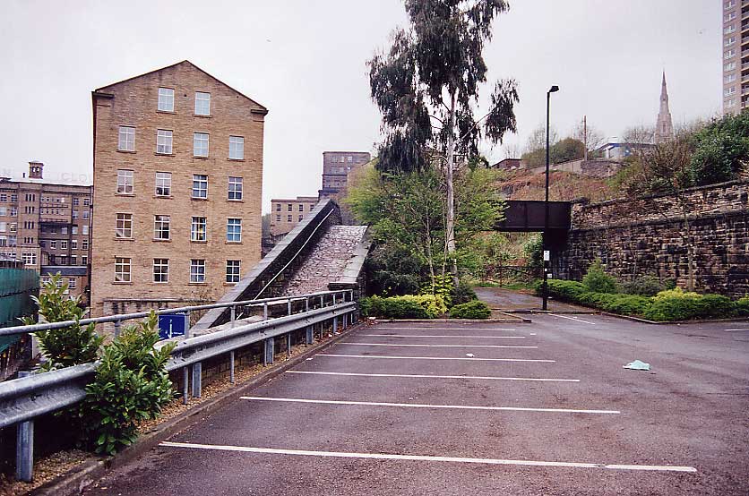
 North
Bridge station facing west 30-04-06 : David Webdale North
Bridge station facing west 30-04-06 : David Webdale
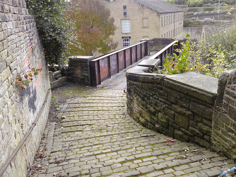
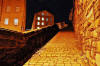
Wider view lets us see the steep stone cobbled
snicket on the
left, leading up to the footbridge. |
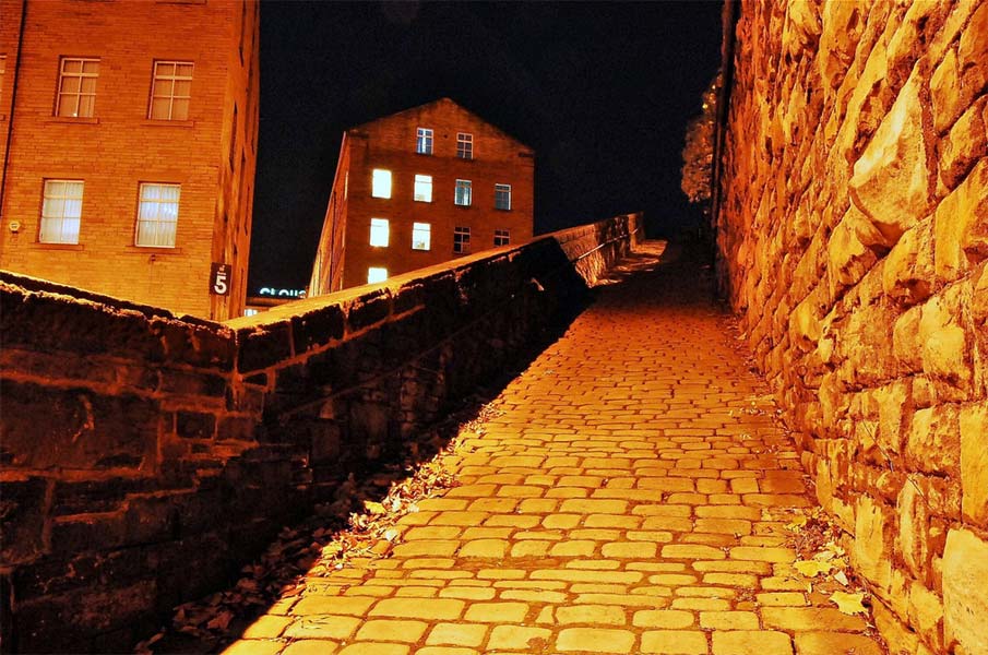
 North
Bridge station stone cobbled snicket : Phill Davison North
Bridge station stone cobbled snicket : Phill Davison
Cobbled slope leading to the footbridge. |
 North
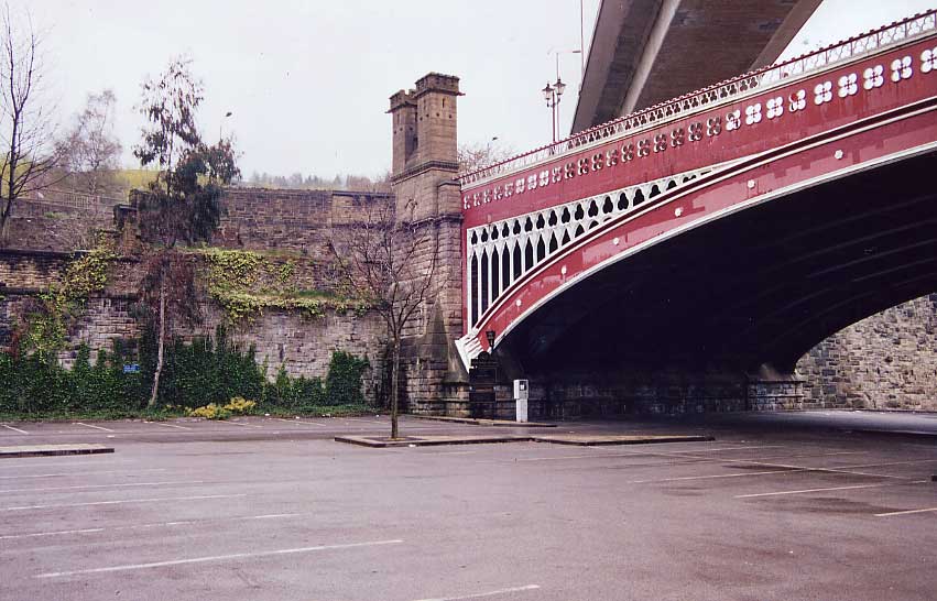
Bridge station entrance 30-04-06 : David Webdale North
Bridge station entrance 30-04-06 : David Webdale
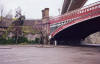
The tasty North bridge itself.
Bricked up station entrance was just to the left of those fancy towers
at the north end of the bridge. |
 North
Bridge (12-10-09) : Brandon Hatzer North
Bridge (12-10-09) : Brandon Hatzer
Near the old Halifax North Bridge Station the old
hand rails are still there! Which I thought was quote astounding. |
 North
Bridge (12-10-09) : Brandon Hatzer North
Bridge (12-10-09) : Brandon Hatzer
This is the bottom of the hand rail and I may be
wrong,
but I'm presuming the path started there going towards the old area of
the station. |
 North
Bridge (12-10-09) : Brandon Hatzer North
Bridge (12-10-09) : Brandon Hatzer
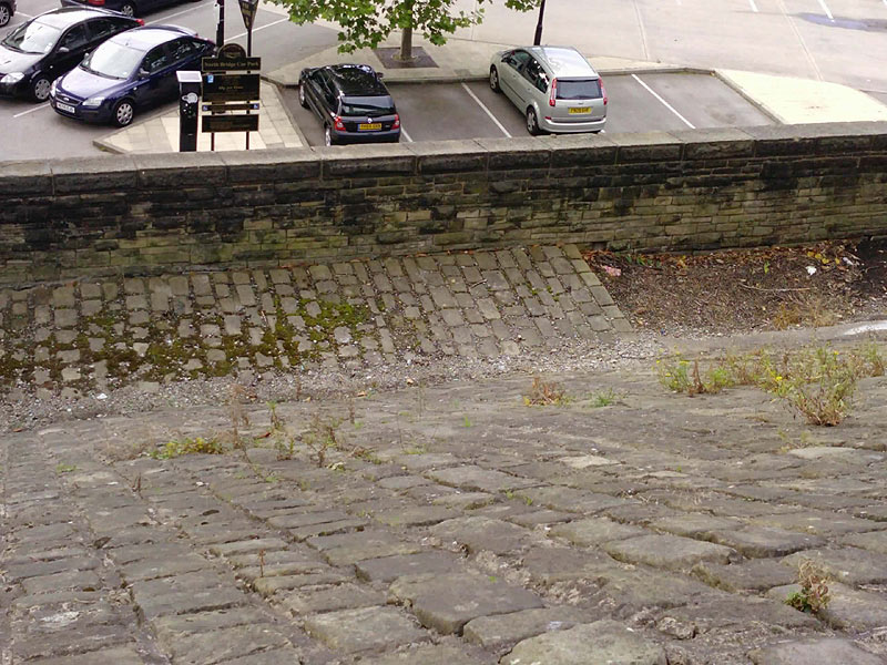
Helping my point that I believe it's a path to the
old station,
you can see the cobbled path which is popular in Halifax and is
overgrown but not removed. |
 North
Bridge (12-10-09) : Brandon Hatzer North
Bridge (12-10-09) : Brandon Hatzer
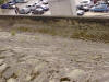
Another picture of the pathway and the 'North
Bridge Car Park' sign in the background for effect!
Along with the parking meter, you didn't get meters like that to park
the train.
|
 North
Bridge (12-10-09) : Brandon Hatzer North
Bridge (12-10-09) : Brandon Hatzer
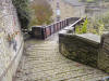
I then started to walk off the bottom of Boothtown
Road (I probably got the road name wrong) to wards the Iron Bridge
above North Bridge Station showing the same type of hand rail that was
shown earlier closer to the bridge. |
 North
Bridge (12-10-09) : Brandon Hatzer North
Bridge (12-10-09) : Brandon Hatzer
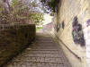
The same steps looking up. At the very top you
turn right to the road that goes towards Boothtown.
You can just see at the top KFC and then further up is LIDL *sigh* |
 North
Bridge (12-10-09) : Brandon Hatzer North
Bridge (12-10-09) : Brandon Hatzer
The bottom of the steps I came down looking
straight at the iron bridge with Dean Clough in the background.
At least this would have looked not too far off this back when active,
though it's less smog now and more masses of graffito.
|
 North
Bridge (12-10-09) : Brandon Hatzer North
Bridge (12-10-09) : Brandon Hatzer
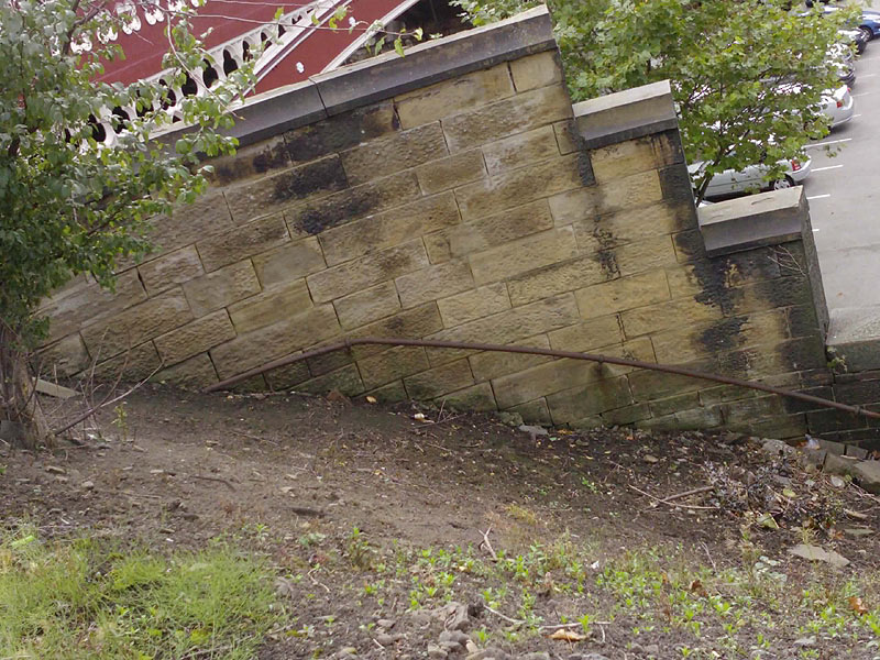
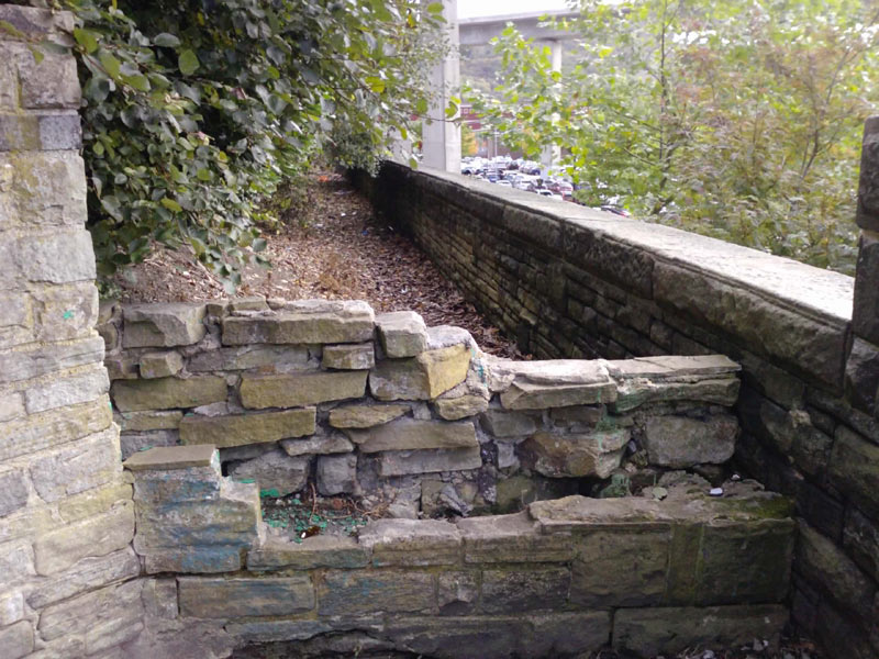
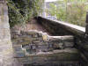
I daren't go on here, mainly didn't want to get my
work smarts dirty! But it's obviously a badly built wall to stop people
walking on the side where the path from earlier leads to. I'm not sure
how it went down to the station but of course whatever was there to get
you to the station has been long removed. The iron bridge starts
directly to the right. |
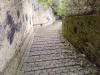
North Bridge (12-10-09) : Brandon Hatzer
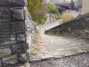 Many
pictures when looking on Flikr and other places of this slope looking up
but I thought I'd do one looking down. Was a benefit walking down here,
made me realise I need new shoes as my grips on my work shoes nearly had
me head over heels, not much looking after here so can be slippy
especially on the sections without a hand rail. Don't know how people
used this in the winters of old Many
pictures when looking on Flikr and other places of this slope looking up
but I thought I'd do one looking down. Was a benefit walking down here,
made me realise I need new shoes as my grips on my work shoes nearly had
me head over heels, not much looking after here so can be slippy
especially on the sections without a hand rail. Don't know how people
used this in the winters of old |
 North
Bridge (12-10-09) : Brandon Hatzer North
Bridge (12-10-09) : Brandon Hatzer
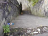
The bottle there kind of spoils it, but I've seen
many of the slope, but no pictures of the steps. Old school steps,
steeper than any health and safety officer would allow them now. Not
nice after dark walking up these! |
 North
Bridge (12-10-09) : Brandon Hatzer North
Bridge (12-10-09) : Brandon Hatzer
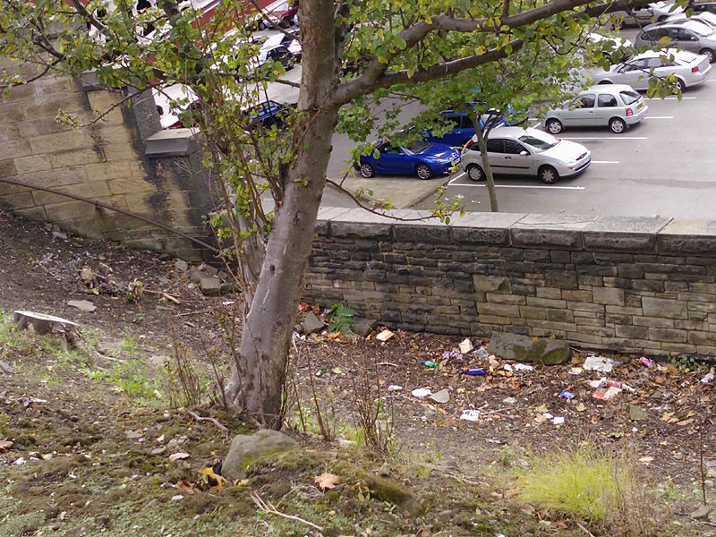
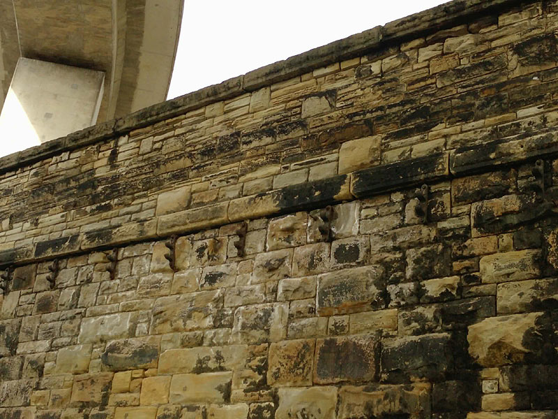
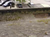
This is the wall next to where the North Bridge
Station would be. Noticed not too long ago the two 'hooks' on the wall,
I have no idea what they would be for, wondering if you could enlighten
me? |
 North
Bridge (12-10-09) : Brandon Hatzer North
Bridge (12-10-09) : Brandon Hatzer
The same picture as above just from a different
angle. |
 GNR
North Bridge Goods Station GNR
North Bridge Goods Station
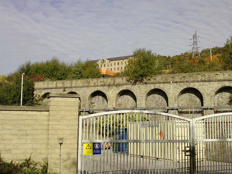
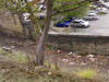
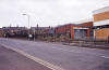
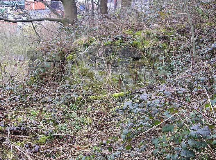
Retaining wall (12-10-09) : Brandon Hatzer
The car park gate is nice and poignant I guess. Sainsbury's petrol station
visible in background. |
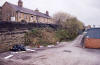
 Retaining
wall (12-10-09) : Brandon Hatzer Retaining
wall (12-10-09) : Brandon Hatzer
Behind the gates is the Mulcture House Council building & car park. Wade
Street sign visible on the right. |
Halifax Viaduct GNR
 Halifax
Viaduct 1980s : Dave Heatley Halifax
Viaduct 1980s : Dave Heatley
Demolition of the viaduct linking Halifax Railway station with the GN
North Bridge site. Photo taken around the mid 80’s
What a great opportunity lost to link the two areas now! |
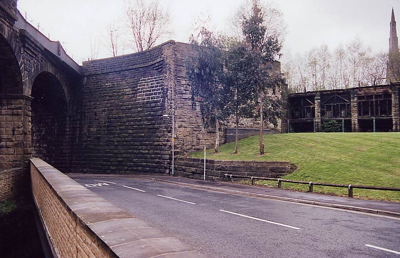
 Viaduct
facing west 30-04-06 : David Webdale Viaduct
facing west 30-04-06 : David Webdale
The remnants of the viaduct leading to North
bridge, demolished in the 70s I think.
The viaduct leading off into Beacon Hill tunnel
along the left here. |
 Holmfield to St Pauls (Halifax high level railway) 1890 - 1960 Holmfield to St Pauls (Halifax high level railway) 1890 - 1960
Joint Great Northern & Lancashire & Yorkshire Railway
See Holmfield to St Pauls
|
 Pellon
lane overbridge (c1963) :
Richard Barnes
©
copyright on all Richard Barnes Photographs. Pellon
lane overbridge (c1963) :
Richard Barnes
©
copyright on all Richard Barnes Photographs.
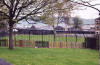
Approach to Pellon station, facing towards Queens Road. The overbridge
is Pellon Lane.
(Photo's taken a week after track was lifted) |
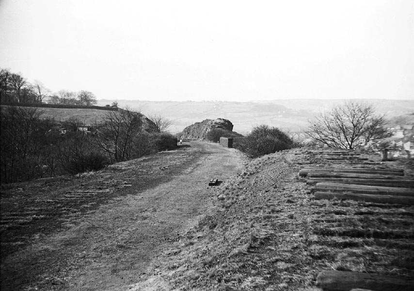
 Trackbed
(c1963) : Richard Barnes Trackbed
(c1963) : Richard Barnes
Same location as previous but facing towards Wheatley.
Note how steeply the trackbed falls away below the level of the
headshunt where I was standing. |
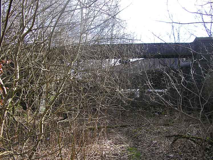
 Pellon
lane overbridge (gas pipe overbridge) (02-06) Matt C Pellon
lane overbridge (gas pipe overbridge) (02-06) Matt C |
 Pellon
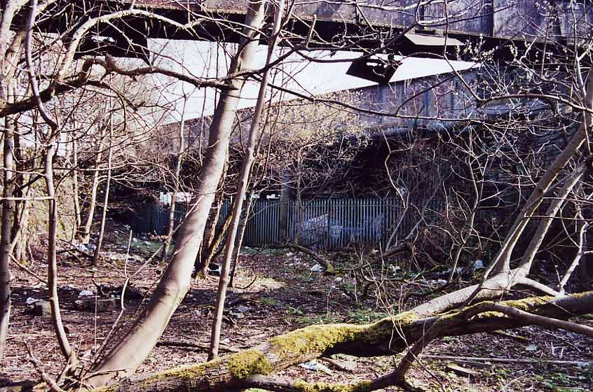
lane overbridge (gas pipe overbridge) (22-04-06) : David Webdale Pellon
lane overbridge (gas pipe overbridge) (22-04-06) : David Webdale
Approach to Pellon station. Gas pipe bridge
nearest camera complete with smoke deflectors.
Fenced off area under the bridge, used for storage by firm on the site
of the Pellon station. |
 Pellon
lane overbridge (gas pipe overbridge) facing north (22-04-06) : David
Webdale Pellon
lane overbridge (gas pipe overbridge) facing north (22-04-06) : David
Webdale
Facing back the other way, view of the bridge from
road level. |
Pellon
station
 Opened
1889. Closed 01-01-1917. Freight 27-06-1960. Opened
1889. Closed 01-01-1917. Freight 27-06-1960.
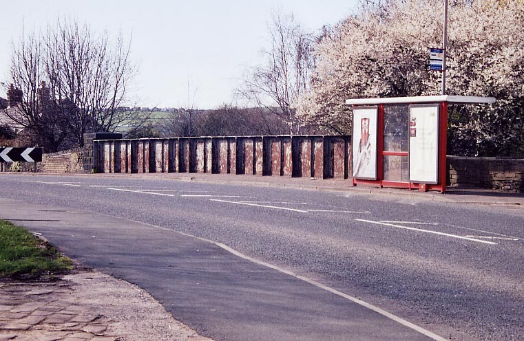
Pellon station entrance (22-04-06) : David Webdale
See Holmfield to St Pauls
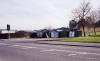
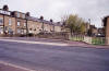
Entrance to the station from road level, the
booking office was situated where those garages are now.
Stone sets still remain along the front of the garages. |
 Pellon
station entrance (02-01-09) : David Webdale Pellon
station entrance (02-01-09) : David Webdale
Three years on from the above photo. Garages
removed to reveal bricked up entrance at road level. |
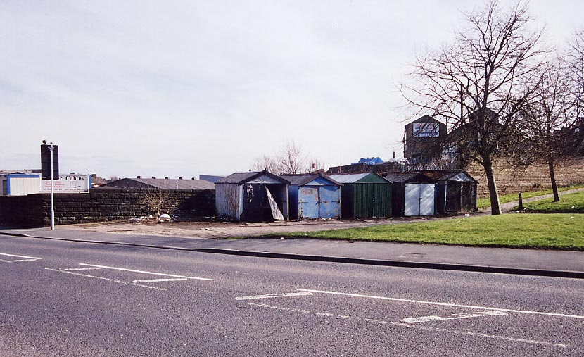
 Pellon
station (22-04-06) : David Webdale Pellon
station (22-04-06) : David Webdale
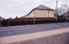
Access from road level was via steps leading down
from the back of those garages (now gone)
through that bricked up section of wall
with the graffiti, to an island platform. |
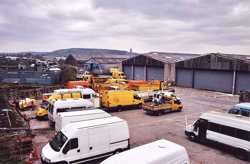
 Pellon
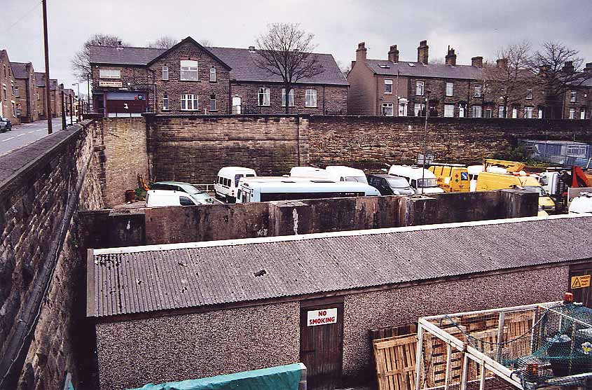
goods yard facing west (30-04-06) : David Webdale Pellon
goods yard facing west (30-04-06) : David Webdale
Taken from a stairway leading up to some flats off Battinson road.
Bricked up bridge visible in the corner, houses in background are on
Dyson road. |
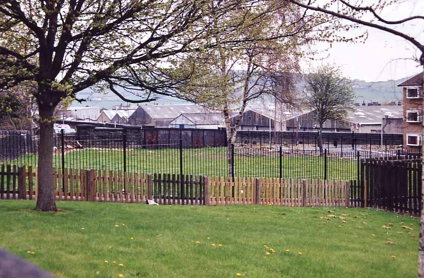
 Pellon
goods yard facing north (30-04-06) : David Webdale Pellon
goods yard facing north (30-04-06) : David Webdale
Stood on top of the bricked up bridge on the corner of Dyson & Battinson
road. |
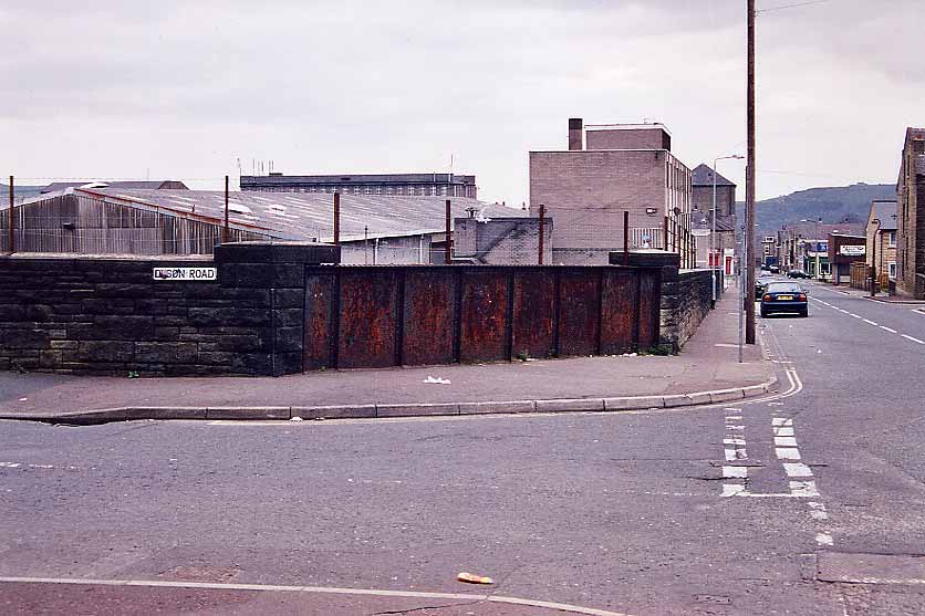
 Dyson
road bridge facing east (30-04-06) : David Webdale Dyson
road bridge facing east (30-04-06) : David Webdale
Corner of Dyson & Battinson road.
Iron bridge & in the background the flats I mentioned. |
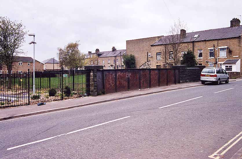
 Battinson
road facing south (30-04-06) : David Webdale Battinson
road facing south (30-04-06) : David Webdale
The other side of the road.
The road running along the top is Ramsgate. |
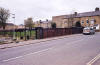
 Hanson
lane facing north (30-04-06) : David Webdale Hanson
lane facing north (30-04-06) : David Webdale
Facing back towards the bridge under Battinson
road.
Looking over the old bridge parapet on the corner of Ramsgate & Hanson
lane.
The cutting filled in & used as gardens along here. |
 Hanson
lane facing west (30-04-06) : David Webdale Hanson
lane facing west (30-04-06) : David Webdale
View of the well kept bridge parapet I was looking
over in previous photo. |
 Hanson
lane facing south (30-04-06) : David Webdale Hanson
lane facing south (30-04-06) : David Webdale
Taken from the other side of the road, cutting
filled in & new houses built along the old formation. |
 Gibbet
street facing west (30-04-06) : David Webdale Gibbet
street facing west (30-04-06) : David Webdale
Facing up Gibbet street. Bridge walls clearly
visible on both sides.
The guy in the approaching red car, stopped when he saw my camera,
waited a couple of minutes, reversed & disappeared down a side street,
maybe he's a bit shy. |
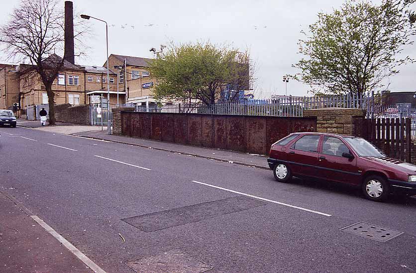
 Hopwood
lane facing west (30-04-06) : David Webdale Hopwood
lane facing west (30-04-06) : David Webdale
Next street along towards St Pauls is another
rusty Iron bridge. |
 Hopwood
lane facing south (30-04-06) : David Webdale Hopwood
lane facing south (30-04-06) : David Webdale
Opposite side of the road, the site of St Pauls
station yard just the other side of the bridge.
Kingston Close built on the site now.
Yard included a signal box &
turntable.
The formation of the line clearly visible on Google earth. |
St
Pauls
 Opened
05-09-1890. Closed 01-01-1917. Freight 27-06-1960. Opened
05-09-1890. Closed 01-01-1917. Freight 27-06-1960.
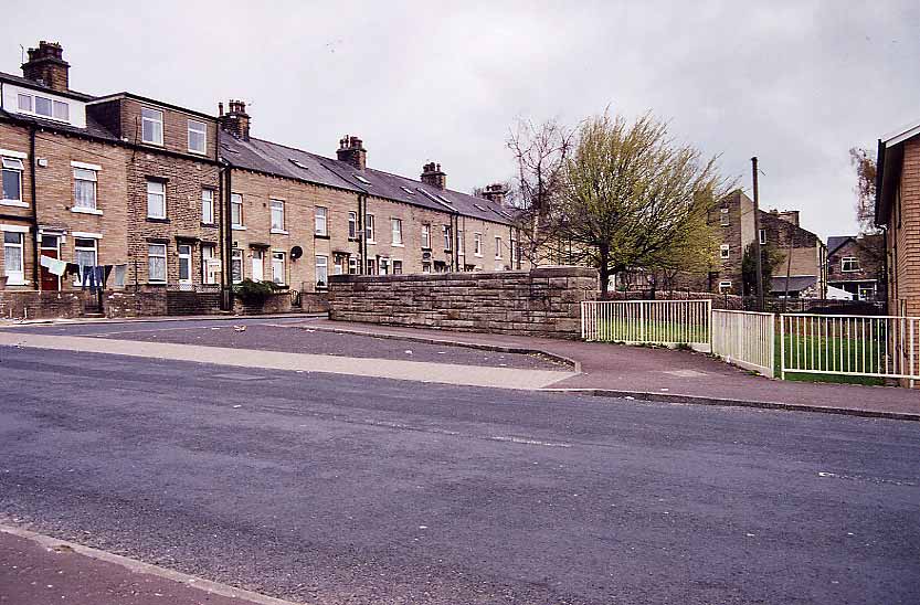
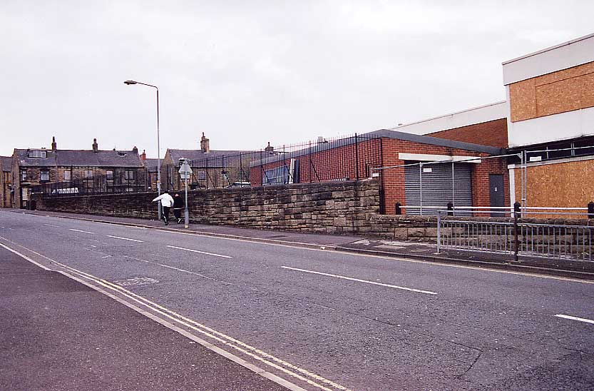
St Pauls station Parkinson lane facing west (30-04-06) : David Webdale
See Holmfield to St Pauls
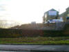
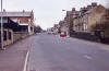
Taken from the corner of Queens road & Parkinson
lane. The site of St Pauls station, just over that wall. |
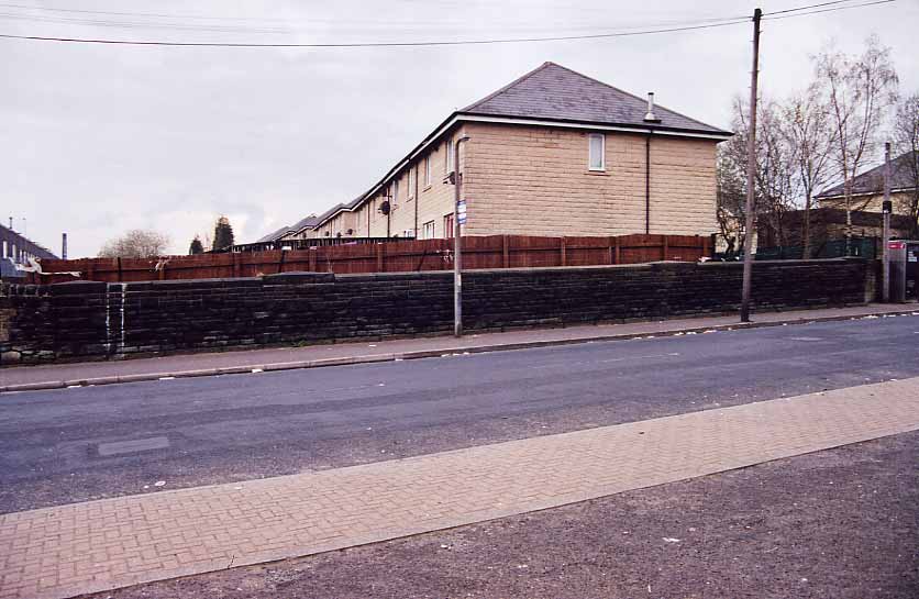
 Parkinson
lane facing north (30-04-06) : David Webdale Parkinson
lane facing north (30-04-06) : David Webdale
Looking over the wall, the site of St Pauls
station, Aspinal street in the background.
Bits of retaining wall still in evidence. |
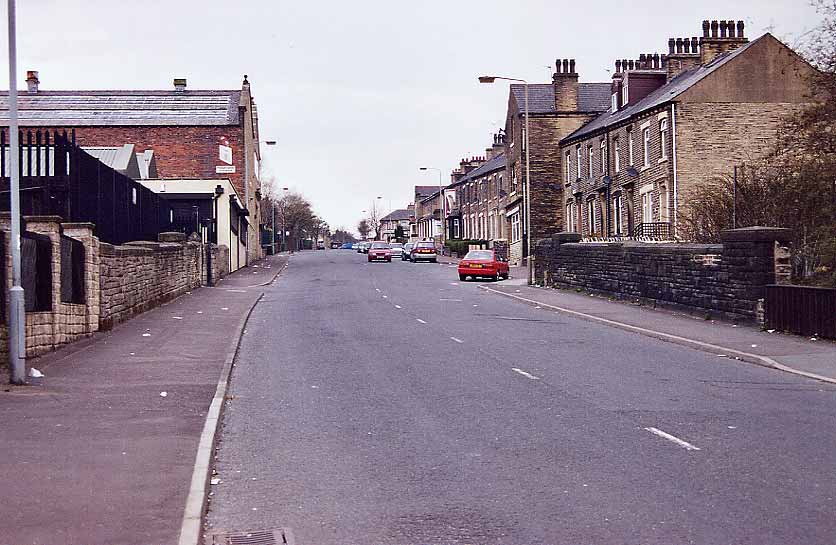
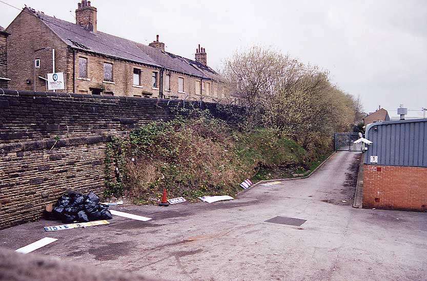
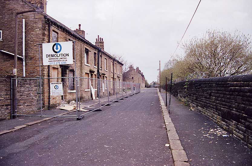
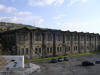
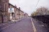 Aspinal
street facing north (30-04-06) : David Webdale Aspinal
street facing north (30-04-06) : David Webdale
Thought I'd better take a photo of these neglected
but solid old houses.
Now on death row, soon to be replaced with concrete & tacky artificial
stone no doubt. |


.jpg)
.jpg)
.jpg)
.jpg)
.jpg)
.jpg)


/Halifax%20Queensbury/20210527_125846.jpg)
%20Viaduct.jpg)