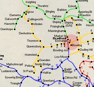
Queensbury & Thornton to Bradford
The Route
From a triangular junction on the Hammerton
street to Bradford Exchange section at St Dustans, to Thornton,
via Manchester road, Horton Park, Great Horton, Clayton,
Queensbury & Thornton.
See also Queensbury
- Keighley
Length
Bradford to Thornton 5 1/2 miles.
Original Companies
The Bradford & Thornton Railway company was formed in 1870.
This company was formed after the failure of the GNR & the
L&Y's proposals to build a line jointly. The Bradford & Thornton
Railway Company was taken over by the GNR on 18th July 1872.
Openings
Freight - July 1877 Bradford to Clayton.
1st May 1878
Clayton to Thornton.
Passengers - 14th October 1878 Bradford to Thornton.
Closures
Passengers - 23rd May 1955.
Freight - 11 November 1963.
|
 |
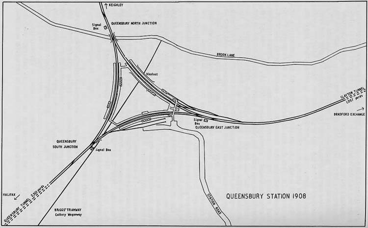 Queensbury
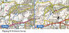
Station Map 1908 Queensbury
Station Map 1908
NIgel Callaghan
Opened 12-07-1879
Closed 21-05-1955
See also
Queensbury Station
|
 Halifax,
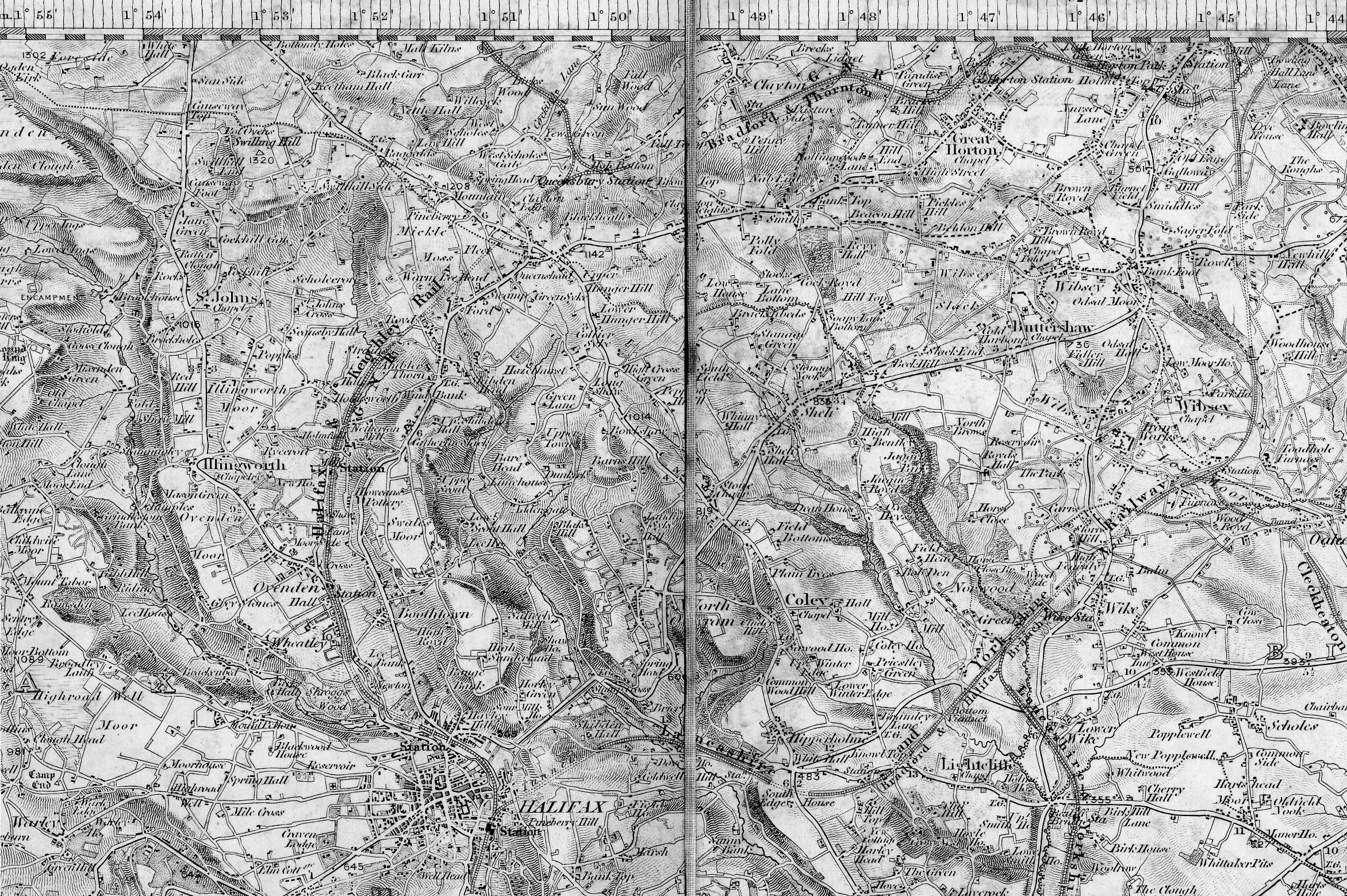
Queensbury, Low Moor & Wyke map (1843) : John Sutcliffe Halifax,
Queensbury, Low Moor & Wyke map (1843) : John Sutcliffe
One inch to the mile map showing Sowerby Bridge in the west and
Dewsbury in the east. Published by Col. Colby dated 1843.
(This file size is about 1.4 meg, so it may take a while to
download) |
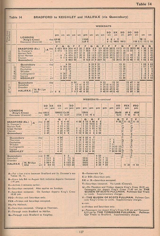
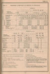  Timetables (1950)
: Charles Boylan Timetables (1950)
: Charles Boylan
A summer 1950 Queensbury line timetable. Note
that the Queensbury - Keighley section is repeated in the "down"
direction on both timetables. A mistake which presumably would have been
rectified in a timetable supplement.
See also Queensbury Keighley |
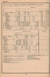
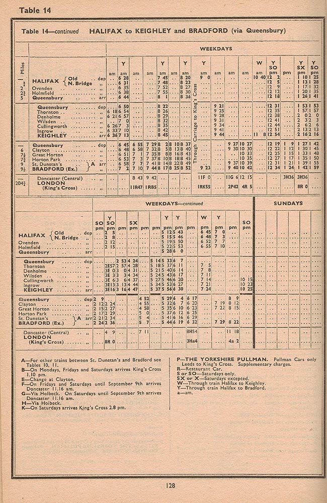
_small.jpg) _small.jpg) Timetables (1954/55)
: Charles Boylan Timetables (1954/55)
: Charles Boylan
Sadly, this is the last ever timetable for the
Queensbury lines from the winter 1954/55 North Eastern Region edition. I
am particularly impressed by the 14 minutes allowed for the non stop run
of the last Bradford Halifax service bringing through coaches from Kings
Cross. The thought of a LNER N1 going all out up the gradient to
Queensbury is impressive but in reality it most probably went via Low Moor
so the lines signalboxes could be closed as all other services had ceased
a few hours earlier with the exception of a later service on Saturday. I
would be delighted to be told otherwise.
See also Queensbury Keighley |
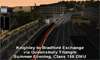 Keighley
to Bradford Exchange via Queensbury : Dave Graham (c/o Paul Holroyd) Keighley
to Bradford Exchange via Queensbury : Dave Graham (c/o Paul Holroyd)
A simulation of the journey from Keighley to Bradford if the
line was still in use today.
http://www.youtube.com/watch?v=msL3L5t1uAs |
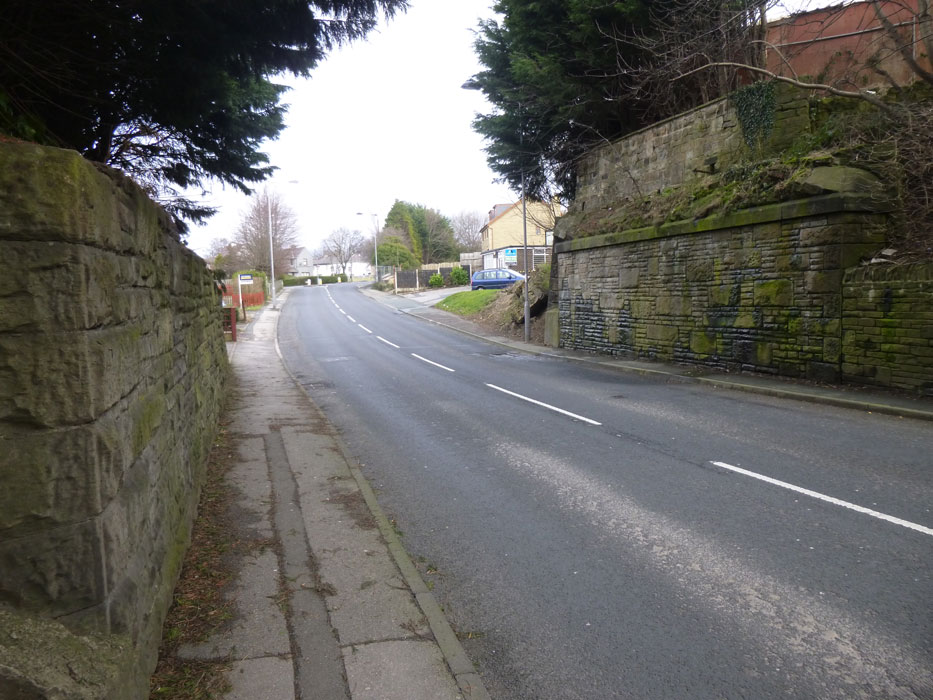
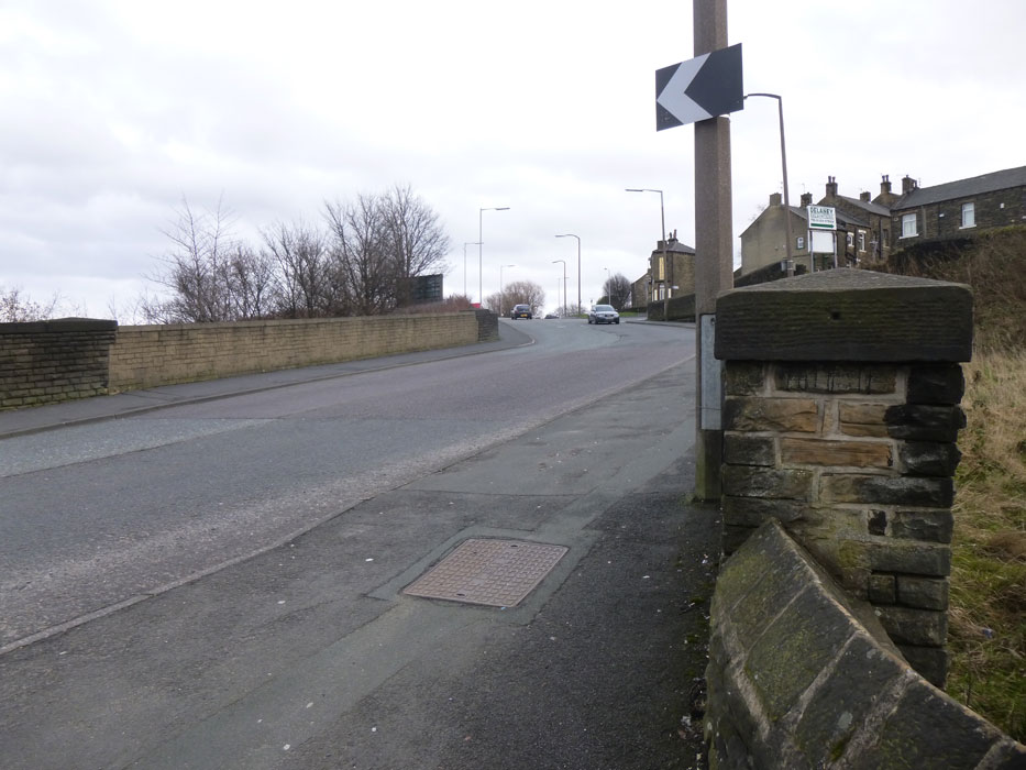
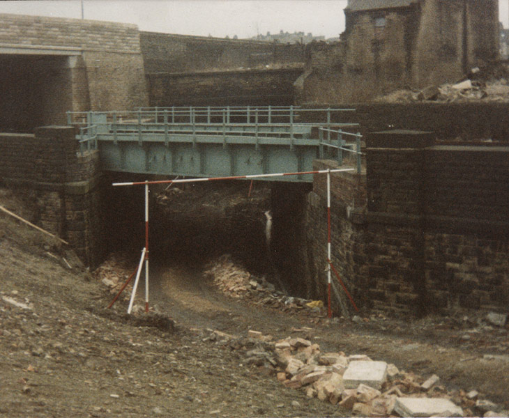
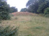
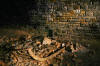
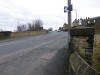
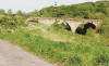
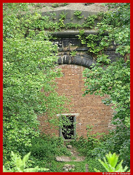
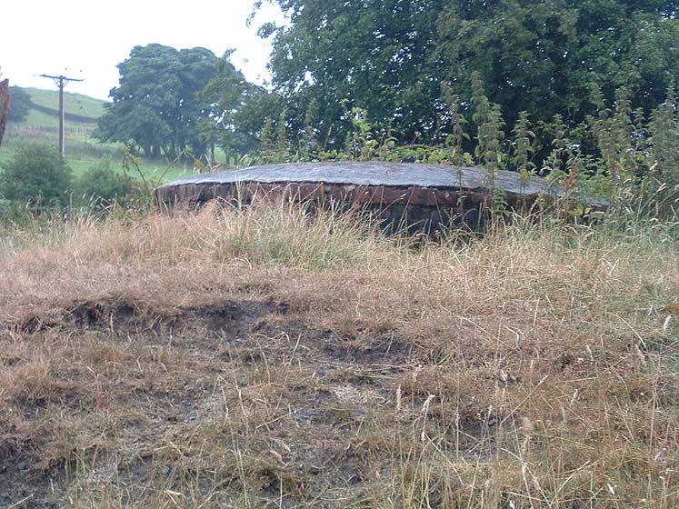
_small.jpg) Iron
bridge Queensbury east junction facing east
(21-08-05) : David
Webdale Iron
bridge Queensbury east junction facing east
(21-08-05) : David
Webdale
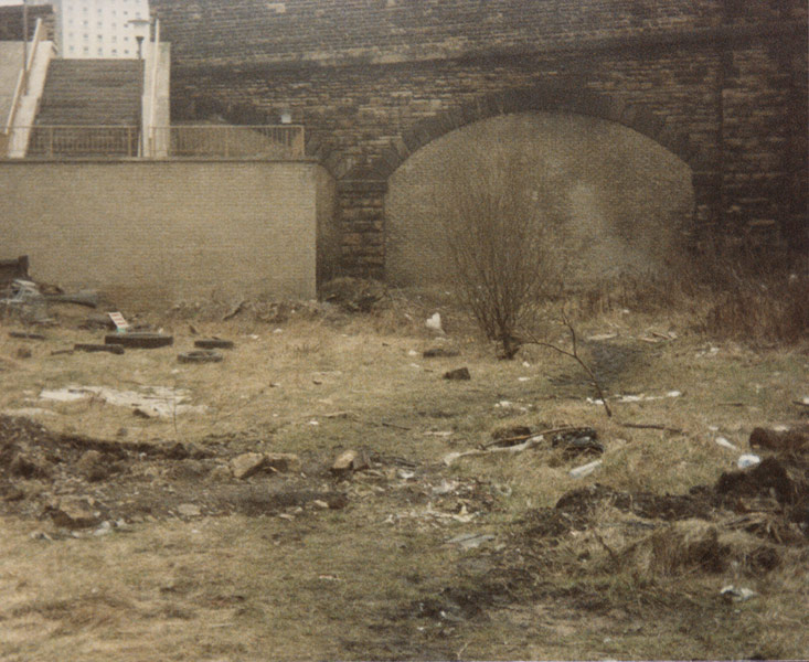
Standing on, or near, Queensbury east junction, facing east. see
Queensbury station
This rusty but solid little iron bridge is the only real bit of
evidence on the whole site there was actually any railway here
at all.
Clayton tunnel is a bit further on around the corner. |
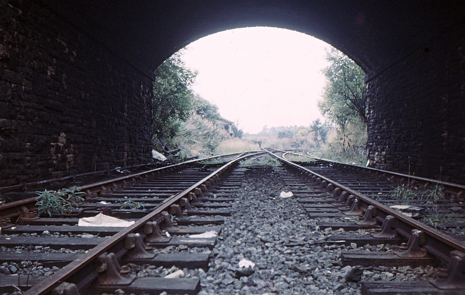
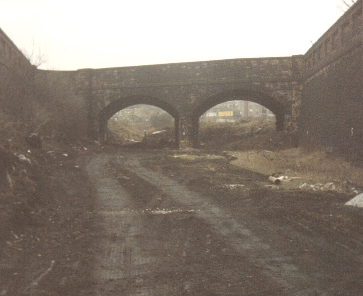
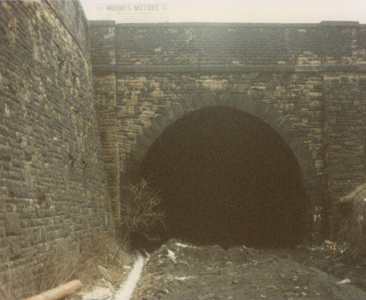
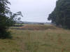
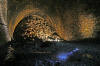
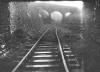
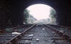
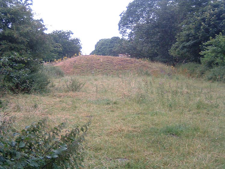
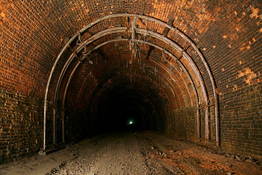
_small1.jpg) Clayton
Tunnel Clayton
Tunnel
Clayton tunnel west portal (21-08-05)
: David Webdale
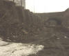
Standing on top of a mountain of landfill, peering down at the
west portal of Clayton tunnel.
Pile of spoil from the tunnel excavations visible on top. |
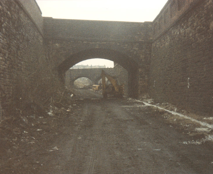
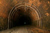
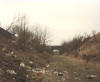
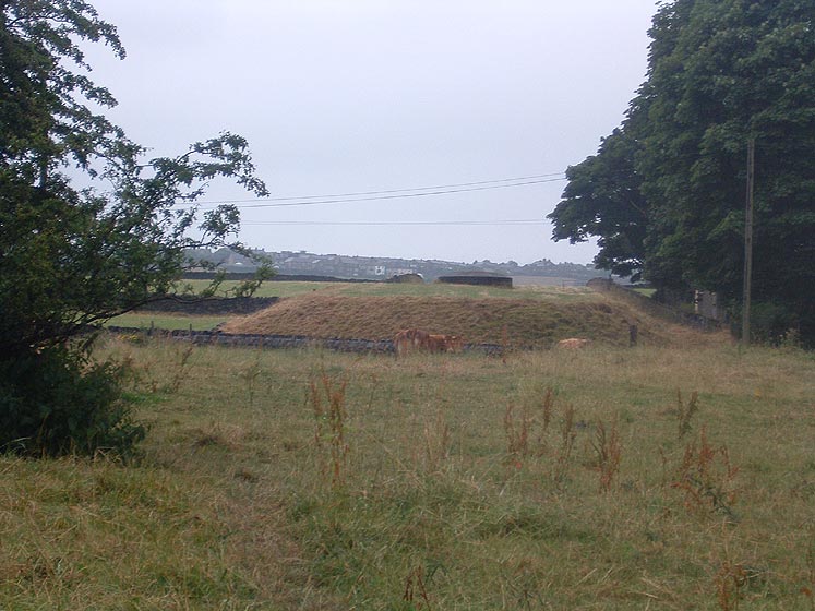
_small.jpg) Clayton
tunnel west portal
(21-08-05) : David
Webdale Clayton
tunnel west portal
(21-08-05) : David
Webdale
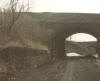
The view of Clayton tunnel from half way up station road, facing
east.
see map Queensbury station
The cutting leading up to the tunnel entrance completely land
filled.
Small gap left between Portal & landfill marked by a ring of
trees. |
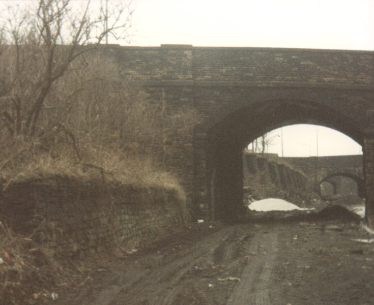
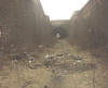
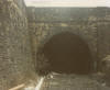
 Clayton
tunnel west portal : Grahame H Beacher
website -
http://www.nethernutone.co.uk/ Clayton
tunnel west portal : Grahame H Beacher
website -
http://www.nethernutone.co.uk/
|
 Clayton
Tunnel Clayton
Tunnel
A walk through Clayton tunnel : Wetdog
video.
https://www.youtube.com/watch?v=QxEWATm6IIg |
Clayton Tunnel visit
Nigel Callaghan & Adam Carter
website -
www.pullman-publications.co.uk
Clayton tunnel approach has been infilled with huge amounts of
waste and this now rises to something like 30-40ft ABOVE the
tunnel,
with just a small gap between the infill and the tunnels portal.
I've walked right through the 1,057-yard long Clayton Tunnel,
unfortunately the other end has been completely infilled and
earthed-over, so I had to do a smart about turn and walk all the
way back again. I've tried to find the precise location of the
north-eastern portal and believe it lies somewhere close to the
edge of a new housing development, though I never found its
exact position. If you are ever able to do this, I would
appreciate some photographs.
Notes for Clayton Tunnel.
Yorkshire West - SE 111311-120315
Length in Yards -
1057
Bore -
Double
Railway Company -
Great Northern Railway
Internal Condition
Internally wet in places, though not in any way flooded, nor
very muddy. There are two ventilation shafts, both of which have
been sealed and capped. The lining of these shafts lays in a
heap below on the tunnel floor. The tunnel has been strengthened
in two places for a short stretch of around 20-yards, one place
about two thirds of the way from the southwestern post and the
other close to the northeastern portal. The northeastern portal
has been infilled, by piling up mud and rubble about 11 yards
into the tunnel. Could not ascertain whether it had also been
bricked up from the outside.
Access
Reach south-western portal via Queensbury Station site along
track bed.
This portal has been bricked-up with an opening door,
which was not locked when visited.
This portal has been almost
smothered
by infilling and now lies in a deep and precipitous abyss
surrounded by infill.
The north eastern portal was not found and I believe it now lies
somewhere on the edge of a large new housing development, close
to Oakleigh Avenue, which is off Station Road, Clayton. See
E-mail on the North eastern portal : 02/10/05 Below.
Access to the west portal easy, along trackbed from the site of
Queensbury Station, reached by a footpath from the huge skew
railway bridge, which crosses the steeply inclined Brow Lane, or
from another path off Bridle Stile Lane.
Usage, Ownership or Status
Owned by BR Property Board Ref: Y-SDK-30-6
Date of last visit, inspection or update
Southwestern portal visited and entered by Nigel Callaghan &
Andrew King on Wednesday 28th April 2004, and the tunnel was
walked through right up to the infill, on 23rd July 2004 by the
same people.
Notes & other points of interest
The approach to the western portal has been in filled with
enormous quantities of inert waste, filling the approach to a
height of about 35-ft above trackbed level. The portal of the
tunnel is now engulfed in an abyss around 35-ft deep to within
50 yards of its portal. If further landfill material is dumped
here the tunnels southwestern mouth will be entirely
obliterated.
Comments
These routes abound in extensive earthworks, viaducts and
tunnels, including the short branch to Bradford, City Road,
Goods Deport and the branch to Halifax. The most notable being
Lees Moor (1,533 yards) between Ingrow and Cullingworth on the
Keighley section, Clayton (1,057 yards) between Queensbury and
Clayton on the Bradford side of the longest tunnel on the
system.
Sadly, the entire area of the historic and unusual triangular
Queensbury Station has been bulldozed and totally destroyed;
many of the approach cuttings to the tunnels have been in filled
with waste and levelled. Anyone wishing to visit and view this
interesting and unique site should do so without haste before it
is totally destroyed forever.
Walking through the tunnel from the southwestern portal, it is
straight and almost clear of any debris or rubbish. There are a
few piles of old rotting sleepers and the tunnel is damp with a
few drips of water. There are a few deep open drains in the
centre of the tunnel and care must be taken not to fall into
these. Both of the shafts have been sealed and a pile of bricks
from their linings lays on the tracked below. At the
northeastern end, a huge amount of clay, mud and rubble has been
bulldozed against the tunnels mouth making entry or exit
impossible and we had to exit by making the return walk back to
the souteastern portal, facing a steep climb out.
|
Clayton Tunnel north eastern portal : Nigel
Callaghan & Adam Carter
I now have some some photo's showing evidence of the elusive NE
Portal of Clayton Tunnel. I will attach a few of these to this
email. It would seem that its been totally earthed-over in a
rather peculiar way. From inside the infill appears a a large
sloping mound of earth of bricks piled up at a 45° angle.
These recent photographs were taken by a chap named Adam Carter,
who was showing an interest in the area. He investigated the
site on my behalf and managed to find the other end of the
tunnel, taking photographs of what he found and saw. See below. |
 Clayton
Tunnel N E Portal (02/10/05)
: Adam Carter Clayton
Tunnel N E Portal (02/10/05)
: Adam Carter
I ventured to the Clayton portal yesterday and took a few
pictures.
I did find it, however, locating the precise location of the
portal proved
slightly confusing due to the artificial topography as you will
read.
I entered the field from Oakleigh Avenue I think it was, and
took an immediate right.
There I saw a large mound of earth with a shaft on top of it. |
 Clayton
Tunnel N E Portal ( 02/10/05) : Adam Carter Clayton
Tunnel N E Portal ( 02/10/05) : Adam Carter
This confused me as I thought the shaft would have been needed
further into the tunnel and not at the entrance. |
 Clayton
Tunnel N E Portal (02/10/05) : Adam Carter Clayton
Tunnel N E Portal (02/10/05) : Adam Carter
I climbed the mound to find a plateau almost, which then rose once
again about 100metres further down in a similar way.
I
realised this could not have been the portal as the shaft would have
been outside it. |
Clayton Tunnel N E Portal (02/10/05) : Adam Carter
I
walked along another raised section of land beyond this 2nd mound to
find the embankment intersecting Baldwin Lane.
 Baldwin cut straight
through it , I could see a third shaft on the other
side of the road on top of the embankment. Baldwin cut straight
through it , I could see a third shaft on the other
side of the road on top of the embankment.
I cannot make sense of what I saw. I do not understand why there was
this embankment feature running above ground above the tunnel,
unless it was formed from earth which was extracted from within the
hillside, but then would the shaft not have been at the original
land height? Hmmm.... I suspect the portal to therefore be at the
first embankment although this misplaced shaft requires explanation.
I could not find any crown of the portal or any stonework. Hope you
can make more sense of this than I could!! |
Clayton Tunnel north eastern portal location : Graeme
Bickerdike (19-02-06) website -
http://www.forgottenrelics.co.uk/
I’m currently writing a series of articles entitled ‘Forgotten Relics of
an Enterprising Age’, about notable but long-lost bits of railway
infrastructure and the people who used to work there. I discovered your
website whilst researching a piece about the Queensbury triangle. I
found your information on Clayton tunnel fascinating, in particular the
search for the lost north-eastern portal. I hope the two attached files
will help you locate it.
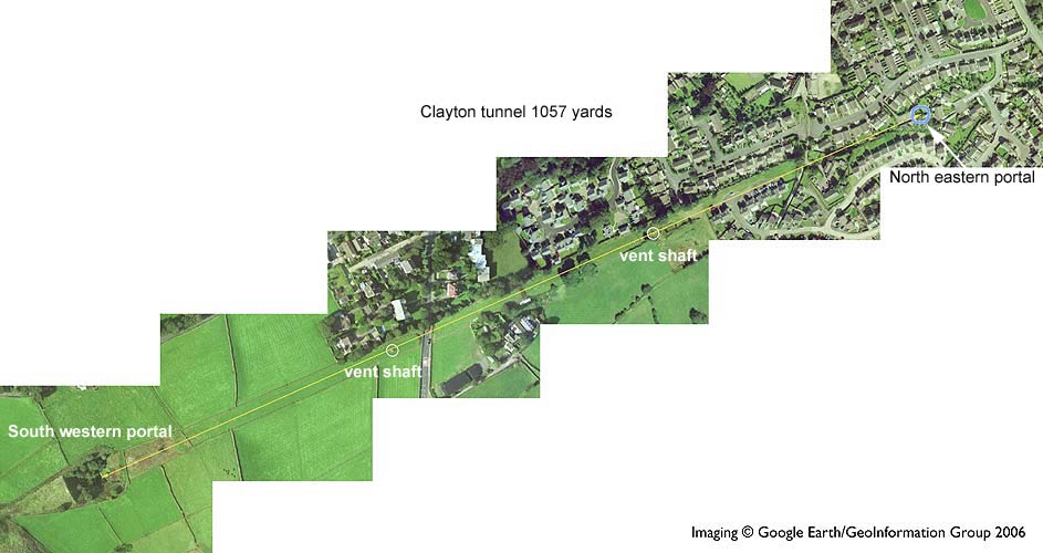
File 1 Clayton aerial view (Google
earth)
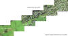 “CLAYTON-AERIAL”
is an image composited using Google Earth. As you may know, this
software allows you to view aerial shots of almost anywhere in the
world. It also has a measuring tool. Using it, it’s possible to measure
1,057 yards from the visible south-west portal. This is shown by the
yellow line. “CLAYTON-AERIAL”
is an image composited using Google Earth. As you may know, this
software allows you to view aerial shots of almost anywhere in the
world. It also has a measuring tool. Using it, it’s possible to measure
1,057 yards from the visible south-west portal. This is shown by the
yellow line.
The capped shafts which Adam Carter photographed are also shown on the
photo.
 To
allow for any inaccuracy, I suspect the north-east portal could be
anywhere within the blue circle. To
allow for any inaccuracy, I suspect the north-east portal could be
anywhere within the blue circle.
The layout of the houses supports this. Two rows built either side of
the tunnel line (Oakleigh Avenue and Rosehip Rise/Blackberry Way) which
move further apart close to the portal.
Their gardens are over the tunnel itself together with what appear to be
lock-ups on top of the actual portal.
There is then a house on Bramble
Close, in the middle of the former trackbed. |
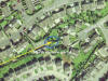
 File
2 Clayton maps present & c1950 File
2 Clayton maps present & c1950
“CLAYTON-MAP” compares two OS maps – one current and the other from
the 1950s.
These suggest the location given above looks pretty accurate.
I hope this information helps you find some remnant on the ground. |
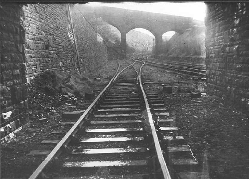
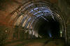
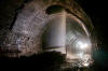
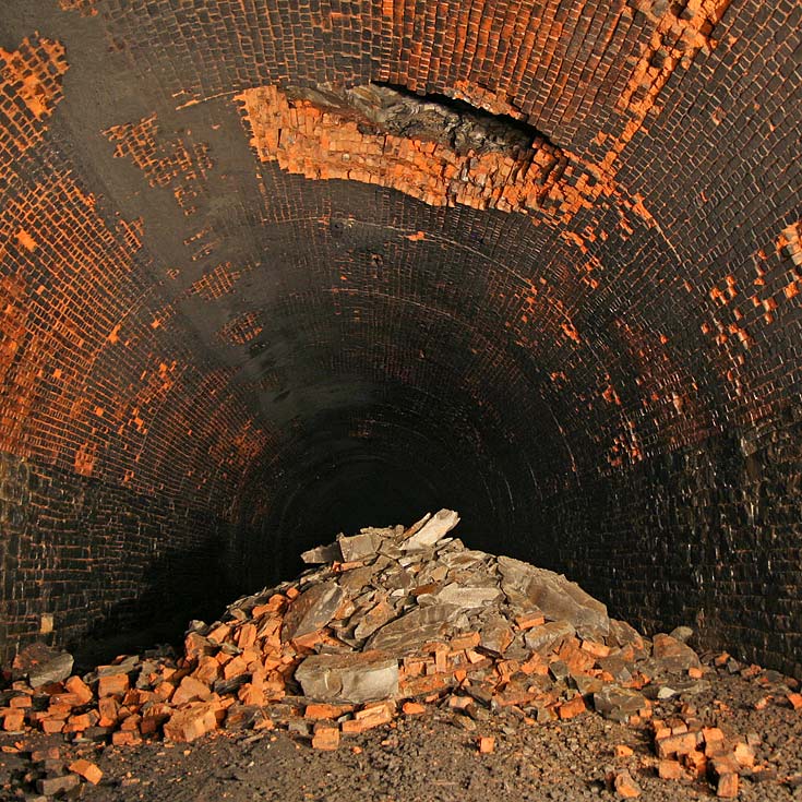
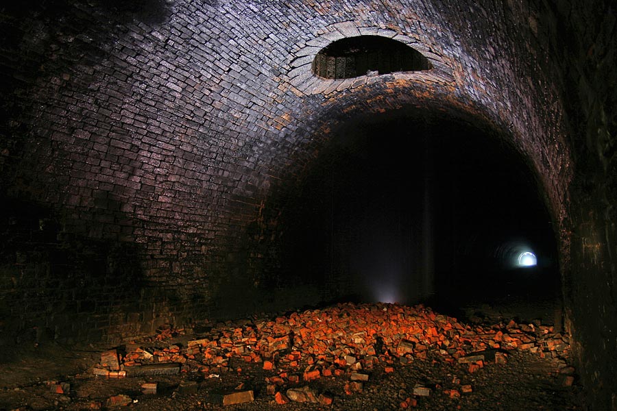
Clayton Tunnel
exploration
 Clayton-1:
(23-11-07) : Graeme Bickerdike
website -
http://www.forgottenrelics.co.uk/ Clayton-1:
(23-11-07) : Graeme Bickerdike
website -
http://www.forgottenrelics.co.uk/
The eastern portal is unceremoniously buried beneath infill which
is probably around 50 feet deep. The back garden of a bungalow is on the
surface here. At the base of this rubble is a pit in which a drain has
been unearthed. Remarkably the water is still flowing. |
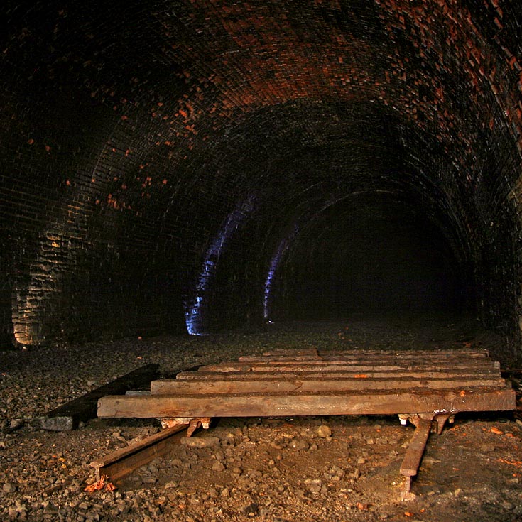
 Clayton-2:
(23-11-07) : Graeme Bickerdike Clayton-2:
(23-11-07) : Graeme Bickerdike
The tunnel contains two structures fashioned from bullhead rail -
this is the smaller one - which would have been used by maintenance
staff when carrying out inspections and repointing work. Hanging from it
are horizontal rails to support a platform. |
 Clayton-3:
(23-11-07) : Graeme Bickerdike Clayton-3:
(23-11-07) : Graeme Bickerdike
Neither of these frameworks are connected to the tunnel itself so
they don't support the lining. This one is about 30 feet from
end-to-end. Between here
and the easterly ventilation shaft, two bore
holes can be seen in the roof.
Presumably these were drilled from the surface. |
Clayton-4:
(23-11-07) : Graeme Bickerdike
 Between
the bore holes and the shaft, a section of rock and lining has fallen -
it's probably about 8 feet square. Perhaps this was caused by the
drilling of a third bore hole. The near edge is along the line of a butt
joint. This shot gives you some idea of the extent of the tunnel's
structure. At this point, the lining is five bricks thick. It's likely
to be more near the ventilation shafts. The effort involved in
constructing a tunnel is beyond our comprehension today.
It's also interesting to note that Clayton doesn't have any refuges for
trackworkers - quite something for such a long tunnel. Perhaps the
clearances were not as tight as other bores. At its northern end,
Queensbury doesn't have any until you're about quarter-of-a-mile in. Between
the bore holes and the shaft, a section of rock and lining has fallen -
it's probably about 8 feet square. Perhaps this was caused by the
drilling of a third bore hole. The near edge is along the line of a butt
joint. This shot gives you some idea of the extent of the tunnel's
structure. At this point, the lining is five bricks thick. It's likely
to be more near the ventilation shafts. The effort involved in
constructing a tunnel is beyond our comprehension today.
It's also interesting to note that Clayton doesn't have any refuges for
trackworkers - quite something for such a long tunnel. Perhaps the
clearances were not as tight as other bores. At its northern end,
Queensbury doesn't have any until you're about quarter-of-a-mile in. |
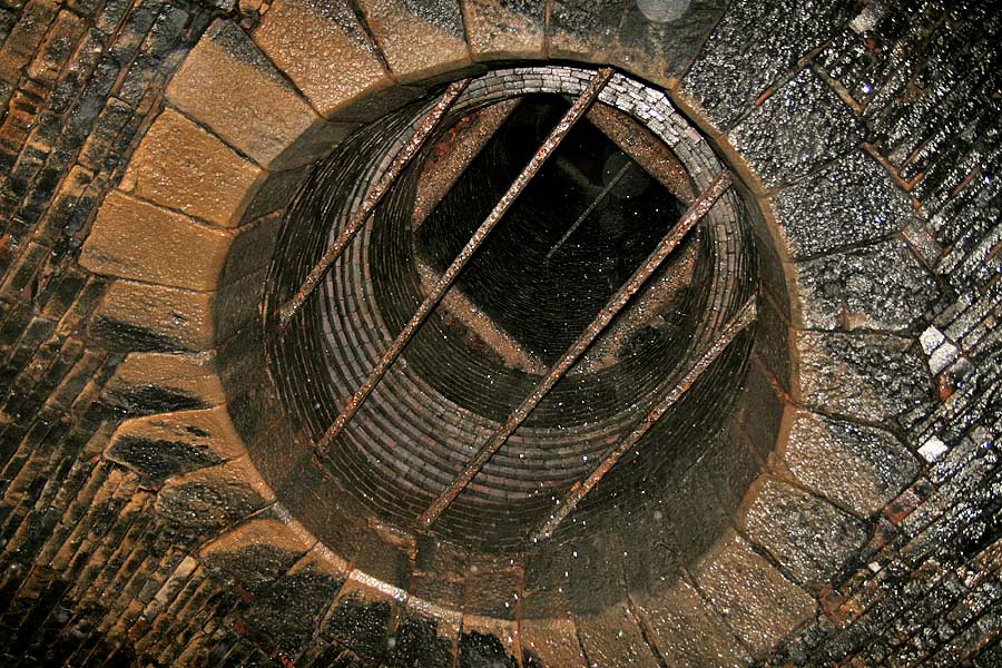
 Clayton-5:
(23-11-07) : Graeme Bickerdike Clayton-5:
(23-11-07) : Graeme Bickerdike
The easterly shaft (383 yards in from the Clayton end) is in
great condition but has been reinforced. I don't know whether the
ironwork is original or was added more recently. There is some water
coming down but it was possible to stand beneath without drowning! |
 Clayton-6:
(23-11-07) : Graeme Bickerdike Clayton-6:
(23-11-07) : Graeme Bickerdike
As with most other tunnels, the surface funnel was pushed into
the shaft before its concrete cap was attached.
In this case, half the pepperpot came down too. |
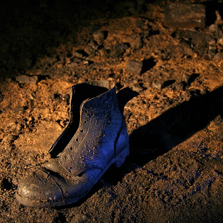
 Clayton-7:
(19-02-08) : Graeme Bickerdike Clayton-7:
(19-02-08) : Graeme Bickerdike
It's amazing the stuff you find in these places. As well as the
usual assortment of bolts and fishplates, Clayton is home to this boot.
Who lost or abandoned it? Was he also the owner of the crutch which lies
a few yards away? |
 Clayton-8:
(19-02-08) : Graeme Bickerdike Clayton-8:
(19-02-08) : Graeme Bickerdike
The westerly ventilation shaft, around 350 yards from the portal,
with its obligatory pile of rubble. |
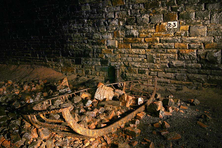
 Clayton-9:
(19-02-08) : Graeme Bickerdike Clayton-9:
(19-02-08) : Graeme Bickerdike
A few yards from fresh air, part of a track panel - now
overturned - was left by the salvage men.
|
Clayton Station
/DSC_0032_small.jpg) Clayton
Station Map1910 : Malcolm Mallison Clayton
Station Map1910 : Malcolm Mallison
Clayton (1910 Survey) Right on edge
of map, so area to north (1890 survey) added using Photoshop. |
 Pasture
lane (08-02-14) : Matt c Pasture
lane (08-02-14) : Matt c
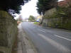
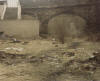
Pasture lane overbridge |
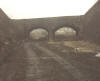
 Hollingwood
lane (08-02-14) :
Matt c Hollingwood
lane (08-02-14) :
Matt c
Hollingwood lane underbridge. |
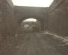
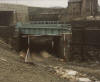
 Beckside
Road bridge (nd) : Paul Whitfield c/o Alan Thompson Beckside
Road bridge (nd) : Paul Whitfield c/o Alan Thompson
A picture taken by Paul Whitfield under Beckside
Road bridge looking up to Old Corn Mill Lane bridge, that is in the
Clayton direction.
|
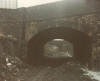
 Beckside
Road bridge (08-02-14) : Matt c Beckside
Road bridge (08-02-14) : Matt c
Beckside Road bridge from above. |
Great Horton station
Opened 14-10-1878. Closed 21-05-1955.
 Great
Horton Junction (01-1972) : Keith Rose Great
Horton Junction (01-1972) : Keith Rose
Great Horton Junction, January 1972. |
 Park Avenue Cutting (1980s) : Alan Thompson
See also Bradford Section Park Avenue Cutting (1980s) : Alan Thompson
See also Bradford Section
Laisteridge lane bridge crosses in front, beyond was Horton Park
junction. |
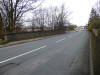
 Manchester
Road to Horton Tunnel (1980s) : Alan Thompson Manchester
Road to Horton Tunnel (1980s) : Alan Thompson |
Manchester Road station
Opened 14-10-1878. Closed 31-12-1915.
 Manchester
Road Station Site (1980s) : Alan Thompson
See also Bradford Section Manchester
Road Station Site (1980s) : Alan Thompson
See also Bradford Section |
 Newby
Street bridge (1980s) : Alan Thompson Newby
Street bridge (1980s) : Alan Thompson
Newby street has since been renamed Stone Arches. Beyond was Manchester
Road station. |
 Bowling
Old lane bridge (1980s) : Alan Thompson Bowling
Old lane bridge (1980s) : Alan Thompson
Beyond is Newby street bridge. |
 Spring
Mill street bridge (1980s) : Alan Thompson Spring
Mill street bridge (1980s) : Alan Thompson |
 Bowling
cutting (1980s) : Alan Thompson Bowling
cutting (1980s) : Alan Thompson
Spring Mill street bridge in front. |
 Upper
Castle street (1980s) : Alan Thompson Upper
Castle street (1980s) : Alan Thompson |
 Ripley
Street Tunnel (1980s) : Alan Thompson Ripley
Street Tunnel (1980s) : Alan Thompson |
 St
Dunstans West Junction Site (1980s) : Alan Thompson St
Dunstans West Junction Site (1980s) : Alan Thompson |

 Queensbury
- Halifax
Queensbury
- Halifax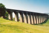
.jpg)
.jpg)
.jpg)
.jpg)
.jpg)


/DSC_0032.jpg)