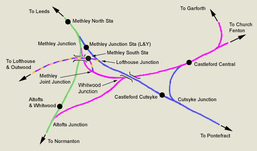
 Castlford
& Methley junctions
See also Cutsyke Methley section Castlford
& Methley junctions
See also Cutsyke Methley section
|
 Railway Ramblers gazetteer Railway Ramblers gazetteer
See also the Railway Ramblers gazetteer -
Leeds : Castleford east junction - Garforth |
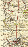
/Altofts%20&%20Whitwood_small.jpg) Altofts
& Whitwood map (1932) : Malcolm Mallison Altofts
& Whitwood map (1932) : Malcolm Mallison
From the Six inch map 1932 Survey.
Altofts & Whitwood (tiny, almost missed it). |
/Whitwood%20Colliery_small.jpg) Whitwood
colliery map (1932) : Malcolm Mallison Whitwood
colliery map (1932) : Malcolm Mallison
Collieries from the same sheet as above. |
/Hopetown%20Colliery_small.jpg) Hopetown
colliery map (1932) : Malcolm Mallison Hopetown
colliery map (1932) : Malcolm Mallison
Collieries from the same sheet as above.
The residents of Hopetown seem to have a railway through their back
gardens. Note LMS line, deep inside LNER territory. |
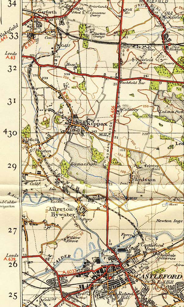
 Castleford
- Garforth 1 inch Map 1947 : Ralph
Rawlinson Castleford
- Garforth 1 inch Map 1947 : Ralph
Rawlinson |
 Layout
Plans : Keith Looker Layout
Plans : Keith Looker
Castleford. |
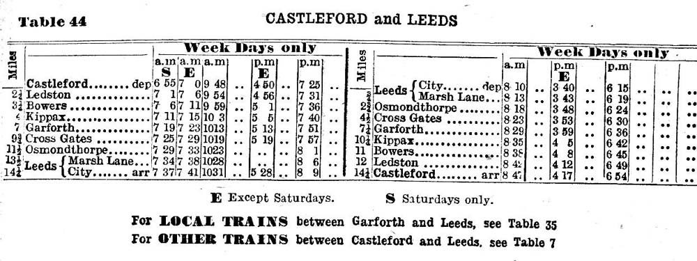
 Castleford
- Garforth - Leeds Time table 1951 : Ralph Rawlinson Castleford
- Garforth - Leeds Time table 1951 : Ralph Rawlinson
Table 44 from the summer 1949 BR (NER) timetable. |
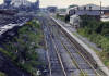
_small.jpg) _small.jpg) Castleford
Central station Castleford
Central station
Castleford (nd) : Michael Kaye
Facing east, approaching Castleford Central from Pontefract.
Via the now gone L&Y Cutsyke junction.
See also Cutsyke Methley
The signal box is now all boarded up. |
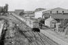
Ledston station
Opened 12-08-1878. Closed
22-01-1951.
 Ledston
station (23-04-85) : Michael Kaye Ledston
station (23-04-85) : Michael Kaye
Ledston Station 2nd August 1985 looking towards Kippax. I
think all that is left in this picture is the building centre top. |
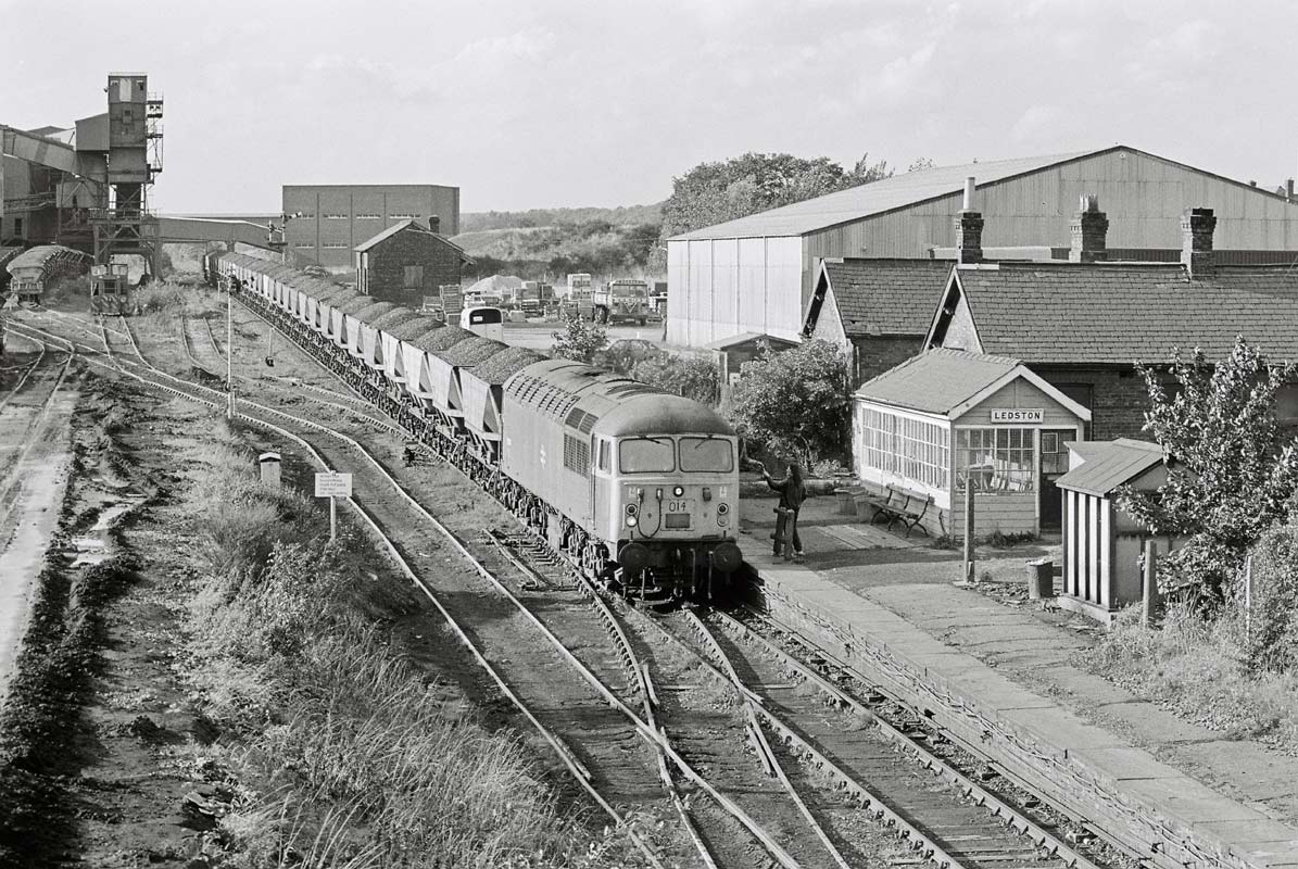
 Ledston
station (03-10-85) : © Andrew Gallon Ledston
station (03-10-85) : © Andrew Gallon
Ledston station and signalbox, and Allerton Bywater Colliery, on October
3rd 1985.
56 014 heads laden MGR coal hoppers from Bowers Row
Opencast Site to Ferrybridge Power Station. |
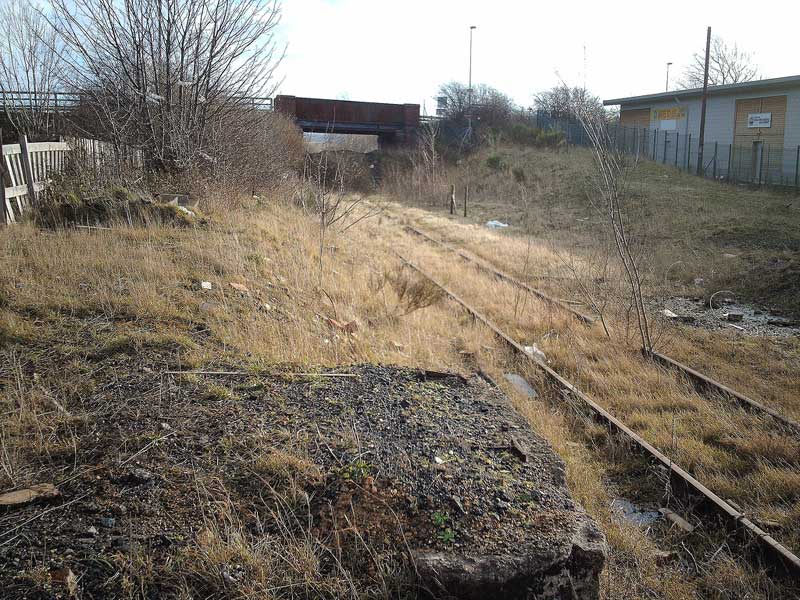
 Ledston
station : Phill Davison website -
http://flickr.com/photos/phill_dvsn/sets/72157594397421428/ Ledston
station : Phill Davison website -
http://flickr.com/photos/phill_dvsn/sets/72157594397421428/
(N.E.R) Taken from the remains of Ledston station closed in 1951 on the
former Garforth-Castleford branch.
This section of line remained in use for coal traffic from the nearby
Allerton Byewater colliery untill it closed in 1992.
There are plans to rip this line up & turn it into a cycle path. This
view is looking towards Castleford. |
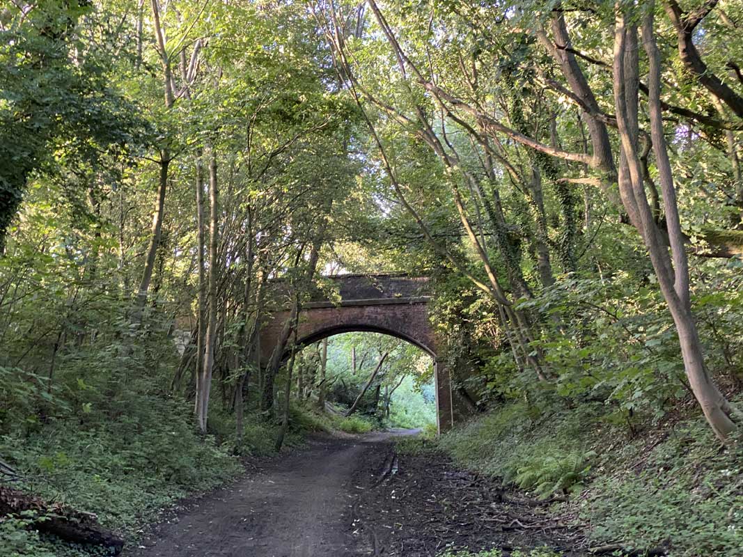
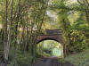
 Barnsdale
rd bridge : Phill Davison Barnsdale
rd bridge : Phill Davison
The overgrown remains of the trackbed from the Barnsdale rd bridge. |
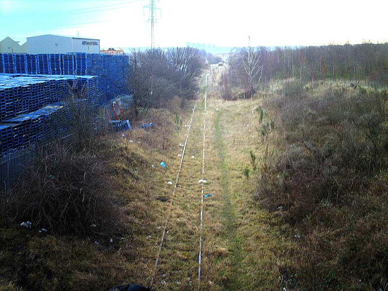
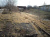
 Trackbed
subsidence : Phill Davison Trackbed
subsidence : Phill Davison
The flood water has eroded the ballast away from the trackbed & it looks
rather precarious to say the least. |
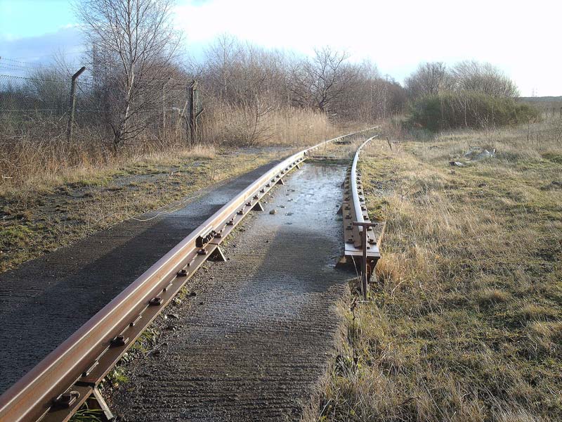
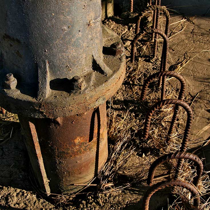
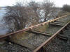
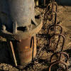
 Allerton
Byewater colliery end of line : Phill Davison Allerton
Byewater colliery end of line : Phill Davison
There seemed to have been some sort of weigh bridge here for the coal
m.g.r wagons. |
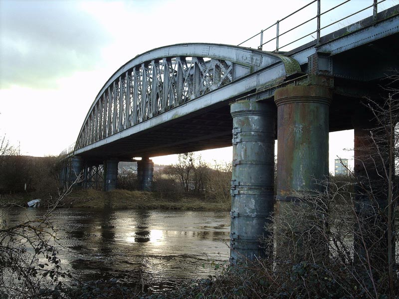
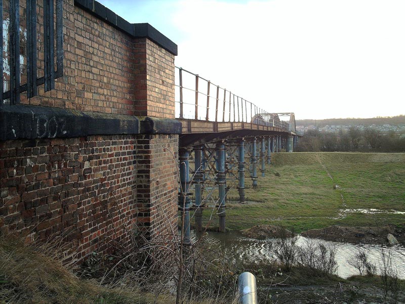
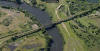
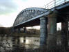 Aire
& Calder navigation bridge : Phill Davison Aire
& Calder navigation bridge : Phill Davison
(N.E.R) The northern eastern railway bridge spanning the Aire & Calder
navigation abandoned in 1992. |
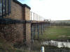
 Aire
& Calder navigation bridge :
Ralph Rawlinson (01-05-09) Aire
& Calder navigation bridge :
Ralph Rawlinson (01-05-09)
Network Rail is considering reopening Castleford - Garforth line. If
this comes about it would bring back into use the magnificent (although
sadly deteriorating) 840ft long Castleford Viaduct over the River Aire. |
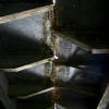
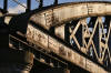 Aire
& Calder navigation bridge (30-01-08) : Graeme Bickerdike Aire
& Calder navigation bridge (30-01-08) : Graeme Bickerdike
The bowstring span over the Aire remains in fair
condition. |
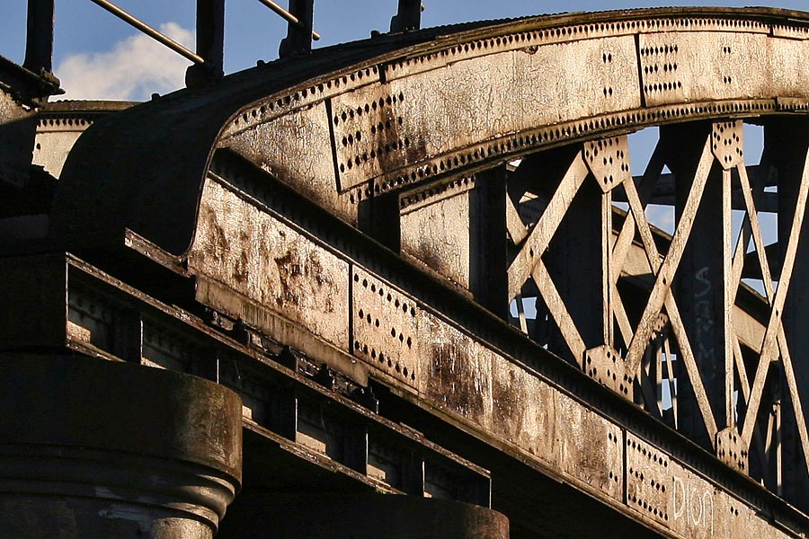
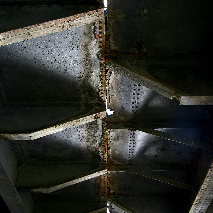
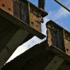
 Aire
& Calder navigation bridge : Phill Davison Aire
& Calder navigation bridge : Phill Davison
The massive span of the cast iron bridge. It's in a terrible condition. Huge
girders have split in half & the decking is paper thin.
I find it amazing
that fully laden coal trains were using this bridge as little as 14yr's ago. |
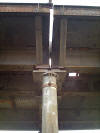
 Aire
& Calder navigation bridge (30-01-08) : Graeme Bickerdike Aire
& Calder navigation bridge (30-01-08) : Graeme Bickerdike
No part of this 840-feet long structure appears to
align, presumably due to movement of the piers. |
 Aire
& Calder navigation bridge : Phill Davison Aire
& Calder navigation bridge : Phill Davison
Totally severed. |
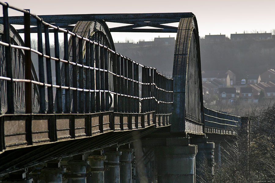
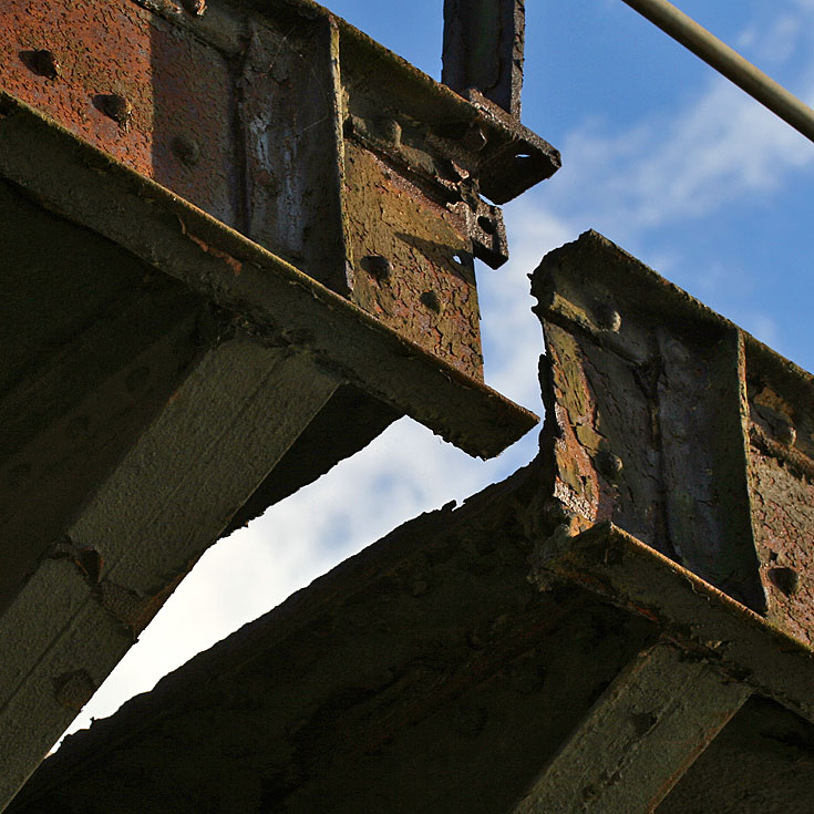
 Aire
& Calder navigation bridge (30-01-08) : Graeme Bickerdike Aire
& Calder navigation bridge (30-01-08) : Graeme Bickerdike
According to a local, a walkway is due to be
constructed across the viaduct. I can't find any reference to it on the
net.
Some serious repairs would certainly be needed before it was fit for
foot traffic. |
 Aire
& Calder navigation bridge (30-01-08) : Graeme Bickerdike Aire
& Calder navigation bridge (30-01-08) : Graeme Bickerdike
Corrosion has caused holes to form in the deck. |
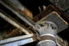 Aire
& Calder navigation bridge (30-01-08) : Graeme Bickerdike Aire
& Calder navigation bridge (30-01-08) : Graeme Bickerdike
Wherever you look, the structure is under attack
from rust. |
 Aire
& Calder navigation bridge (30-01-08) : Graeme Bickerdike Aire
& Calder navigation bridge (30-01-08) : Graeme Bickerdike
One of the pier's substantial feet.
Note : Reopening of the Castleford -
Garforth line : Ralph Rawlinson (01-05-09)
Rail magazine reports that, in order to run more shuttles to Leeds,
Network Rail is considering reopening Castleford - Garforth line and the
disused Up platform at Castleford. If this comes about it would bring
back into use the magnificent (although sadly deteriorating) 840ft long
Castleford Viaduct over the River Aire. |
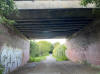
  Berry
Lane near Kippax (25-06-20) : Christopher Franz Berry
Lane near Kippax (25-06-20) : Christopher Franz |
 Selby
Road (A63) near Garforth (25-06-20) : Christopher Franz Selby
Road (A63) near Garforth (25-06-20) : Christopher Franz |

/Altofts%20&%20Whitwood.jpg)
/Whitwood%20Colliery.jpg)
/Hopetown%20Colliery.jpg)
.jpg)
.jpg)