 Railway Ramblers
gazetteer Railway Ramblers
gazetteer
See also the Railway Ramblers gazetteer -
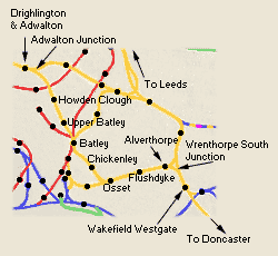
Kirklees : Wakefield - Batley - Adwalton Junction |
Adwalton junction to
Batley section
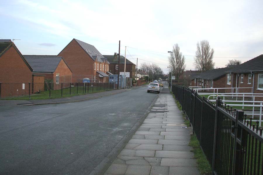
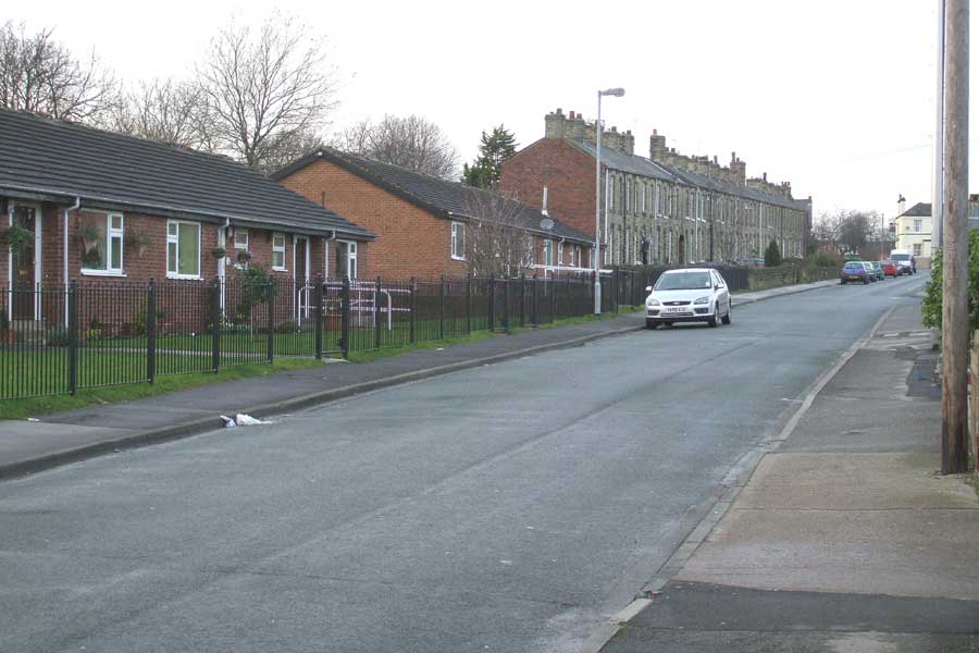
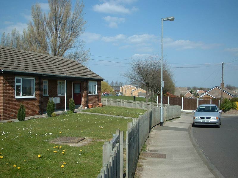
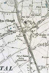
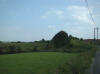
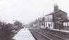
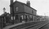
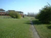
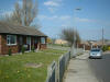
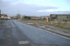
Drighlington
& Adwalton
  Opened
20-08-1856. Closed 30-12-1961. Opened
20-08-1856. Closed 30-12-1961.
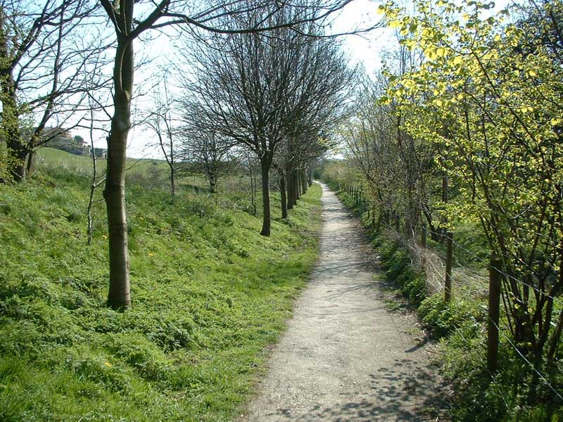
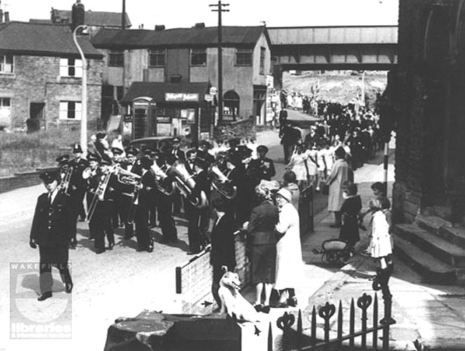
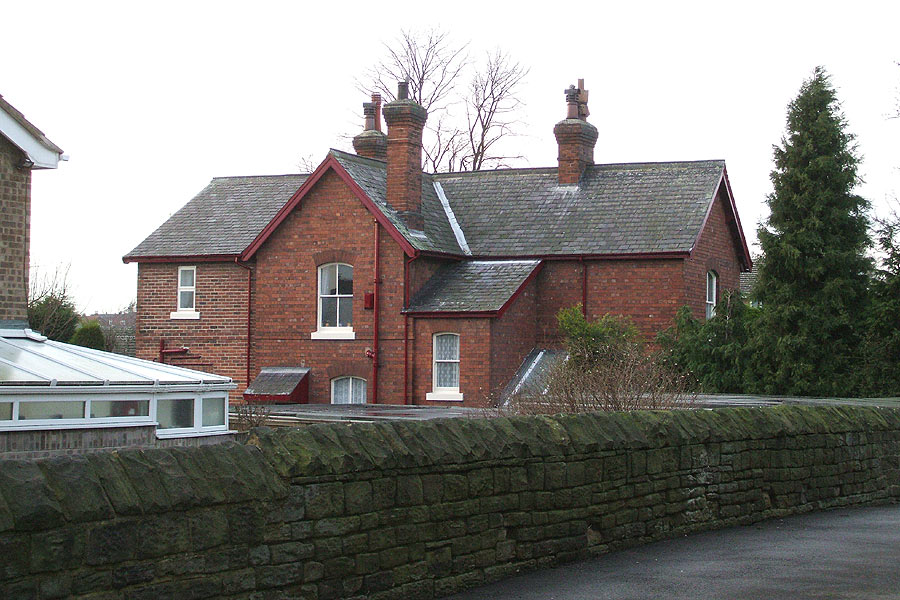
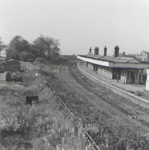
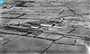
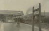
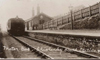
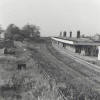
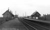
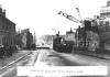
Drighlington
and Adwalton station (c1960) : Dennis Sefton
See also Ardsley
to Laisterdyke section |
 Drighlington
and Adwalton station painting : Gary Hunter Drighlington
and Adwalton station painting : Gary Hunter
I am currently in the process
of building a web site and have yet to complete it. I
will provide a link once my website is up and running
as I have painted lots of local trains around West
Yorkshire and would be delighted to share more with
your audience on your site.
In the meantime this painting is for sale here -
http://www.ebay.co.uk/itm/-/291757929578?ssPageName=STRK:MEBIDX:IT |
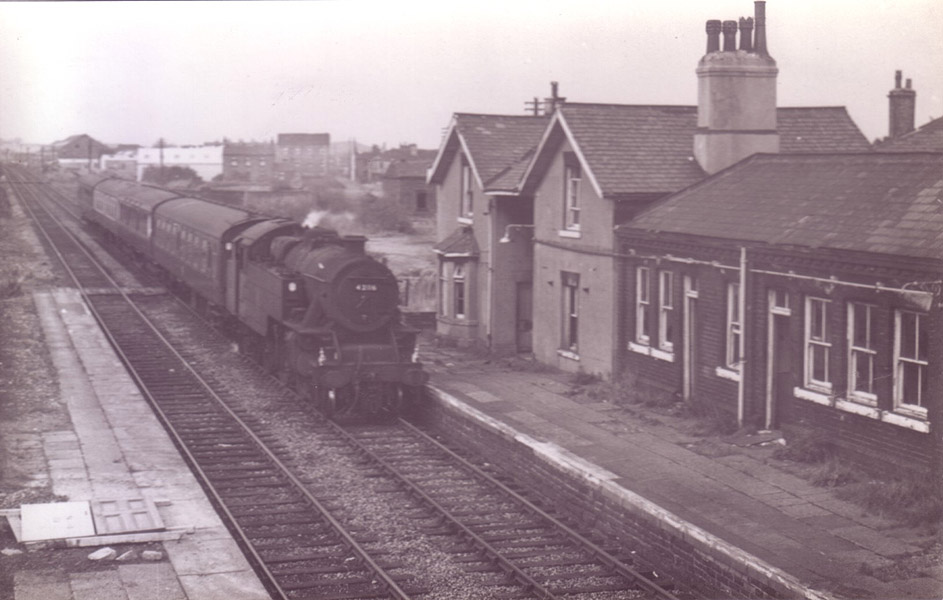
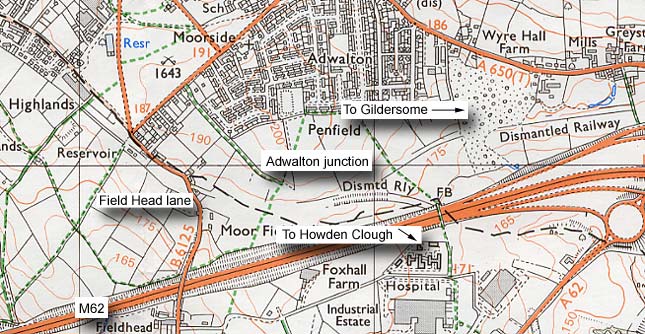
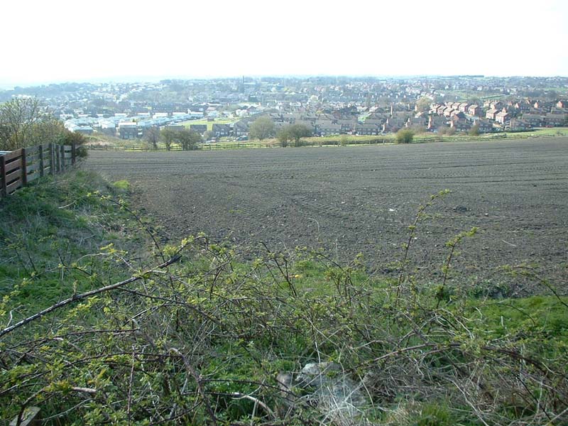
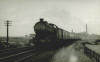
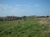
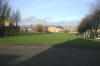
Adwalton junction
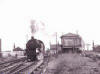 Adwalton
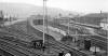
junction c1959 : Melvyn Aveyard Adwalton
junction c1959 : Melvyn Aveyard
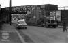
This is loco No 42116 at Adwalton junction. Just
behind the train the Adwalton to Dewsbury line, joins
the Adwalton to Tingley line, which ran through
Gildersome & Morley top stations. I don't know the
exact date of the picture, but believe it to be about
1959. Adwalton station is just in front of the train,
the picture may well have been taken from the
platform. The road crossing the line is Field Head
lane. |
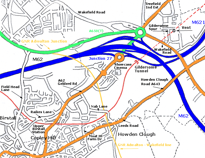
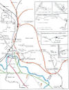
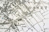
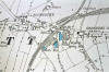
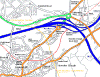 Hybrid Map Adwalton Junction
GNR & Leeds
New Line (roads 2005 rails 1960s) : David
Webdale Hybrid Map Adwalton Junction
GNR & Leeds
New Line (roads 2005 rails 1960s) : David
Webdale |
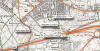 Adwalton junction OS map 1985 Adwalton junction OS map 1985 |
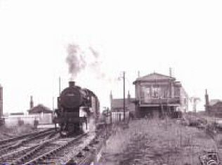
 Adwalton
junction : Maggie Blanck
website -
www.maggieblanck.com/Land/PhotosBirstall.html Adwalton
junction : Maggie Blanck
website -
www.maggieblanck.com/Land/PhotosBirstall.html
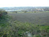
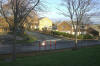
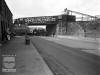
Train approaching Adwalton junction, running from
Morley Top via Gildersome.
The old brickworks chimney visible in the background,
still in existence, this building is now the
Brickworks pub.
The houses just visible to the front left of the loco
are on Wakefield road at Drighlington. |
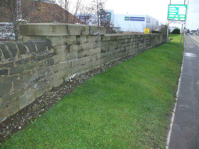
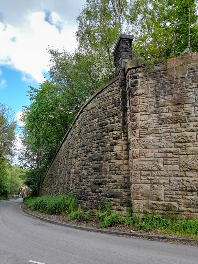
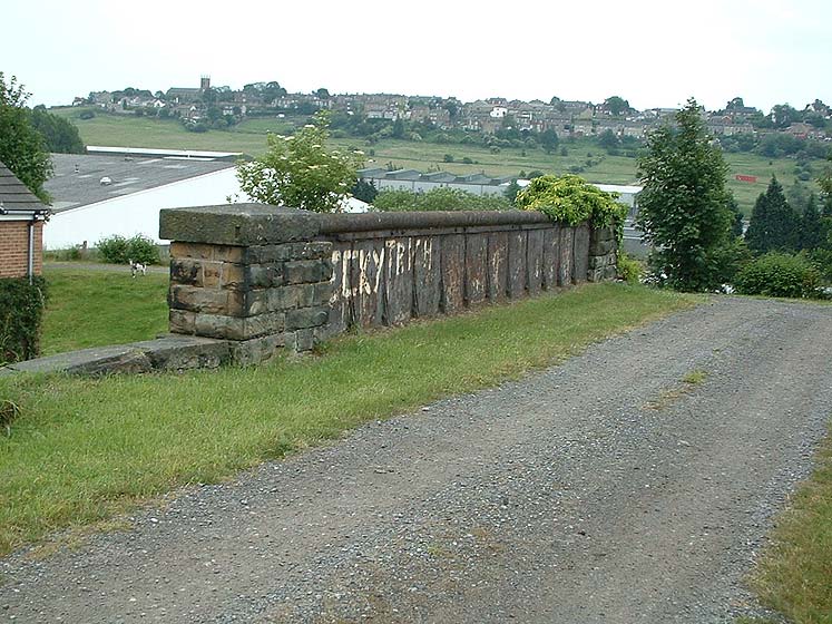
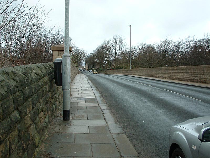
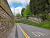
 A62 Gelderd Road (07-12-07) : Andrew Stopford A62 Gelderd Road (07-12-07) : Andrew Stopford
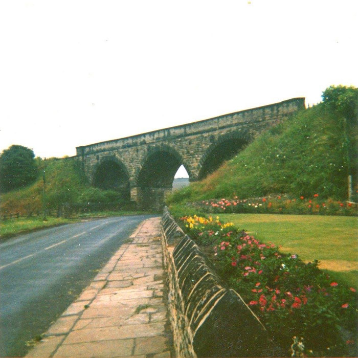
A62 Gelderd Road, Birstall, looking towards Nab Lane.
Bridge parapet from GNR Batley-Adwalton line. |
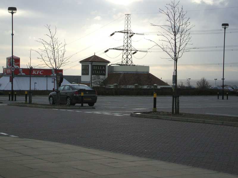
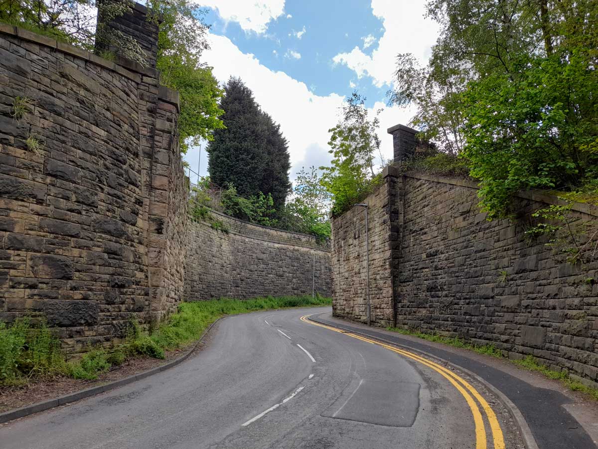
 A62 Gelderd Road (07-12-07) : Andrew Stopford A62 Gelderd Road (07-12-07) : Andrew Stopford
Looking along what was the line of
the GNR Batley-Adwalton line - Gelderd Road bridge
parapet visible beneath Bella Italia.
The line ran right through ToysRus! |
 Robert
Hudson foundry (09-1928) : c/o John Barraclough Robert
Hudson foundry (09-1928) : c/o John Barraclough
The photo on this link might be of
interest. It's taken some locating but is in fact the
Robert Hudson foundry with its GNR/LMS sidings on the
Adwalton/Wakefield line, just east of Gildersome
station and now completely gone, under the industrial
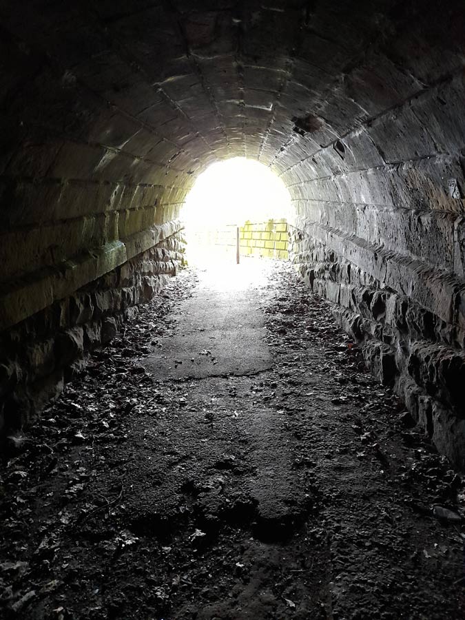
estate. The railway manufacturing connection makes it
particularly interesting. Vents from Gildersome Tunnel
on the Leeds New Line are visible and the embankment
top left is Asquith Avenue. |
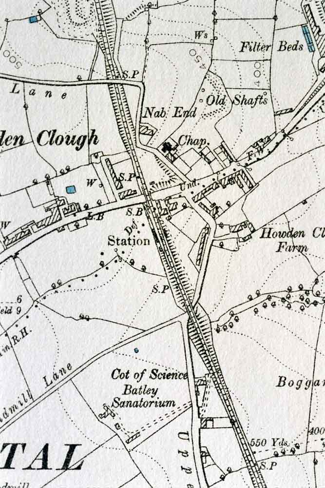
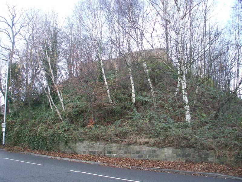
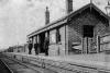
 Howden
Clough Howden
Clough
Opened 01-11-1866. Closed 29-11-1952.
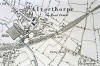
Howden Clough map (1890) : Malcolm Mallison
6 inch maps from the 1890
survey. |
 Howden Clough (07-12-07) :
Andrew Stopford Howden Clough (07-12-07) :
Andrew Stopford
Underneath me and running from
right to left is the Batley-Adwalton line.
Even further underneath and running from behind me to
in front of me is the Leeds
New Line (looking towards Gildersome Tunnel).
Impossible to imagine! |
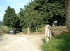
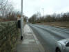
 Howden Clough Leeds road
bridge (18-08-06) : Andrew Stopford Howden Clough Leeds road
bridge (18-08-06) : Andrew Stopford
I guess this is the only remains
of the north western abutment of the GN bridge over
Leeds Road at Howden Clough.
It's very difficult when you go up Nab Lane to
orientate how the bridge crossing of the GN line over
the Leeds New was laid out because of all that infill! |
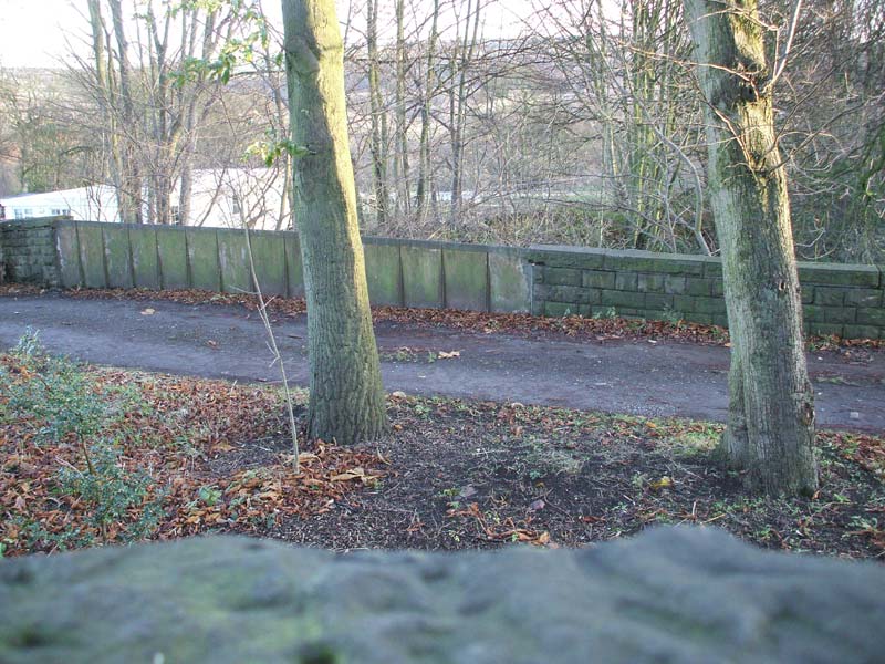
 Howden
Clough Upper Batley Low Lane bridge (1972) : Andrew
James Bennett c/o Heather Banham Howden
Clough Upper Batley Low Lane bridge (1972) : Andrew
James Bennett c/o Heather Banham
I have recently had the pleasure
of finding this Photo of the old Howden Clough rail
viaduct taken a week before it was demolished in 1972
courtesy of Andrew James Bennett. The photo was taken
by his father when they were returning from holiday to
use up the last exposure on his camera. I’m so glad he
did, I grew up around the corner from here and have
been searching for a photograph for years! |
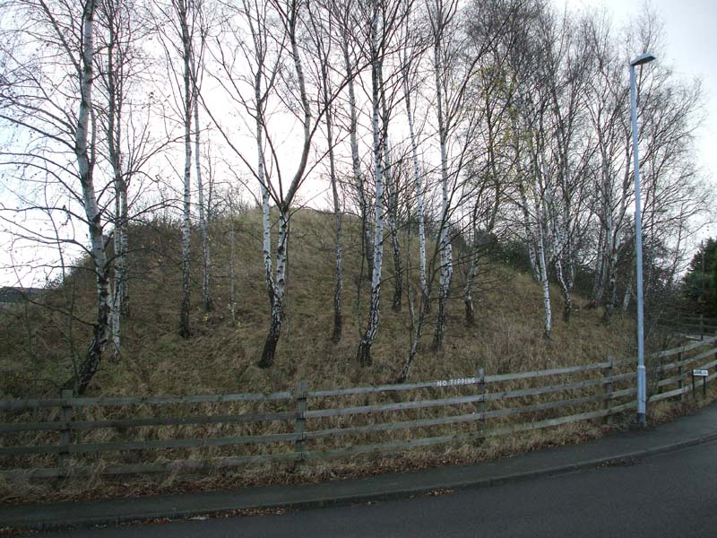
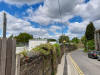
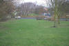
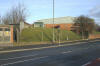
 Howden Clough (02-07-06) :
Andrew Stopford Howden Clough (02-07-06) :
Andrew Stopford
End of the embankment at Howden Clough. |
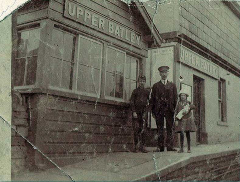
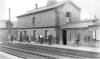
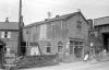
Upper Batley
Opened 19-08-1863. Closed 02-02-1952.
Upper Batley & station master (nd) : John Whitaker
 Undated
view of Upper Batley station. We thought that might be
the young Samuel Drewitt, looking proud of his station
master's uniform. Undated
view of Upper Batley station. We thought that might be
the young Samuel Drewitt, looking proud of his station
master's uniform.
See Lofthouse & Outwood section but as Mark
Drewitt has pointed out the gent on the platform is
wearing a double chain on his watch from one side of
his waistcoat to the other and Samuel’s watch has only
a single chain. |
Upper
Batley & station master (nd) : John Whitaker
Undated view of Upper Batley station.
 Note : Linda Wootton Note : Linda Wootton
The gentleman on the platform at Upper Batley
Station here, is my Great-Grandfather Mark Winder
Sugden. From family research I know he was a foreman
in the GNR goods department (1871 census) then station
master at Beeston (1881&1891 census). He moved to
Upper Batley some time after that and died in 1898
aged 54 shortly after he had been kicked in the head
by a horse whilst working. |
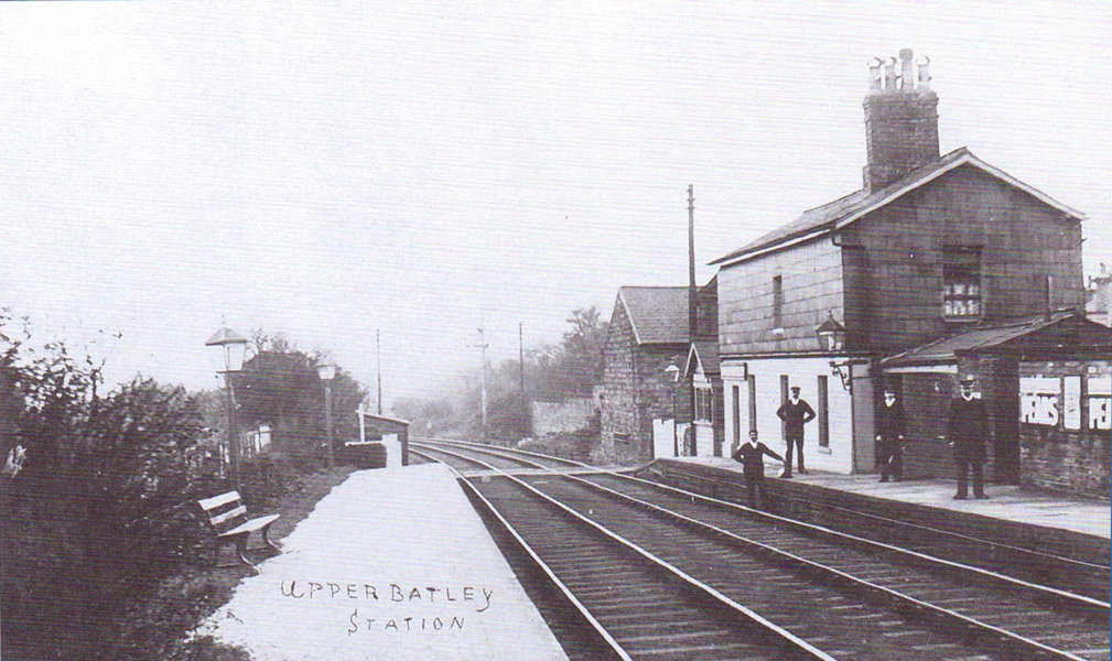
 Upper
Batley (1910) : Peter Burnell Upper
Batley (1910) : Peter Burnell
Upper Batley station here from 1910. |
 Upper
Batley (1910) : Peter Burnell Upper
Batley (1910) : Peter Burnell
Upper Batley station here from 1910.
The building, wall and lamppost to the right hand of
the crossing in the first picture still exist today.
(See Andrew Stopfords photo below) |
 Crossing Upper Batley
(02-07-06) : Andrew Stopford Crossing Upper Batley
(02-07-06) : Andrew Stopford
Former crossing point & gate
near Upper Batley. Lamppost & wall still in
existence see above photo. |
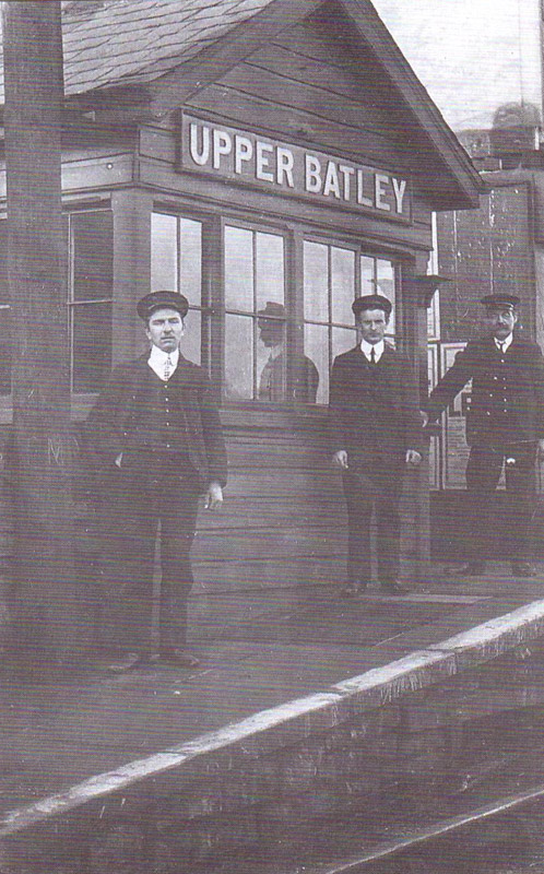
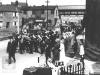
 Upper
Batley (n.d) : Dave Walker Upper
Batley (n.d) : Dave Walker
“Team” photos of the station with several uniformed
railway staff,
plus I’m pretty sure the big guy
in the suit at the right hand side of the picture is my
Grandfather John Henry Thorpe. (see below) |
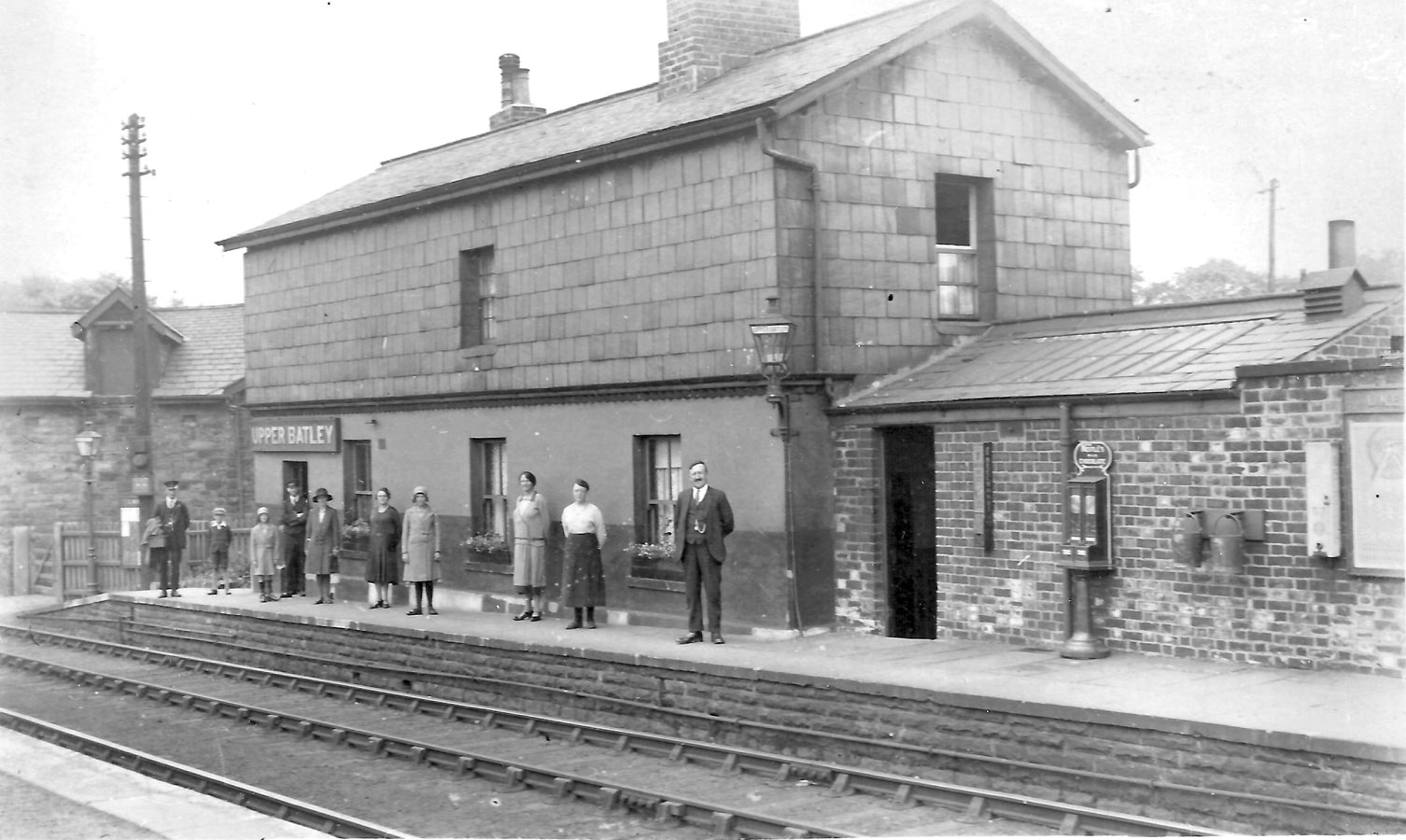
Upper
Batley (n.d) : Dave Walker
 I believe the door under the Upper Batley sign was the
ticket office and not connected to the rest of the house. I believe the door under the Upper Batley sign was the
ticket office and not connected to the rest of the house.
My Mum grew up there, I believe my aunt and uncle were
born there. My Gran lived there I until perhaps the end of
the fifties.
After my Grandmother left, the house was derelict for a
number of years, before being bought by “Alfie” Fox (boss
of Fox’s biscuits)
and being refurbed as a wedding present
for his daughter. |
John Henry Thorpe (c1925-1935) :
Dave Walker
  Two
pictures of Granddad Thorpe.I would guess these photos
would be between 1925 and 1935. Two
pictures of Granddad Thorpe.I would guess these photos
would be between 1925 and 1935.
My maternal Grandfather
was a railwayman from before WW1 and after the war went
back to the railways as an engineer.
The marriage
certificate says “Permanent Way Inspector”. I’m guessing
he could have been responsible for the whole of the track,
Adwalton Junction to Wakefield. As part of his employment,
he got “Station House” at Upper Batley as his home, having
moved from Langwith Junction, Derbyshire. Sadly, he died
fairly young in 1935, having been married "only 14 years”.
My Aunt likely fell foul of his job, contracting polio
when young and had a permanently affected leg.
Years
later, epidemiological research identified a closer causal
link between polio and infection in railway workers
families,
thanks to the toilets being emptied direct on
to the tracks, faeces and sewage being key vectors. |
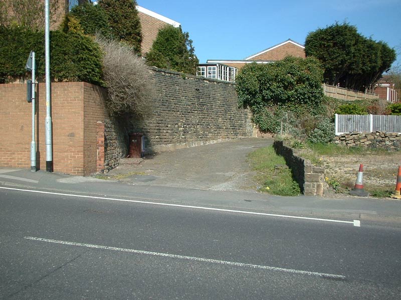
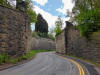
 Upper Batley (07-12-07) :
Andrew Stopford Upper Batley (07-12-07) :
Andrew Stopford
GNR Batley-Adwalton overbridge site, Scotchman lane
(Timothy Lane) Batley. Adwalton side. |
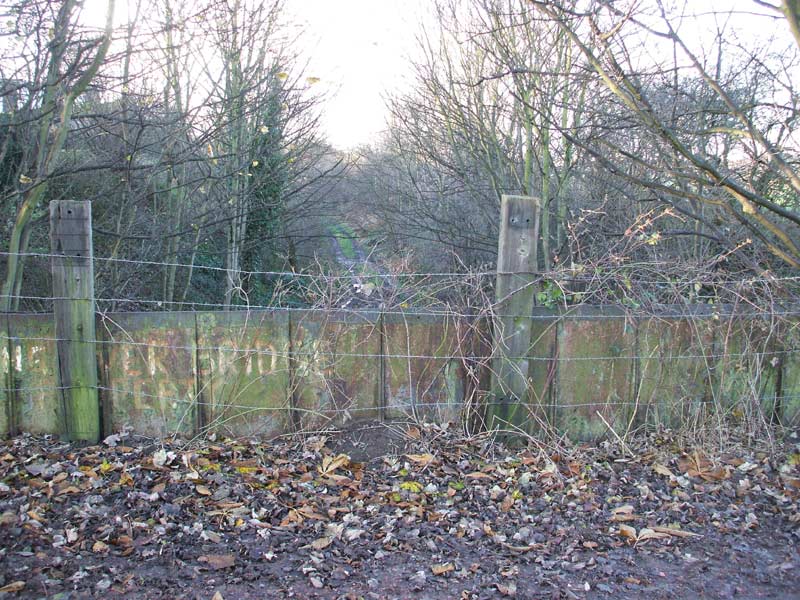
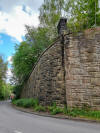
 Upper Batley (07-12-07) : Andrew Stopford Upper Batley (07-12-07) : Andrew Stopford
GNR Batley-Adwalton overbridge
site, Scotchman lane (Timothy Lane) Batley side. |
 Upper Batley (07-12-07) : Andrew Stopford Upper Batley (07-12-07) : Andrew Stopford
GNR Batley-Adwalton trackbed, near
Lamplands House (Sunny Bank road) Upper Batley. Batley
side. |
 Upper Batley (07-12-07) : Andrew Stopford Upper Batley (07-12-07) : Andrew Stopford
GNR Batley-Adwalton trackbed, near
Lamplands House (Sunny Bank road) Upper Batley.
Adwalton side. |
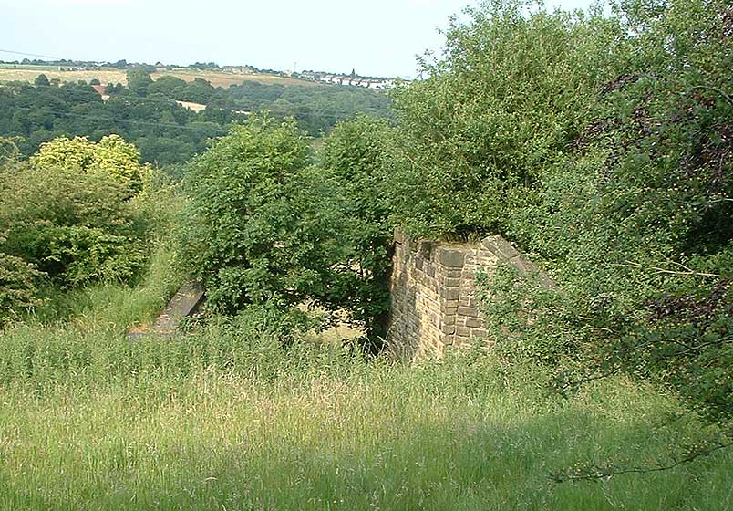
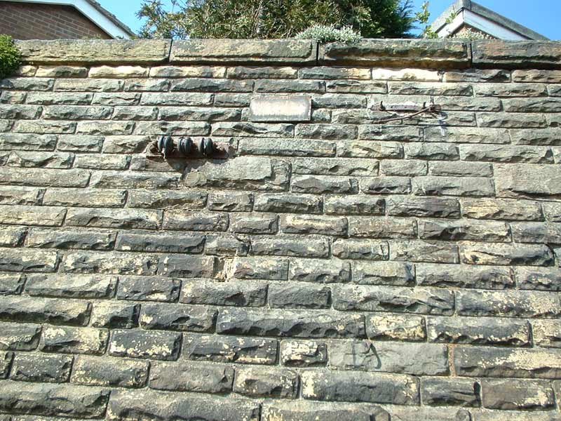
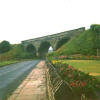
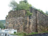
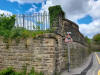
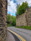
 Bridge
Upper Batley (02-07-06) : Andrew Stopford Bridge
Upper Batley (02-07-06) : Andrew Stopford
Bridge abutment remains near Upper Batley on the Great
Northern railway, Drighlington & Adwalton junction
to Batley line. |
 Lady Anne Crossing, Batley (02-07-06) : Andrew Stopford Lady Anne Crossing, Batley (02-07-06) : Andrew Stopford
Eastern abutment at Lady Anne crossing. Here the GNR
crossed the LNWR Huddersfield to Leeds line on a
girder bridge.
See Leeds Mirfield |
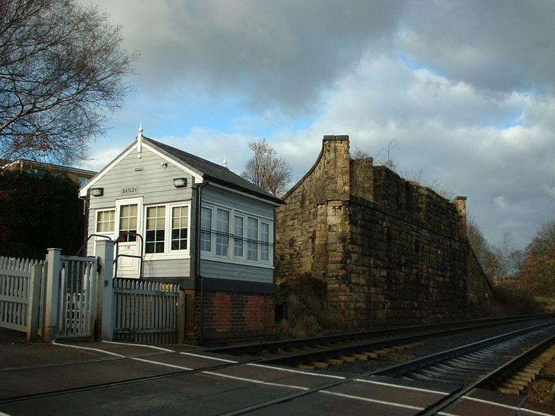
 Lady Anne Crossing, Batley (25-12-05) : Andrew Stopford Lady Anne Crossing, Batley (25-12-05) : Andrew Stopford
Western abutment & Batley
signal box (used to be called Lady Anne
Crossing). During rationalization of the Batley area
in 1966, this small Lady Anne gate box, was upgraded
to a full signal box, replacing three others
controlling Batley. This is one of the only four
surviving boxes controlling Kirklees railways.
See Leeds Mirfield |
 Lady
Anne Crossing, Batley (26-12-08) : Peter Burnell Lady
Anne Crossing, Batley (26-12-08) : Peter Burnell
The Adwalton - Wakefield line
crossed here over the existing Huddersfield - Leeds
Line.
See Leeds Mirfield |
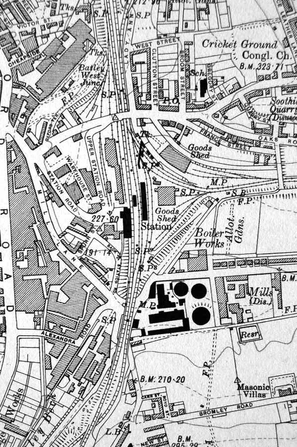
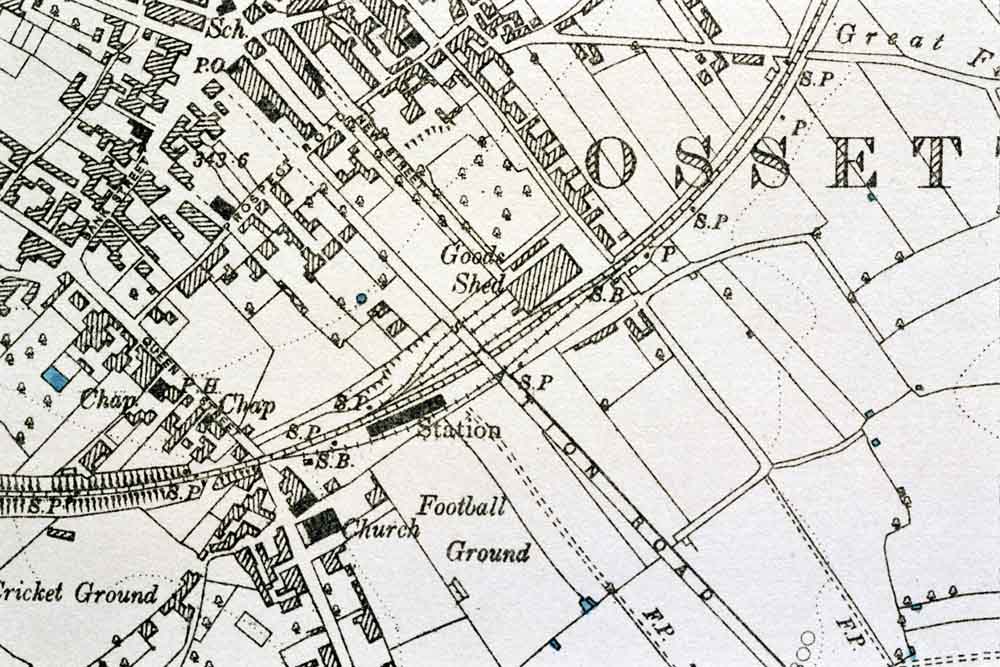
 Batley to Ossett
section Batley to Ossett
section
Dewsbury
& Batley Map c1900 : Ralph Rawlinson |
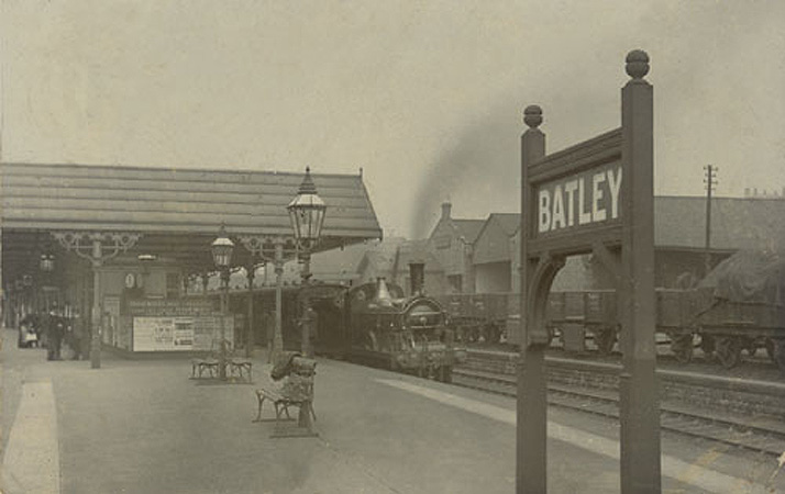
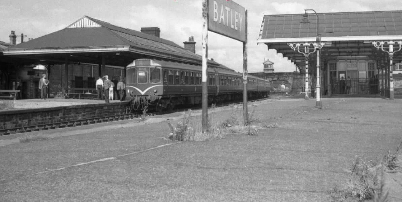
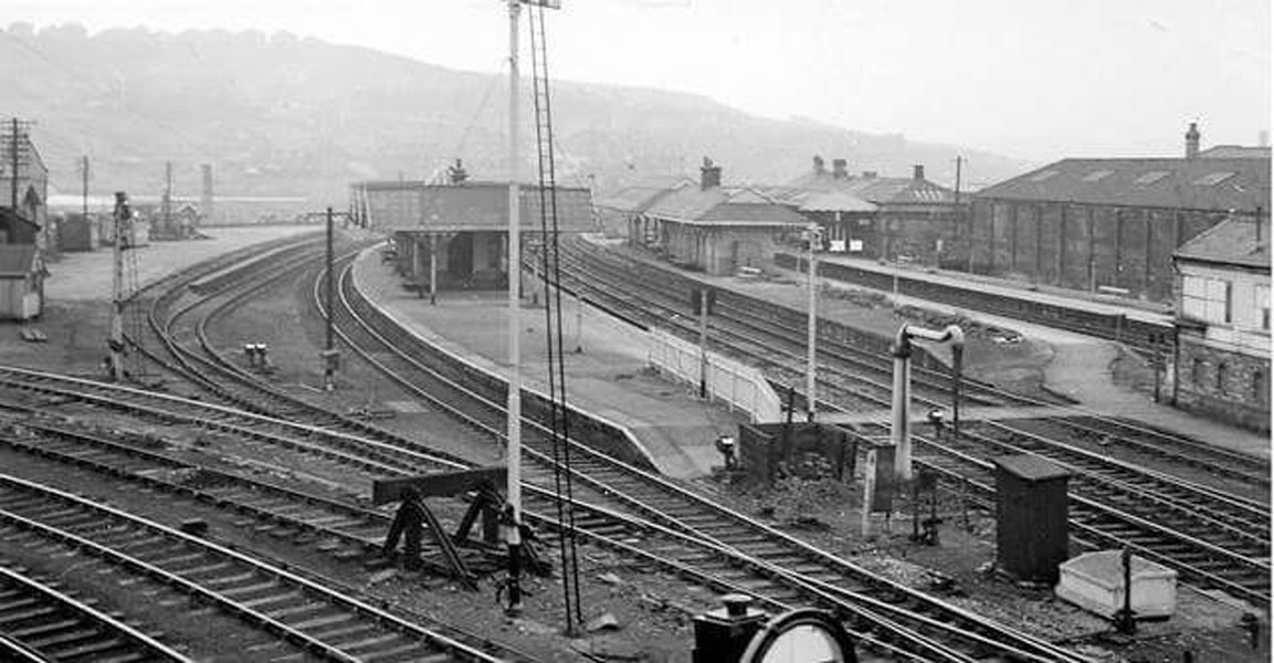
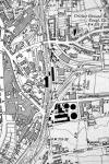 Batley
GNR Batley
GNR
Opened 01-08-1890. Closed 07-09-1964.
Batley
(c1931) : Malcolm Mallison
From the 1931 survey- Batley, Dewsbury, Woodkirk |
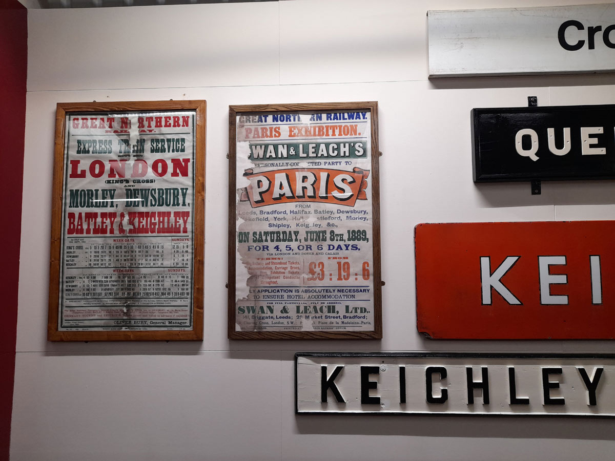
 Batley
GNR (22-05-23) : Paul
Holroyd Batley
GNR (22-05-23) : Paul
Holroyd
Vintage posters on display at the Vintage Carriage
Trust's museum at Ingrow.
Vintage Carriages Trust
June 1889 Package tours to
Paris from Batley and Dewsbury - just three weeks after
the opening of the Eiffel Tower.
June 1905 Express
train service to London from Morley, Batley and Dewsbury. |
 Batley
GNR c1900 : Paul
See also Dewsbury Loop Batley
GNR c1900 : Paul
See also Dewsbury Loop
This is a picture of a platform at Batley
station that no longer exists. I believe it was the
island platform that trains from Earlsheaton,
Dewsbury, Batley Carr came to. If you go to Batley
station and go down the steps to go over to platform 2
before you go up the steps you can see where it has
been bricked up, where u could carry on going to then
reach this platform. |
 Batley
(nd) : Paul Holroyd Batley
(nd) : Paul Holroyd
Batley. |
 Batley (nd) : Paul
Holroyd Batley (nd) : Paul
Holroyd
Batley. |
  Batley
GNR (22-05-23) : Paul
Holroyd Batley
GNR (22-05-23) : Paul
Holroyd
Lady Ann Road and West Street, Batley. |
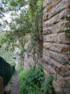
 Batley
GNR (22-05-23) : Paul
Holroyd Batley
GNR (22-05-23) : Paul
Holroyd
Retaining walls, Lady Ann Road, Batley. |
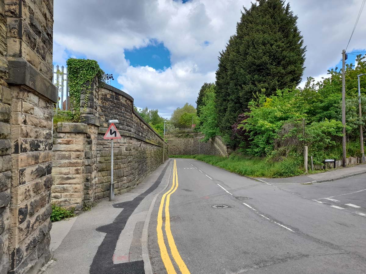
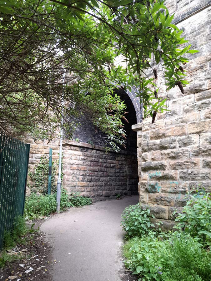
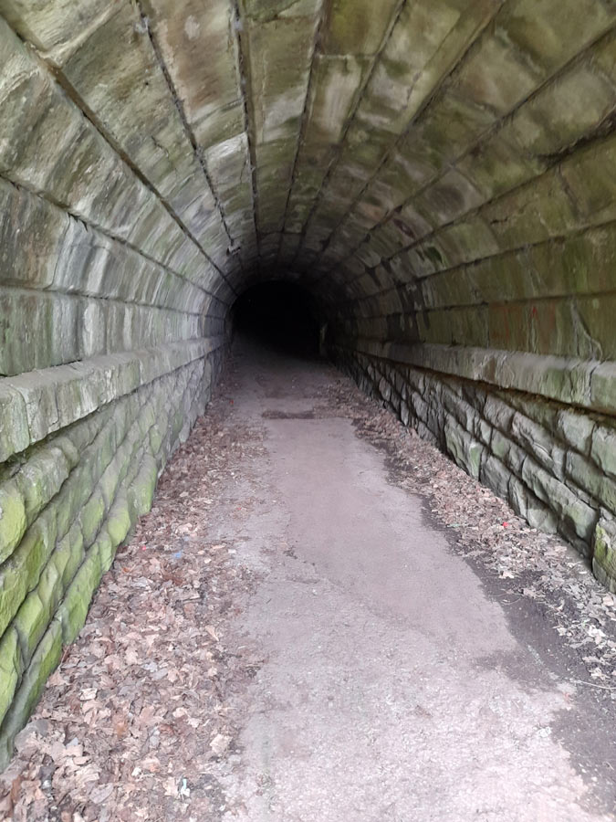
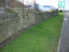
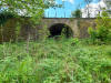
 Batley
GNR (22-05-23) : Paul
Holroyd Batley
GNR (22-05-23) : Paul
Holroyd
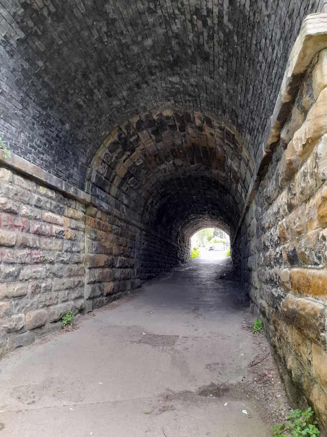
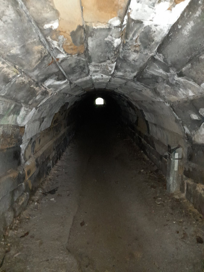
Pedestrian tunnel under railway, opposite West
Street, Batley. |
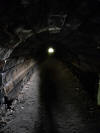
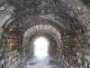 Batley
GNR (22-05-23) : Paul
Holroyd Batley
GNR (22-05-23) : Paul
Holroyd
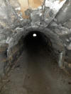
Pedestrian tunnel. |
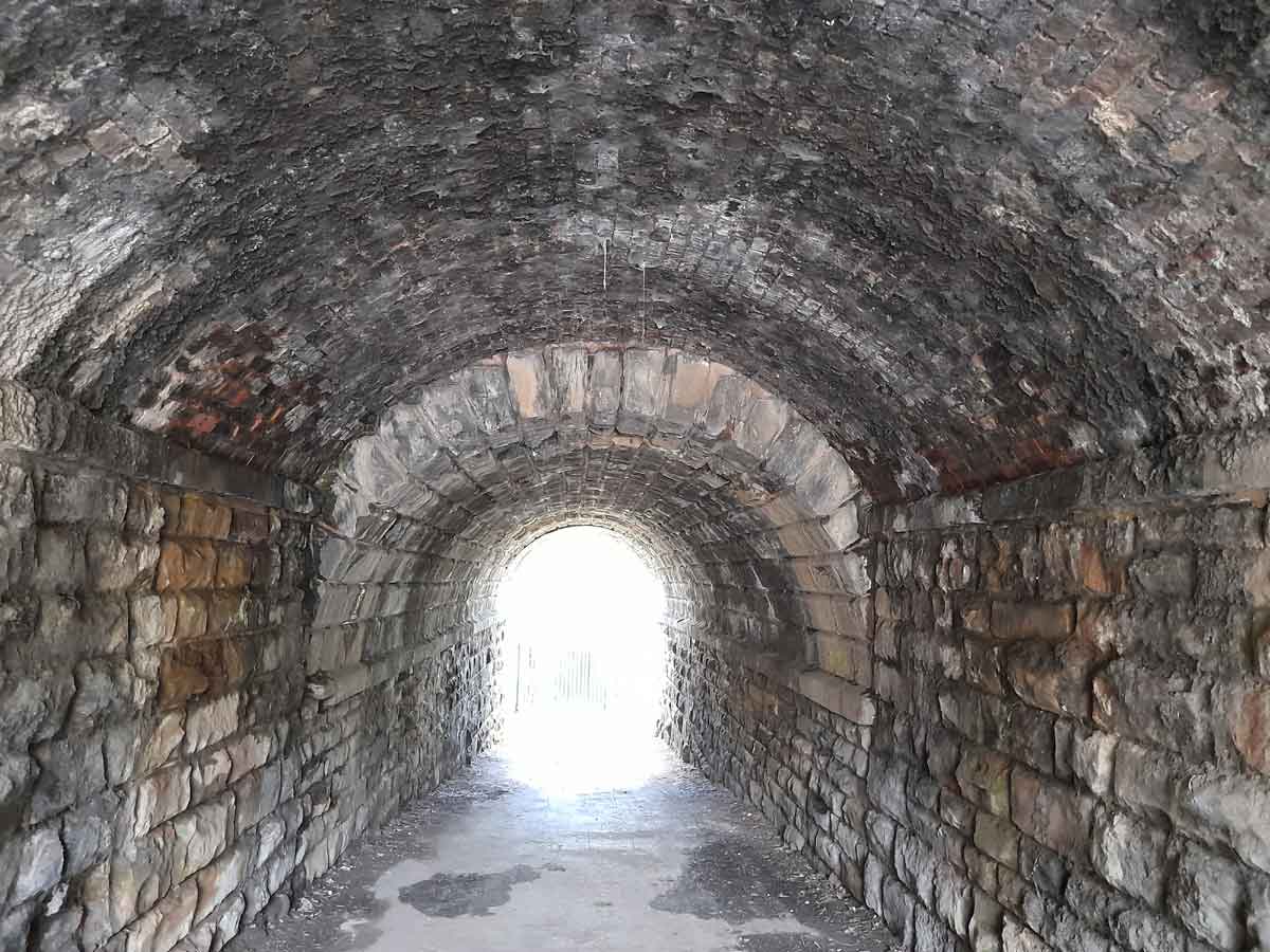
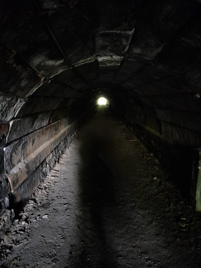
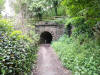
 Batley
GNR (22-05-23) : Paul
Holroyd Batley
GNR (22-05-23) : Paul
Holroyd
Pedestrian tunnel under railway, opposite West
Street, Batley, the other end of the tunnel. |
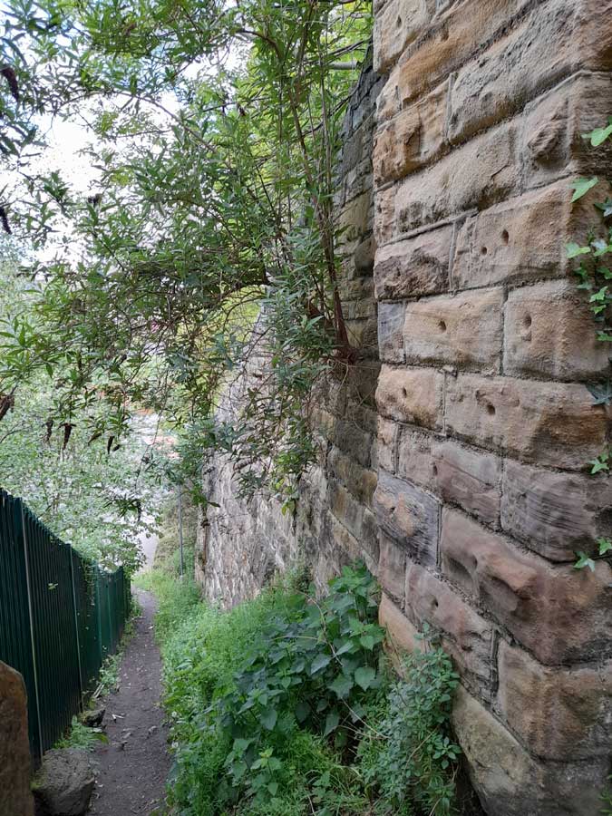
 Batley
GNR (22-05-23) : Paul
Holroyd Batley
GNR (22-05-23) : Paul
Holroyd
Footpath and retaining wall next to the pedestrian
tunnel. |
 Batley
GNR (22-05-23) : Paul
Holroyd Batley
GNR (22-05-23) : Paul
Holroyd
Retaining walls, Lady Ann Road, Batley, the
opposite side to the footpath. |
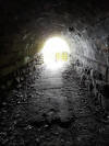
 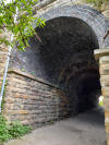 Batley
GNR (22-05-23) : Paul
Holroyd Batley
GNR (22-05-23) : Paul
Holroyd
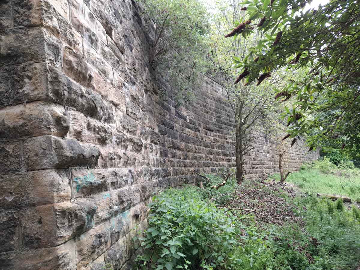
BatleyBatley GNR 125936 pedestrian tunnel under
railway, looking towards West Street, Batley. |
 Batley
GNR (22-05-23) : Paul
Holroyd Batley
GNR (22-05-23) : Paul
Holroyd
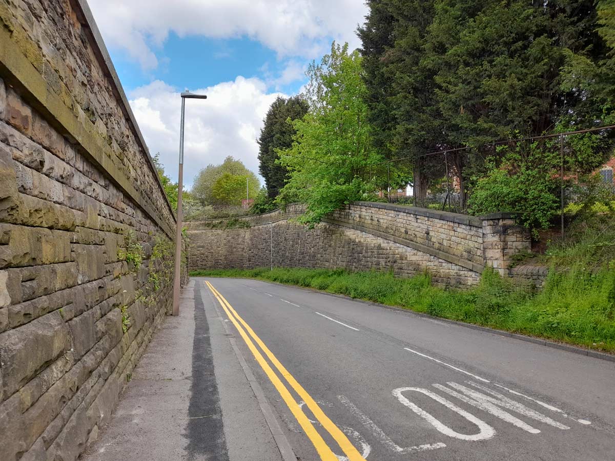
Retaining walls, Lady Ann Road, Batley. |
 Batley
GNR (22-05-23) : Paul
Holroyd Batley
GNR (22-05-23) : Paul
Holroyd
Bridge abutments, Lady Ann Road, Batley, looking
towards the junction with Primrose Hill. |
 Batley
GNR (22-05-23) : Paul
Holroyd Batley
GNR (22-05-23) : Paul
Holroyd
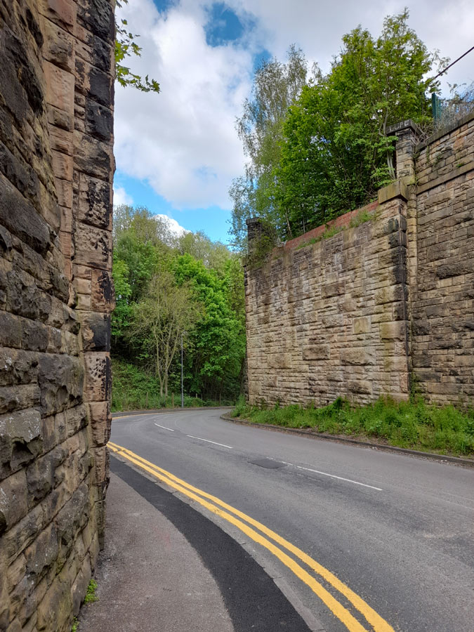
Bridge abutments, Lady Ann Road, Batley. |
 Batley
GNR (22-05-23) : Paul
Holroyd Batley
GNR (22-05-23) : Paul
Holroyd
Bridge abutments, Lady Ann Road, Batley, looking
towards the junction with Soothill Lane. |
 Batley
GNR (22-05-23) : Paul
Holroyd Batley
GNR (22-05-23) : Paul
Holroyd
View of the railway embankment from Primrose Hill. |
  Batley
GNR (22-05-23) : Paul
Holroyd Batley
GNR (22-05-23) : Paul
Holroyd
Pedestrian tunnel opposite Lady Ann Road junction
with Primrose Hill. |
 Batley
GNR (22-05-23) : Paul
Holroyd Batley
GNR (22-05-23) : Paul
Holroyd
Pedestrian tunnel opposite Lady Ann Road junction
with Primrose Hill. |
 Batley
GNR (22-05-23) : Paul
Holroyd Batley
GNR (22-05-23) : Paul
Holroyd
Pedestrian tunnel opposite Lady Ann Road junction
with Primrose Hill, looking back towards Primrose Hill and
Lady Ann Road. |
 Batley
GNR (22-05-23) : Paul
Holroyd Batley
GNR (22-05-23) : Paul
Holroyd
Pedestrian tunnel opposite Lady Ann Road junction
with Primrose Hill. |
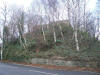
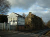
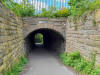
 Shaw
Cross line (06-06) : Andrew Stopford Shaw
Cross line (06-06) : Andrew Stopford
Old bridge over the Shaw Cross line just outside
Batley as it was in June this year. |
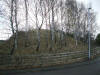
 Shaw
Cross line (06-06) : Laura McTigue Shaw
Cross line (06-06) : Laura McTigue
I recently visited a Cattery
which is close to Batley train station and in its
garden is the old Shaw Cross line bridge.
As I walked across the bridge, I realised it was a
railway bridge and when I came down the side of it and
turned round I just had to take a picture. |
 Shaw Cross-1 (15-04-07) :
Andrew Stopford Shaw Cross-1 (15-04-07) :
Andrew Stopford
I'm sure I'm standing on the
line of the branch - looking towards Batley between
'old' and 'new' Owl Lane. |
 Shaw Cross-8 (15-04-07) :
Andrew Stopford Shaw Cross-8 (15-04-07) :
Andrew Stopford
Leeds Road, at the point where
the line went underneath, looking towards Ossett
(Parish Church spire visible). |
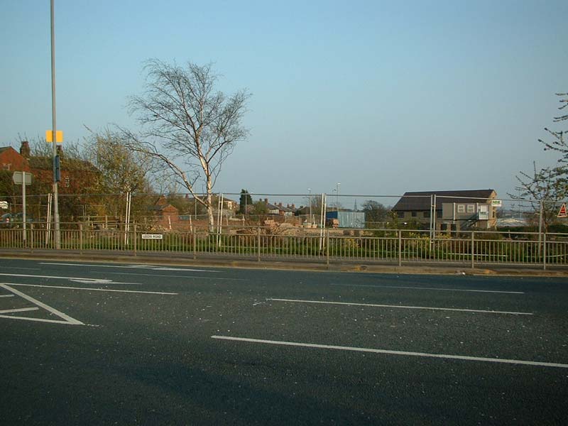
 Chickenley (15-04-07) :
Andrew Stopford Chickenley (15-04-07) :
Andrew Stopford
Looking across the new Wakefield
Road (built after the railway had gone, I think)
towards Ossett.
The line came through where the new houses are centre
shot. |
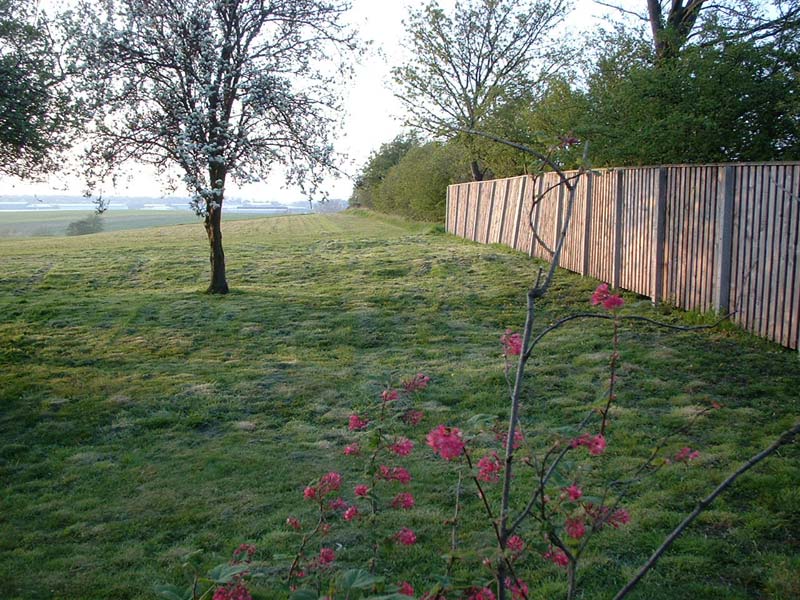
 Chickenley (15-04-07) :
Andrew Stopford Chickenley (15-04-07) :
Andrew Stopford
Shot over the top of a razor wire
garden fence!
looking towards Shaw Cross from more or less the same
point - trees to right mark line of trackbed. |
Chickenley Heath
Station
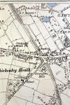 Opened
02-07-1877. Closed 30-06-1909. Opened
02-07-1877. Closed 30-06-1909.
Chickenley Heath Station
map (1890) : Malcolm Mallison |
 Chickenley Heath Station
(1905) : c/o Martin Smith Chickenley Heath Station
(1905) : c/o Martin Smith
Martin pointed us towards this
site -
Ossett - the history of a Yorkshire town -
with a rare photo of Chickenley Heath station. |
 Chickenley
Heath Station (n.d) : Geoff Rooks Chickenley
Heath Station (n.d) : Geoff Rooks
Chickenley station, with the
station master and his staff, the station master is a
long time family member. |
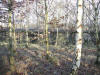
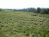
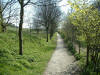 Chickenley Heath-1 (07-04-07) : Andrew Stopford Chickenley Heath-1 (07-04-07) : Andrew Stopford
Now a footpath from a car park at Pildacre Lane,
Chickenley Heath branch looking towards Runtlings
Junction just south of Pildacre Lane. |
 Chickenley Heath-2 (07-04-07) : Andrew Stopford Chickenley Heath-2 (07-04-07) : Andrew Stopford
Slightly further south. |
 Chickenley Heath-3 (07-04-07) : Andrew Stopford Chickenley Heath-3 (07-04-07) : Andrew Stopford
Approaching Runtlings Junction. |
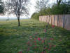
 Chickenley Heath-5 (07-04-07) : Andrew Stopford Chickenley Heath-5 (07-04-07) : Andrew Stopford
Between Chickenley & Pildacre Lane -
looking west from Love Lane.
Branch runs horizontally marked by line of trees &
fencing centre shot. |
 Chickenley Heath-6 (07-04-07) : Andrew Stopford Chickenley Heath-6 (07-04-07) : Andrew Stopford
Standing on a crossing point looking
south towards Pildacre Lane - another infrastructure
survivor at left! |
 Chickenley Heath-7 (07-04-07) : Andrew Stopford Chickenley Heath-7 (07-04-07) : Andrew Stopford
Same point looking north at Chickenley. |
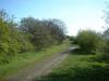
 Chickenley
Heath (02-04-07) : Andrew Stopford Chickenley
Heath (02-04-07) : Andrew Stopford
Chickenley Heath branch - this part of it is now a
footpath. Looking south from Pildacre Lane towards
Runtlings Junction.
The branch runs between the trees near the top of the
photo. |
Runtlings Lane Junction
 Runtlings
lane junction-1 (07-04-07) : Andrew Stopford Runtlings
lane junction-1 (07-04-07) : Andrew Stopford
Runtlings Junction looking north
west Earlsheaton line goes to left (through the goal
posts), Chickenley Heath line diverges to the right. |
 Runtlings
lane junction-3 (07-04-07) : Andrew Stopford Runtlings
lane junction-3 (07-04-07) : Andrew Stopford
Same point looking towards Ossett - new
building across trackbed. |
 Runtlings
lane junction-4 (07-04-07) : Andrew Stopford Runtlings
lane junction-4 (07-04-07) : Andrew Stopford
Standing on the line of the track behind
the new building in above shot - even more new
building! |
 Queen Street / The Green :
Dave Watson Queen Street / The Green :
Dave Watson
When the railway left Ossett
station towards Dewsbury it went over a bridge on
Queen Street / The Green.
At the side of the bridge was / is a pub which was
called The Masons Arms ( now called The Tap ).
To the left of the pub still exists the bridge
abutment and part of a retaining wall. |
 Queen Street / The Green :
Dave Watson Queen Street / The Green :
Dave Watson |
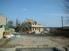
 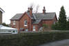 Ossett Station House
(03-02-07) : Andrew Stopford Ossett Station House
(03-02-07) : Andrew Stopford
Ossett Station House - it fits with the old OS map and
is in line with the Station Road overbridge.
(see below) |
 Ossett
Station House (07-04-07) : Andrew Stopford Ossett
Station House (07-04-07) : Andrew Stopford
Access to the station house that I
photographed earlier (Queen Street / The Green) -
obvious railway access,
and the house indeed has a plate saying "Station House
- GNR", so I guessed right when I was there before! |
 Ossett
Station House (07-04-07) : Andrew Stopford Ossett
Station House (07-04-07) : Andrew Stopford
Detail of surviving electrical
equipment on the wall. |
 Ossett
Station Ossett
Station
Opened 07-04-1864. Closed 05-09-1964.
Pudsey
Greenside station map (1890) : Malcolm Mallison
6 inch maps from the 1890
survey. |
 Ossett
Station : Dave Watson Ossett
Station : Dave Watson
Ossett station shortly after the
track has been lifted. |
 Station
Road overbridge (03-02-07) : Andrew Stopford Station
Road overbridge (03-02-07) : Andrew Stopford
which is still there (although infilled and built
either side). |
 Goods Shed (03-02-08) :
Andrew Stopford Goods Shed (03-02-08) :
Andrew Stopford
Looking from the Station Road overbridge down at the
site of the Goods Shed (view towards Wakefield) |
 Ossett Station platform
(03-02-08) : Andrew Stopford Ossett Station platform
(03-02-08) : Andrew Stopford
Standing precisely on the site of the platform
(Southdale Gardens), looking towards Wakefield.
Station Road overbridge visible running left to right. |
 Intake Lane, Ossett
(03-02-08) : Andrew Stopford Intake Lane, Ossett
(03-02-08) : Andrew Stopford
Intake Lane, Ossett. Site of level crossing and rail
exit from Ossett Station (Wakefield to left).
Site of station & goods yard is to right. |
 Intake Lane, Ossett
(03-02-08) : Andrew Stopford Intake Lane, Ossett
(03-02-08) : Andrew Stopford
Same spot, looking in opposite
direction (station site to left). |
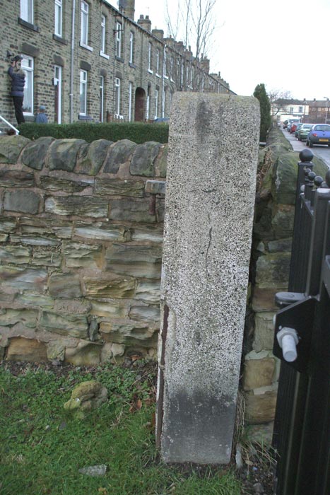
 Station & goods yard
boundary (03-02-08) : Andrew Stopford Station & goods yard
boundary (03-02-08) : Andrew Stopford
Intake Lane infrastructure survivor! Concrete gate
post marking the boundary of the Station & goods
yard. |
 Ossett-2
(07-04-07) : Andrew Stopford Ossett-2
(07-04-07) : Andrew Stopford
looking south west - the line from Wakefield went
through here at about this point in the direction of
the shot.
I think the red brick building has a 'railway' look
about it. |
 Ossett-1
(07-04-07) : Andrew Stopford Ossett-1
(07-04-07) : Andrew Stopford
I think this is a surviving piece
of trackbed a bit further south west from the above
shot. |
 Ossett-3
(07-04-07) : Andrew Stopford Ossett-3
(07-04-07) : Andrew Stopford
I think the grass in mid shot (now a play area) is a
piece of trackbed - Broadgate looking north east. |
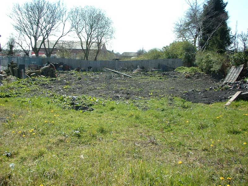
Ossett to Wakefield section
 Towngate, Ossett (13-01-08) :
Andrew Stopford Towngate, Ossett (13-01-08) :
Andrew Stopford
Remains of embankment and approach
to viaduct site crossing Towngate, Ossett (looking
towards Wakefield).
Now a childrens' play area. |
 Towngate, Ossett (13-01-08) :
Andrew Stopford Towngate, Ossett (13-01-08) :
Andrew Stopford
Looking down into Towngate from
the embankment. No visible sign of any viaduct, but it
was a substantial one. |
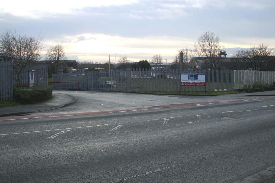
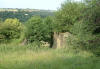
 Flushdyke (13-01-08) : Andrew
Stopford Flushdyke (13-01-08) : Andrew
Stopford
Flushdyke Summit site - looking
towards Wakefield (visible in the distance). The very
slight 'hump' in the grass centre shot marks the line
of the railway. |
 Flushdyke (13-01-08) : Andrew
Stopford Flushdyke (13-01-08) : Andrew
Stopford
Looking across Wakefield Rd,
Flushdyke, along the line of the railway towards
Ossett. |
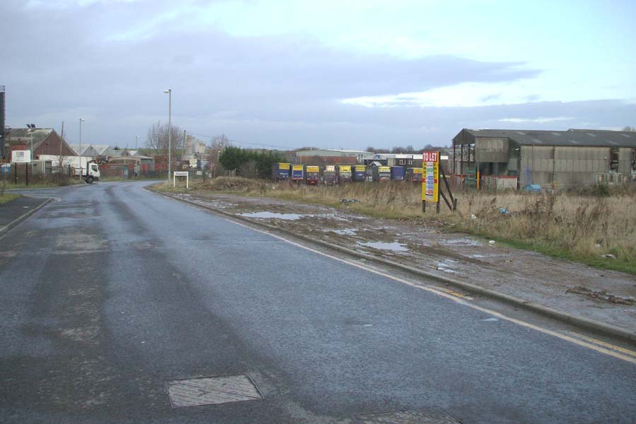
 Flushdyke (13-01-08) : Andrew
Stopford Flushdyke (13-01-08) : Andrew
Stopford
Looking back towards Wakefield
Road along the alignment of the railway.
The red and green low roofed 'shed' above the parked
yellow and blue lorries is on the line. |
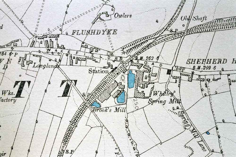
 Flushdyke
Station Flushdyke
Station
Opened 07-04-1862. Closed 03-05-1941.
Embankment (1890)
: Malcolm Mallison
6 inch maps from the 1890
survey. |
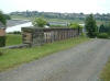
 Flushdyke Station : Dave
Watson Flushdyke Station : Dave
Watson |
 Flushdyke (13-01-08) : Andrew
Stopford Flushdyke (13-01-08) : Andrew
Stopford
Wakefield Road, Flushdyke. Site of
crossing point, presumably a bridge.
I think this would also be the site of Flushdyke
Station (where the red brick/green roofed building
is). Wakefield to left. |
 Flushdyke (13-01-08) : Andrew
Stopford Flushdyke (13-01-08) : Andrew
Stopford
Close up - remains of embankment. |
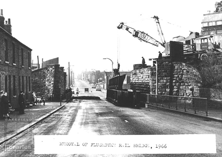
 Flushdyke Rail Bridge : Dave
Watson Flushdyke Rail Bridge : Dave
Watson |
 Flushdyke
Rail Bridge : Dave Watson Flushdyke
Rail Bridge : Dave Watson |
 Demolishing Flushdyke Rail
Bridge (1966) : Dave Watson Demolishing Flushdyke Rail
Bridge (1966) : Dave Watson |
 Flushdyke (13-01-08) : Andrew
Stopford Flushdyke (13-01-08) : Andrew
Stopford
On the alignment of the railway,
looking back towards Ossett. Not much to see because
of massive road building. |
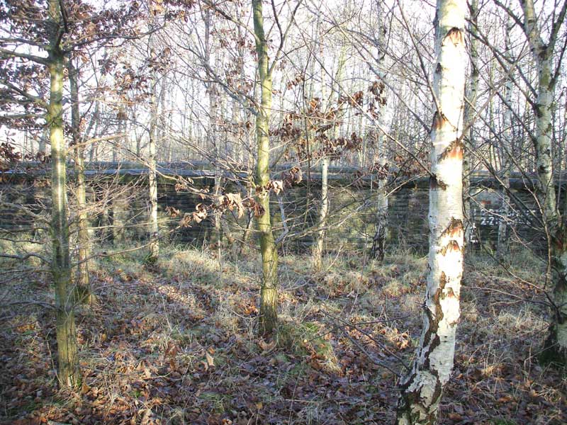
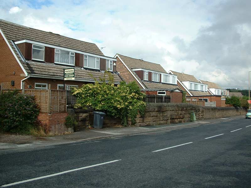
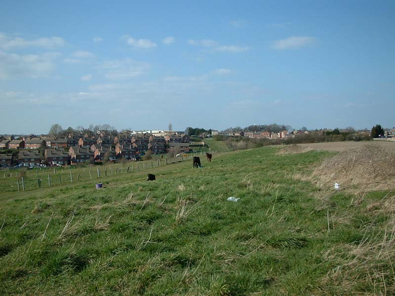
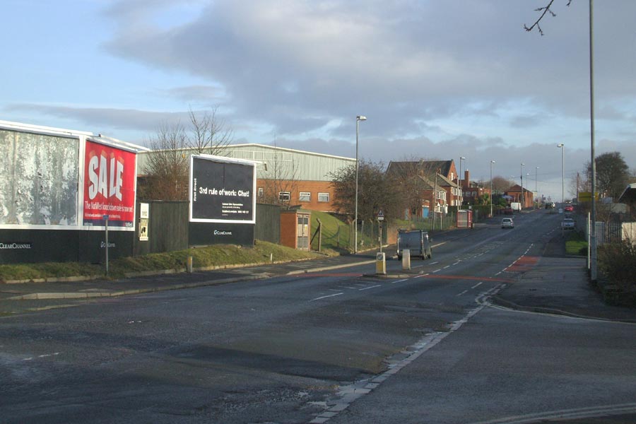
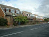
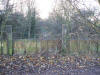
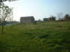
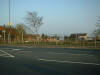
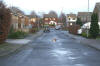
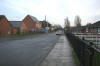
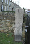
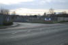
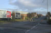
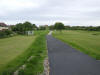
Alverthorpe (19-11-07) : Andrew Stopford
Alverthorpe. |
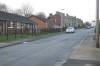
 Alverthorpe
(19-11-07) : Andrew Stopford Alverthorpe
(19-11-07) : Andrew Stopford
Alverthorpe. |
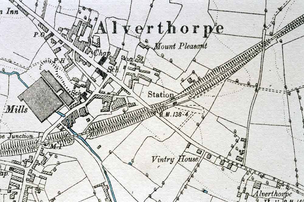
 Alverthorpe
Station Alverthorpe
Station
Opened 10-1872. Closed 03-04-1954.
Alverthorpe
station map (1890) : Malcolm Mallison
6 inch maps from the 1890
survey.
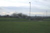
Note : Alverthorpe
Station : Michael Kaye
Alverthorpe was on a embankment
after crossing Batley Road on a bridge, standing on
Batley Road near the football fields near to
Grasmere,
there are a row of terraced houses going off at a
slight angle, this is where the embankment ran and
there was situated the station.
|
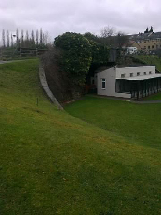
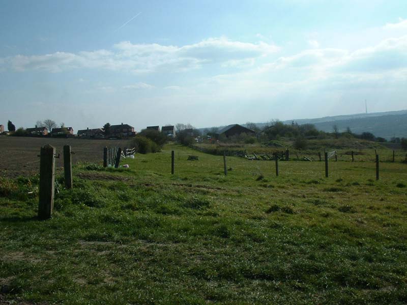
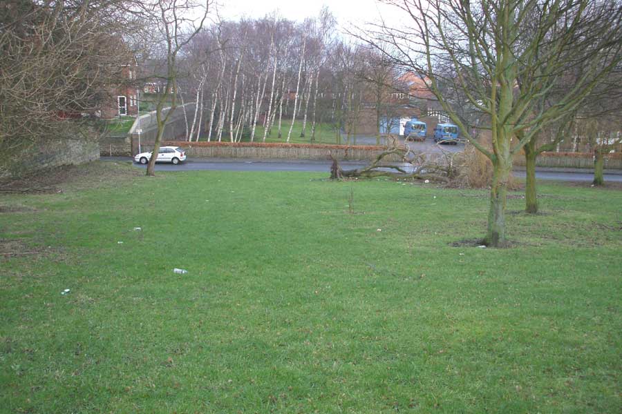
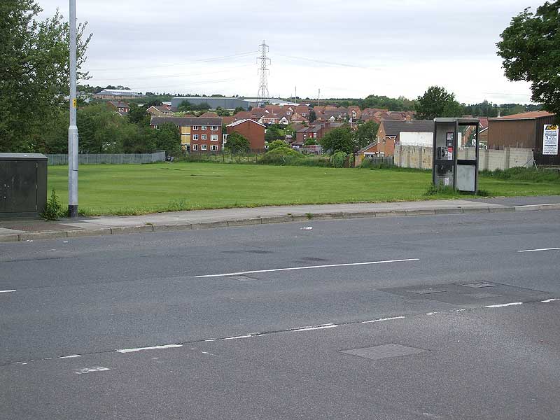
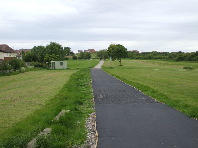
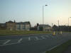
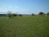
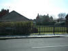
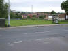
Wrenthorpe West Junction
 Wrenthorpe
Junction (29-11-07)
: Andrew Stopford Wrenthorpe
Junction (29-11-07)
: Andrew Stopford
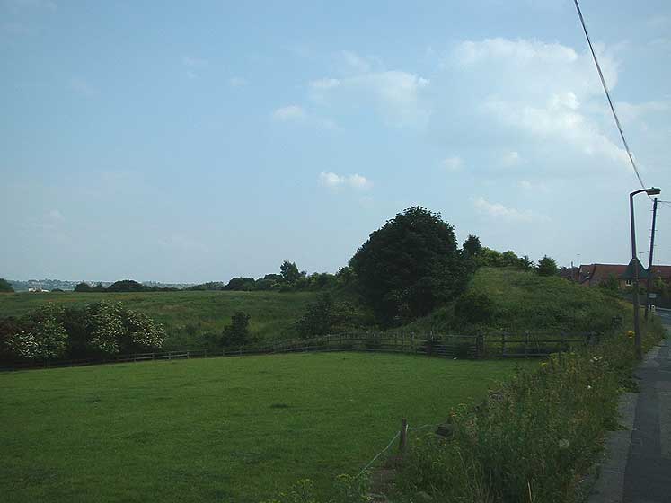
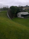
This is Wrenthorpe Junction, Wakefield, where the
line to Ossett & Dewsbury/Chickenley diverged.
There was apparently a big embankment here, but it's
been removed. The surfaced path marks the route
towards Alverthorpe, just over the hill. |